Breezy Today As Clouds Move In; Rain Tomorrow
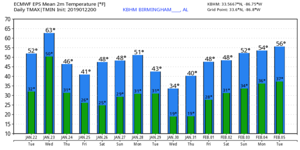
BREEZY, WARMER: The sky becomes mostly cloudy across Alabama today, and a southeast wind of 10-20 mph will make it fairly blustery. We expect a high in the 50-55 degree range this afternoon, not far from average values for January 22 (the average high for Birmingham today is 54.
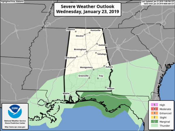
RAIN RETURNS: We might see a bit of rain late tonight, after midnight, but rain becomes widespread during the day tomorrow. The air will be stable, so no severe weather worries for Alabama, but we do note there is a “marginal risk” for the Florida Panhandle.
Along with the rain tomorrow will be a rather windy day, with pressure gradient winds of 12-25 mph out of the south. Rain amounts of one to two inches are likely… it will be another good winter soaking.
A FLAKE OR TWO? As colder air returns to the state tomorrow night, there is some chance we could see a few snow flurries, or maybe patches or sleet on the back edge of the big rain mass, but we expect no accumulation or impact.
THURSDAY/FRIDAY: These two days will be dry and colder. The sky becomes partly to mostly sunny Thursday, and Friday will feature sunshine in full supply. Highs will be in the 40s, and we drop into the 20s Friday morning.
THE ALABAMA WEEKEND: Saturday will be a mostly sunny day; the morning low will be in the upper 20s, but the afternoon high close to 50 degrees. An “Alberta Clipper” type system will zip through the state Sunday, but the air will be dry, and the latest operational runs of the American and European global models show no precipitation. Still, we will mention the chance of a few sprinkles Sunday with a mix of sun and clouds; the high Sunday afternoon will be in the 50s.
NEXT WEEK: Monday will be dry with a high in the 50s, then another clipper passes through the state Tuesday with some risk of light rain. There could be a few snow flurries Tuesday evening as cold air rushes into the state, but once again this setup suggests no impact/accumulation for now. Much colder air blows in here Wednesday with highs only in the 30s. See the Weather Xtreme video for maps, graphics, and more details.
There is no sign of any high impact snow or ice event for Alabama at this point over the next five to seven days.
ON THIS DATE IN 1904: An F4 tornado leveled the community of Moundville in Hale County just after midnight. At least 37 people were killed and around 150 people were injured… the business section of Moundville was destroyed. Fields were laid bare and houses, fences, and outbuildings were demolished. The Alabama Great Southern Railroad lost their water tank, depot and warehouse, with contents of 7 railroad cars. Some of the victims were carried over 200 yards by the tornado. The Griffin Hotel was flattened out. Two people were significantly injured by flying lumber missiles.
BEACH FORECAST: Click here to see the AlabamaWx Beach Forecast Center page.
WEATHER BRAINS: Don’t forget you can listen to our weekly 90 minute show anytime on your favorite podcast app. This is the show all about weather featuring many familiar voices, including our meteorologists here at ABC 33/40.
CONNECT: You can find me on all of the major social networks…
Facebook
Twitter
Instagram
Pinterest
Snapchat: spannwx
I have a weather program this morning at Weaver Elementary in Calhoun County… look for the next Weather Xtreme video here by 4:00 this afternoon. Enjoy the day!
Category: Alabama's Weather, ALL POSTS, Weather Xtreme Videos
About the Author (Author Profile)
James Spann is one of the most recognized and trusted television meteorologists in the industry. He holds the AMS CCM designation and television seals from the AMS and NWA. He is a past winner of the Broadcast Meteorologist of the Year from both professional organizations.Subscribe
If you enjoyed this article, subscribe to receive more just like it.


