Storms Affecting Western Parts Of The Area; None Severe At The Moment
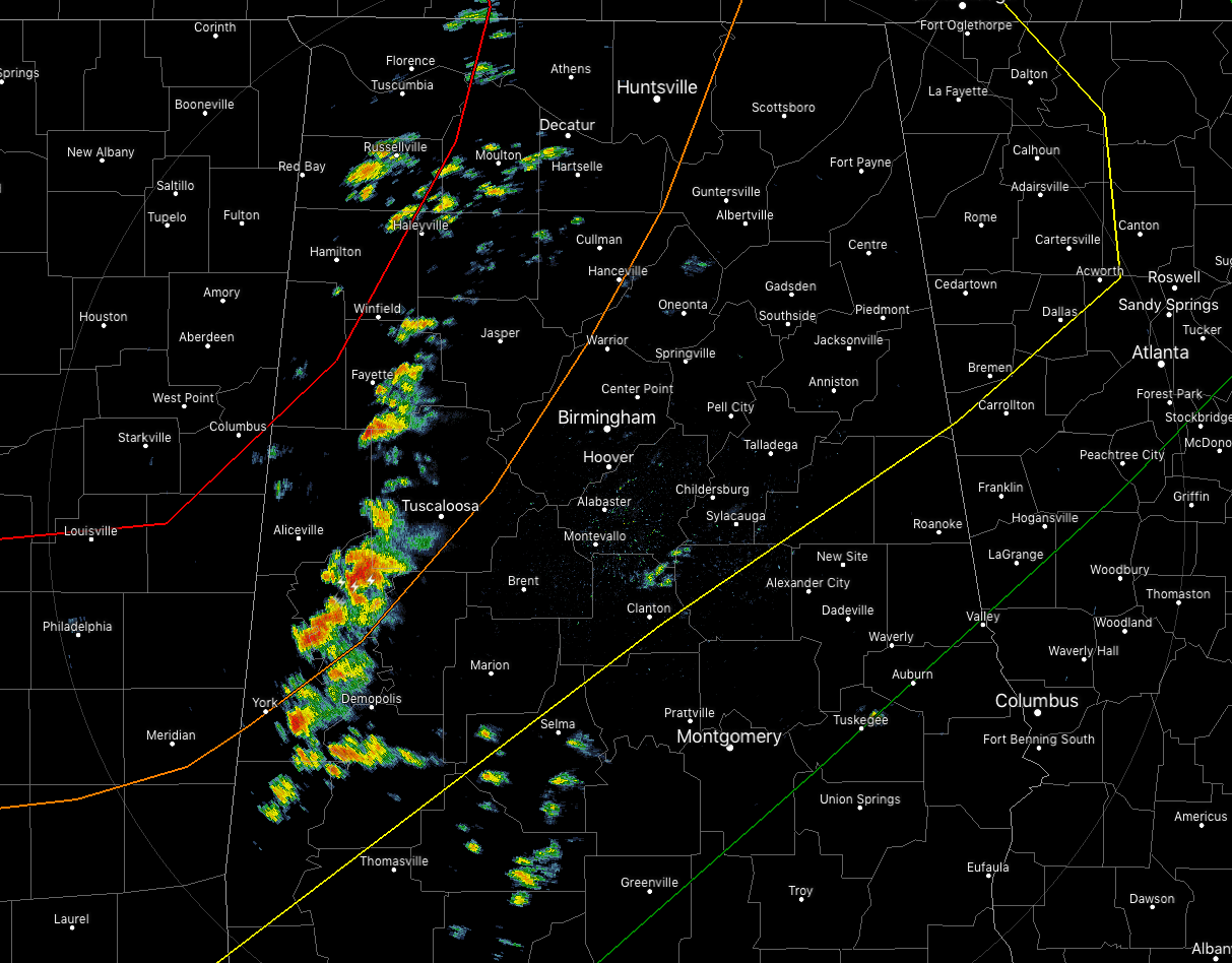
We already have our first batch of storms that have developed over the western portions of the area and at least one of these cells has already tried to rotate and become a supercell. With this occurring, the Storm Prediction Centered issued at Mesoscale Discussion for the western parts of North/Central Alabama. At this point, the probability of a watch being issued is at 40%.
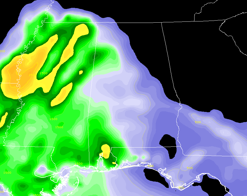
Surface instability has already risen above 500 J/kg with some spots approaching and exceeding 1,500 J/kg. Helicity values continue to rise and are just at the point to where the atmosphere will be supportive of rotating cells.
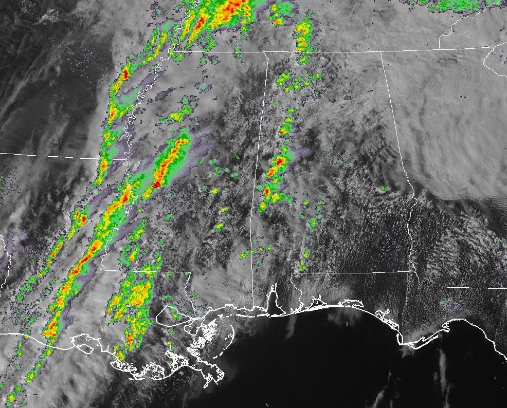
The bulk of the action continues to be over Mississippi and down into Louisiana at this point and the timing for the more organized severe weather to start moving into the state remains the same, with 5-10pm for locations in the moderate and enhanced risk areas, 8pm-1am for those in the slight risk, and 11pm-3am for those in the marginal risk.
Main threats continue to be damaging winds up to 70 MPH, large hail up to and over 1 inch in diameter, and tornadoes (some of which have the potential to be the strong, long-track variety in the moderate and enhanced risk areas).
We’ll continue to keep you posted throughout the event.
Category: Alabama's Weather, ALL POSTS, Severe Weather
About the Author (Author Profile)
Scott Martin is an operational meteorologist, professional graphic artist, musician, husband, and father. Not only is Scott a member of the National Weather Association, but he is also the Central Alabama Chapter of the NWA president. Scott is also the co-founder of Racecast Weather, which provides forecasts for many racing series across the USA. He also supplies forecasts for the BassMaster Elite Series events including the BassMaster Classic.Subscribe
If you enjoyed this article, subscribe to receive more just like it.


