Big Picture at 6:25 p.m.: Tornado Warning Continues for Fayette County But Storm Has Weakened
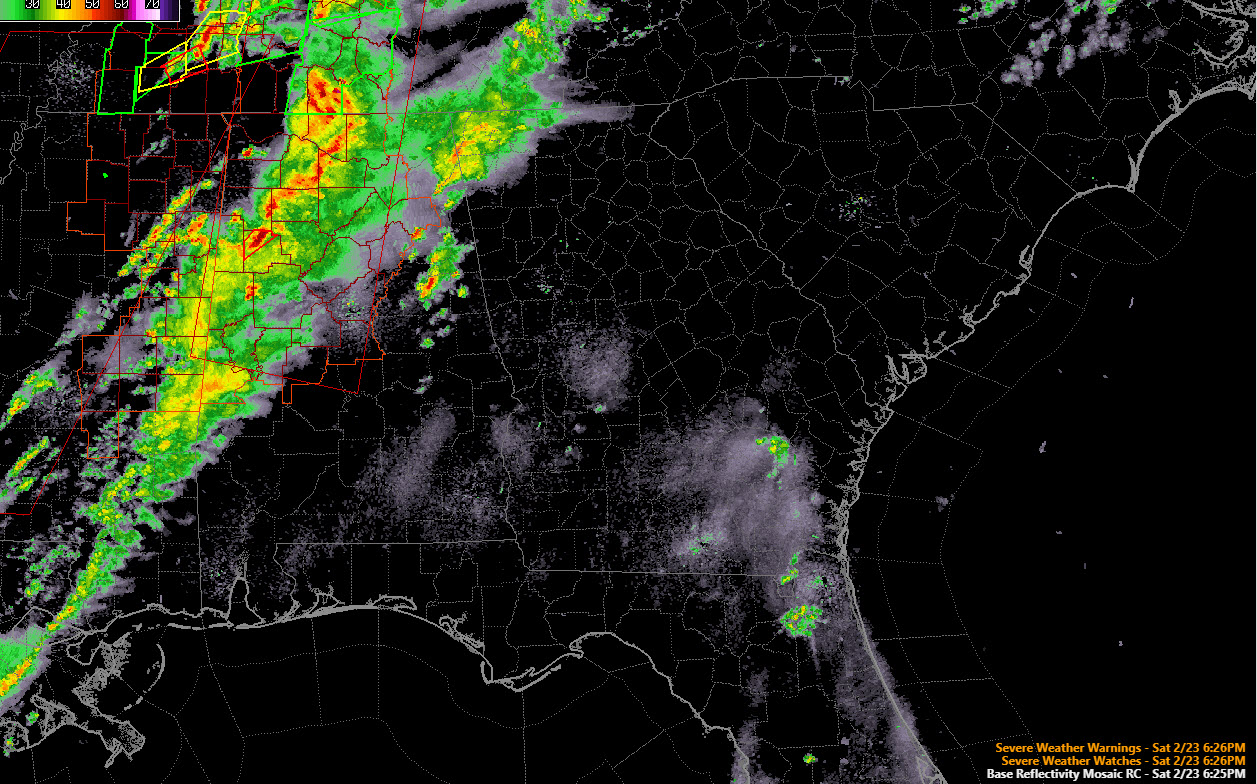
A line of strong storms is over North and western Alabama at this hour. It extends from west of Decatur to Moulton to Haleyville to Winfield to near Millport in Lamar County.
The lone severe storm right now is passing just north of Fayette in Fayette County. The storm appears to be cycling right now and the radar signature is not as impressive as it was 15 minutes across when there was a clear tornado debris signature. There is a tornado warning until 7 p.m. for parts of Fayette COunty.
There is significant tornado damage in Columbus MS from a tornado that occurred around 5 p.m. Injuries are being reported.
A large tornado was observed on US-72 2 miles north of Burnsville MS in Tishomingo County around 4:53. This is west of Iuka MS, which is west of the Quad Cities in Northwest Florida.
The storms will continue to plague areas from Huntsville back down through Marion, Fayette, Walker, Tuscaloosa and western Jefferson Counties through 11 p.m. The storms should move through the Birmingham area between midnight and 1 a.m. The storms should be weaker by then.
A tornado watch continues for a large part of Central and North Alabama until 10 p.m.
Category: Alabama's Weather, ALL POSTS, Severe Weather
About the Author (Author Profile)
Bill Murray is the President of The Weather Factory. He is the site's official weather historian and a weekend forecaster. He also anchors the site's severe weather coverage. Bill Murray is the proud holder of National Weather Association Digital Seal #0001 @wxhistorianSubscribe
If you enjoyed this article, subscribe to receive more just like it.


