Severe Weather Possible Over Southern Sections Today; A Soaking Rain Most Spots; Much Colder Starting Tonight
A quick hitting system will bring rain and thunderstorms to Alabama today, including the possibility of severe weather over South Alabama. The system will be followed by a significant freeze early in the week, but also a welcome chance to dry out.
ON THE WEATHER MAPS THIS MORNING
A fast west to east flow dominates the United States. A kink in the flow, an upper-level disturbance, is across Kansas. The flow near the disturbance is accelerating, which creates upward motion. A surface low will start to spin up this morning over Mississippi to the west. A warm front lies along the Gulf Coast, waiting to come north in response to the developing low. Temperatures are in the 40s along and north of I-20 this morning, with 50s to the south. By noon, for areas south of US-80, readings will climb into the upper 60s and lower 70s. 50s will be prevalent in the I-20 and I-59 Corridors. Readings in North and Northwest Alabama will remain in the 40s all day.
RAIN AND STORMS INCREASING
Showers have been increasing through the overnight hours and are in the process of overspreading much of northern and Central Alabama. They will begin to sweep southeastward ahead of the cold front during the afternoon. It will turn colder behind the front. Meanwhile, storms will become strong to severe along and south of US-80 and I-85.
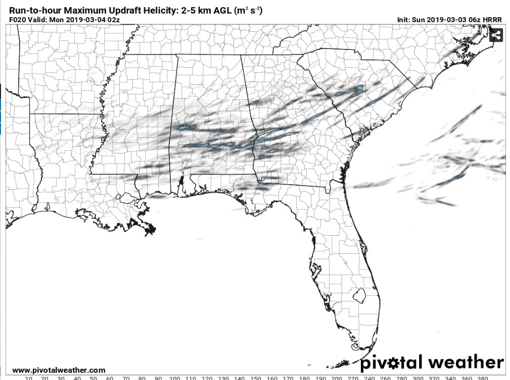
HRRR depiction of maximum updraft helicity through 8 p.m. tonight showing possibility of supercell thunderstorms this afternoon across southern half of Alabama.
SEVERE WEATHER THREAT
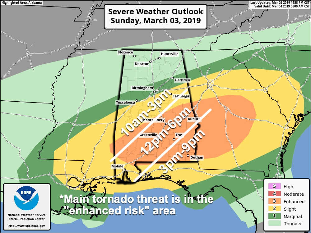
The severe weather threat will increase quickly between noon and 3 p.m. this afternoon for areas south of US-80, in places like Clarke, Monroe and Wilcox Counties. A couple of tornadoes and damaging winds are possible for areas near and south of a line from Camden to Montgomery to Tuskegee and Auburn. We can’t rule out a severe storm with damaging winds or an isolated tornado for areas as far north as I-20 but the possibility appears remote. North of I-20, there is a very small risk.
SPC OUTLOOK
The Storm Prediction Center has outlooked areas along and south of I-20 in at least a slight risk for severe weather (level 2 of 5) today, with an enhanced area (level 3 of 5) over South Central and South Alabama along and south of I-85. They maintain a marginal risk (level 1 out of 5) for areas north of I-20.
RAINFALL AMOUNTS
Rainfall amounts should average 1-1.5 inches across most of Alabama today. This shouldn’t cause significant additional flooding, but if any areas get heavier amounts, some localized flooding is possible. Levels of area rivers may briefly increase again, but they should resume their steady falls by tomorrow.
TURNING COLDER
Lows by Monday morning will be in the lower 30s over North Centra and North Alabama, with middle and upper 30s across the rest of Central Alabama. Highs Monday will be limited to the 40s. Readings Tuesday morning will be below freezing area-wide, with middle 20s in the I-20 Corridor. Tuesday highs will be in the 40s again. Wednesday morning lows will be even colder, as lows as 19-21 across North Alabama, with lower 20s common in the I-20 Corridor.
NEXT RAIN CHANCE
The next rain chance will come late Thursday night into Friday. Rain will continue into Saturday before ending Sunday.
VOODOO TERRITORY
More rain will occur on Wednesday the 13th and from late Saturday into Sunday on the 16th and 17th.
RAIN TOTALS
Over the next two weeks, rainfall totals will average 4-6 inches across most of Alabama, with some 7-8 inch amounts across North Central and Northeast Alabama.
WEATHERBRAINS
Great show this week with the folks from the National Tropical Weather Conference and Rick Reichmuth, the Chief Meteorologist at the Fox News Channel.
WEATHER HISTORY
On this date in 1966, a devastating F5 tornado hit Jackson, Mississippi. The same family of tornadoes would reach into West Alabama where one of our SKywatchers had a personal experience with it. More in a special 9 a.m. post on AlabamaWX.
STAY TUNED
With severe weather across the are atoday, we will have frequent updates throughout the day.
Category: Alabama's Weather, ALL POSTS
About the Author (Author Profile)
Bill Murray is the President of The Weather Factory. He is the site's official weather historian and a weekend forecaster. He also anchors the site's severe weather coverage. Bill Murray is the proud holder of National Weather Association Digital Seal #0001 @wxhistorianSubscribe
If you enjoyed this article, subscribe to receive more just like it.


