Moderate to Heavy Rain Moving into Birmingham Metro Area
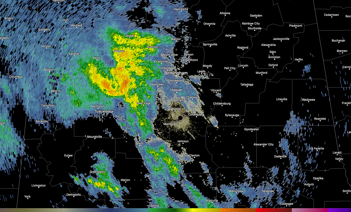
Moderate to heavy rain is moving across Walker and northern Tuscaloosa Counties at this time. It is pushing east into the Birmingham Metro area. Be careful if you will be driving over the next 90 minutes are so.
Most of the area will receive a soaking rain today. Amounts should total 1-1.5 inches.
No lightning and thunder are associated with this activity, but lightning is increasing over Mississippi in the vicinity of a developing surface low near Natchez.
Severe storms are expected to develop south of I-20 this afternoon, with damaging winds the greatest threat. There is also a threat of hail and tornadoes. The greatest threat of tornadoes is over South Alabama from near Chatom in Washington County up to Selma, Alex City, and LaGrange Georgia, southward to the Florida line. There could be a couple of strong tornadoes in this area, up into South Central Georgia.
More lightning is associated with storms along a strengthening Arctic front over northeastern Texas and southwestern Arkansas. This front will bring much colder air to Alabama tonight and through midweek. Lows by Tuesday and Wednesday morning will be well down into the lower and middle 20s, with a few teens in the normally colder spots. This will create hard freeze conditions that could damage tender vegetation.
Category: Alabama's Weather, ALL POSTS
About the Author (Author Profile)
Bill Murray is the President of The Weather Factory. He is the site's official weather historian and a weekend forecaster. He also anchors the site's severe weather coverage. Bill Murray is the proud holder of National Weather Association Digital Seal #0001 @wxhistorianSubscribe
If you enjoyed this article, subscribe to receive more just like it.


