At 12:15 PM, Potential For Tornadoes & Damaging Winds Continue Over Parts Of Central Alabama
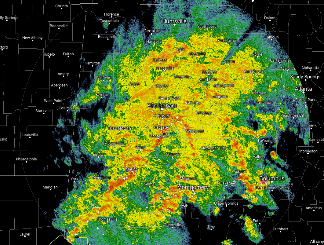
At 12:15 PM, a big mass of rain and thunderstorms continue to cover nearly all of Central Alabama. The stronger and heavier storms are located mainly south of the I-20 corridor over the southern half of the area. We continue to have the potential for strong to severe storms over the southern half of the area with a strong tornado or two possible.
We do want to make a note that rain is already starting to come to an end over the extreme west and northwestern parts of the area. The system will be moving through the area a little faster than first forecast throughout the past few days. I guess Mother Nature must be in a hurry.
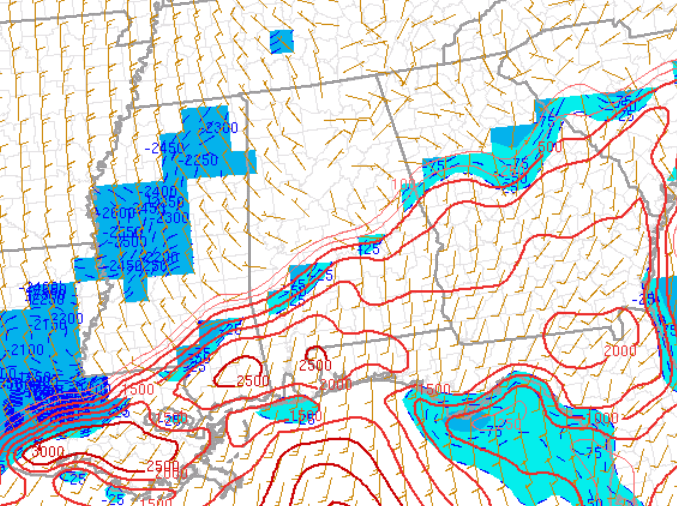
The greatest risk for any severe storms developing over the next couple of hours will be over Marengo, Perry, Dallas, Autauga, Lowndes, Elmore, and Montgomery counties. Surface-based instability is really starting to increase over the southern portions of the area and the line of storms is now entering the areas with the most unstable air in place. Bulk shear values are the highest over those locations at this time as well, but not strong enough to tear the storms apart. Therefore, there is a strong potential for storms to start rotating and produce damaging winds or tornadoes at any time.
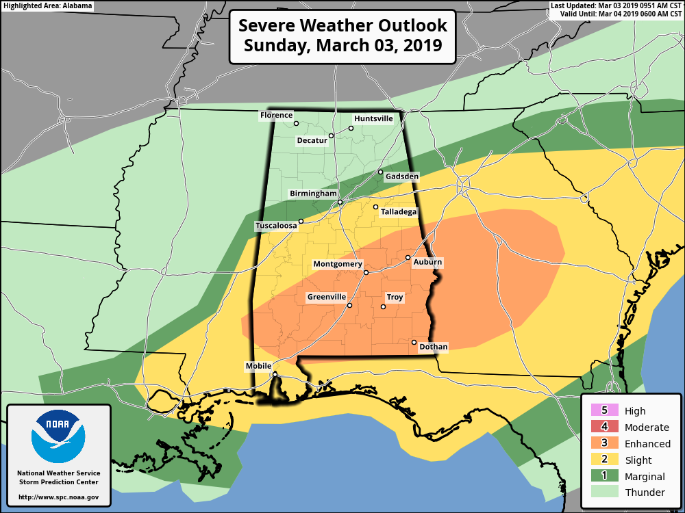
We continue to have an Enhanced Risk (level 3 of 5) for severe storms for locations south of a line stretching from Sweet Water to Billingsley to Daviston. A Slight Risk (level 2 of 5) continues for areas north of the enhanced risk to a line stretching from Tuscaloosa to Vestavia Hills to Saks. The window for severe storms across the risk areas will be from now until 6:00 pm tonight from west to east.
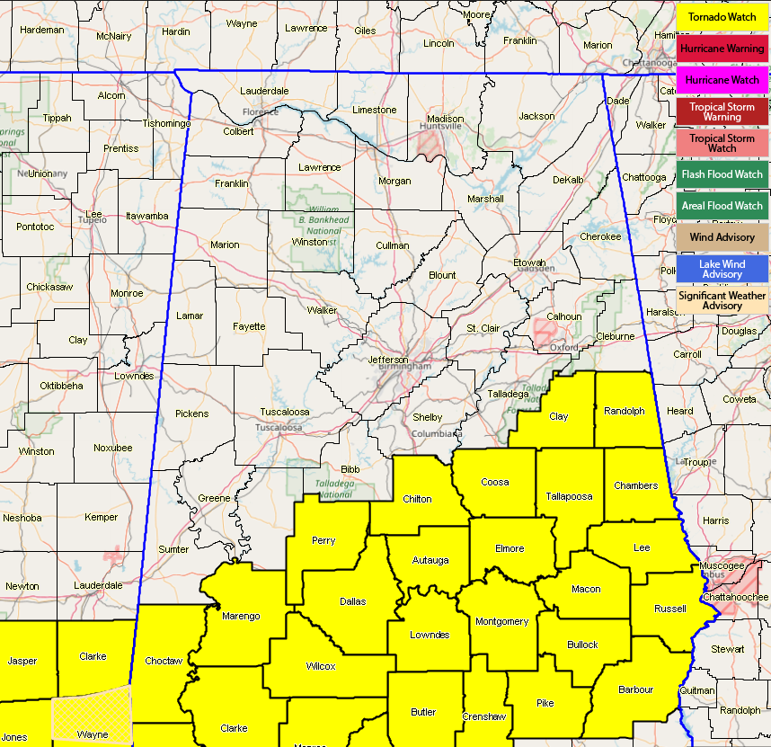
A Tornado Watch continues in effect for Autauga, Barbour, Bullock, Chambers, Chilton, Clay, Coosa, Dallas, Elmore, Lee, Lowndes, Macon, Marengo, Montgomery, Perry, Pike, Randolph, Russell, and Tallapoosa counties until 6:00 pm.
We’ll continue to keep you posted throughout the remainder of the afternoon and evening hours. Stay weather aware.
Category: Alabama's Weather, ALL POSTS, Severe Weather
About the Author (Author Profile)
Scott Martin is an operational meteorologist, professional graphic artist, musician, husband, and father. Not only is Scott a member of the National Weather Association, but he is also the Central Alabama Chapter of the NWA president. Scott is also the co-founder of Racecast Weather, which provides forecasts for many racing series across the USA. He also supplies forecasts for the BassMaster Elite Series events including the BassMaster Classic.Subscribe
If you enjoyed this article, subscribe to receive more just like it.


