

Mainly Cloudy & Cold Just After Midday; Lee County Tornado Now Rated EF4
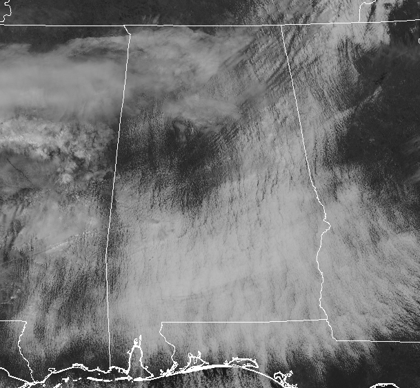
At 1:00 pm, skies are mainly cloudy across Central Alabama, but that cloud cover is slowly starting to erode away and we’ll have clear skies by Tuesday. Temperatures are currently in the lower 30s to the lower 40s across the area from north to south. Haleyville and Cullman are still below freezing at 30 and 31 degrees, while Montgomery, Troy, and Tuscaloosa are the “warm” spots all at 41 degrees.
For the rest of the daylight hours, the clouds will continue to diminish across the area and we’ll finally get a few rays of sun before we reach sunset. Afternoon highs will only make it up into the mid-30s to the upper 40s across the area from northwest to southeast. We’ll have a small disturbance move across the southern half of the area that may bring a very small chance of a few showers possibly mixed with sleet, but we are only looking around a 20-30% chance for anyone location mainly south of a line from Demopolis to Clanton to Alexander City. These will be out of here before surface temperatures drop below the freezing mark, so no travel issues are expected. The rest of Central Alabama will remain dry. Lows will be back down in the lower 20s to the lower 30s.
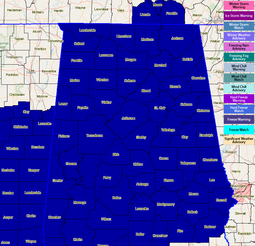
A Freeze Warning goes into effect tonight at 6:00 pm for all counties in Central Alabama and is scheduled to expire at 10:00 am Tuesday morning. Since we have had mild temperatures of late, the growing season has already begun for many across Central Alabama. Therefore, NWS Birmingham will commence the spring frost advisory and freeze warning program. This will be a multi-night freeze event and freeze warnings will likely be needed through Thursday morning.
Tuesday’s weather will be much brighter as skies will be completely clear and we’ll have maximum sunshine. Unfortunately, those afternoon highs will remain chilly, only reaching the lower 40s to the lower 50s across the area from northwest to southeast. With clear skies on Tuesday night, those temperatures will quickly drop once again and a Freeze Warning will be likely. Overnight lows will be back down into the 20s across the area. Some of the locations in the extreme northern parts of Central Alabama may briefly dip into the upper teens before sunrise.
Surveys are continuing on the damage from the violent tornadoes that struck the southern parts of Central Alabama on Sunday. Preliminary reports from NWS Birmingham now has the Lee County tornado rated as an EF4 with winds estimated at 170 MPH. The survey is still going, so the official work will come out later today or tomorrow. Another tornado was confirmed in Macon County just southeast of Tuskegee rated as a high-end EF1 tornado. That survey is ongoing as well. Death toll at this point is at 23. Unfortunately, there are still people missing and unaccounted for. Please continue to keep your thoughts and prayers for all in those affected communities.
BEACH FORECAST CENTER
Get the latest weather and rip current forecasts for the beaches from Fort Morgan to Panama City on our Beach Forecast Center page. There, you can select the forecast of the region that you are interested in.
ALREADY OFF TO A HOT START IN 2019! ADVERTISE WITH THE BLOG!
We have enjoyed over 4 MILLION page views on AlabamaWx.com so far in 2019! Don’t miss out! We can customize a creative, flexible and affordable package that will suit your organization’s needs. Contact Bill Murray at (205) 687-0782.
E-FORECAST
Get the Alabama Wx Weather Blog’s Seven-Day Forecast delivered directly to your inbox by email twice daily. It is the most detailed weather forecast available in Central Alabama. Subscribe here… It’s free!
CONNECT WITH THE BLOG ON SOCIAL MEDIA
You can find the AlabamaWx Weather Blog on the major social media networks:
Facebook
Twitter
WEATHERBRAINS
Don’t forget you can listen to our weekly 90 minute netcast anytime on the web at WeatherBrains.com or on iTunes, Stitcher, or Spotify. This is the show all about weather featuring many familiar voices, including the meteorologists at ABC 33/40.
Category: Alabama's Weather, ALL POSTS
About the Author (Author Profile)
Scott Martin is an operational meteorologist, professional graphic artist, musician, husband, and father. Not only is Scott a member of the National Weather Association, but he is also the Central Alabama Chapter of the NWA president. Scott is also the co-founder of Racecast Weather, which provides forecasts for many racing series across the USA. He also supplies forecasts for the BassMaster Elite Series events including the BassMaster Classic.Subscribe
If you enjoyed this article, subscribe to receive more just like it.


