A Mighty Nice Midday Across Central Alabama; Potential For Severe Storms On Thursday
CONDITIONS AT 10:45 AM
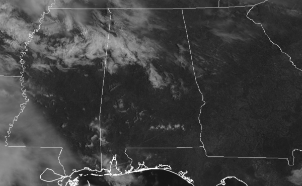
At this point on this fine Tuesday morning, there are actually fewer clouds than what I expected to be floating over Central Alabama as we make the approach to the midday hour. Skies are sunny for much of Central Alabama with the exception of a few clouds over the north and northwestern parts of the area. Temperatures are in the mid-50s to the mid-60s, but those will be warming up to the “mild” category later this afternoon. Birmingham was at 61 degrees, while the warm spot was Uniontown at 64 degrees. The cool spot was Haleyville at 54 degrees.
WEATHER FOR THE REST OF YOUR TUESDAY
We’ll continue to have a mix of sun and clouds throughout the rest of the afternoon hours, but you will notice that there will be more clouds moving in by sunset. We’ll stay dry and it will be a great day to enjoy the weather outside if you get the opportunity. Afternoon highs will top out in the upper 60s to the mid-70s across the area. For tonight, skies will be mostly cloudy and lows will be in the 50s.
RAIN RETURNS LATE ON WEDNESDAY
While much of the day on Wednesday will be dry and mild with mostly cloudy skies, unfortunately, rain will make a return to the area during the late evening through the overnight hours as our next rainmaking system approaches. Highs will top out in the lower to mid-70s with lows in the lower to mid-60s across the area.
POTENTIAL FOR SEVERE STORMS ON THURSDAY
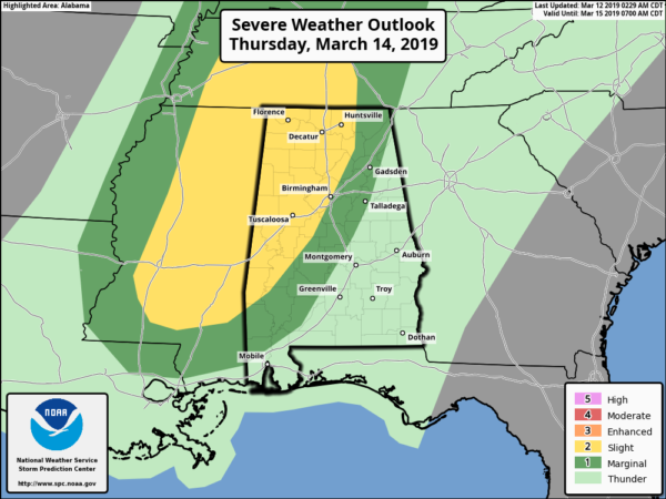
The Storm Prediction Center has nearly all of the western half of Central Alabama defined in a Slight Risk for severe storms on Thursday, mainly for the afternoon through the evening and late night hours. Damaging winds up to 60 MPH and a few tornadoes will be possible as we’ll have a very dynamic system dragging a cold front through the area bringing with it a line of storms. The limiting factor will be instability due to the possibility of heavier rain during the morning hours. If we get less rain and some sun to peek through, we may get enough heating for destabilization to occur. We’ll have a better look at this later today.
Just in case, go ahead and have your severe weather safety plans and kits ready to go, just in case you go under a warning. It is the Spring Severe Weather Season in Central Alabama, so we have to be prepared as any system that moves through the area during this time of the year has the potential of producing severe storms.
Category: Alabama's Weather, ALL POSTS
About the Author (Author Profile)
Scott Martin is an operational meteorologist, professional graphic artist, musician, husband, and father. Not only is Scott a member of the National Weather Association, but he is also the Central Alabama Chapter of the NWA president. Scott is also the co-founder of Racecast Weather, which provides forecasts for many racing series across the USA. He also supplies forecasts for the BassMaster Elite Series events including the BassMaster Classic.Subscribe
If you enjoyed this article, subscribe to receive more just like it.


