

Late Look at Alabama’s Weather: Severe Threat Has Diminished for Overnight, Not Out of the Woods for Tomorrow Though
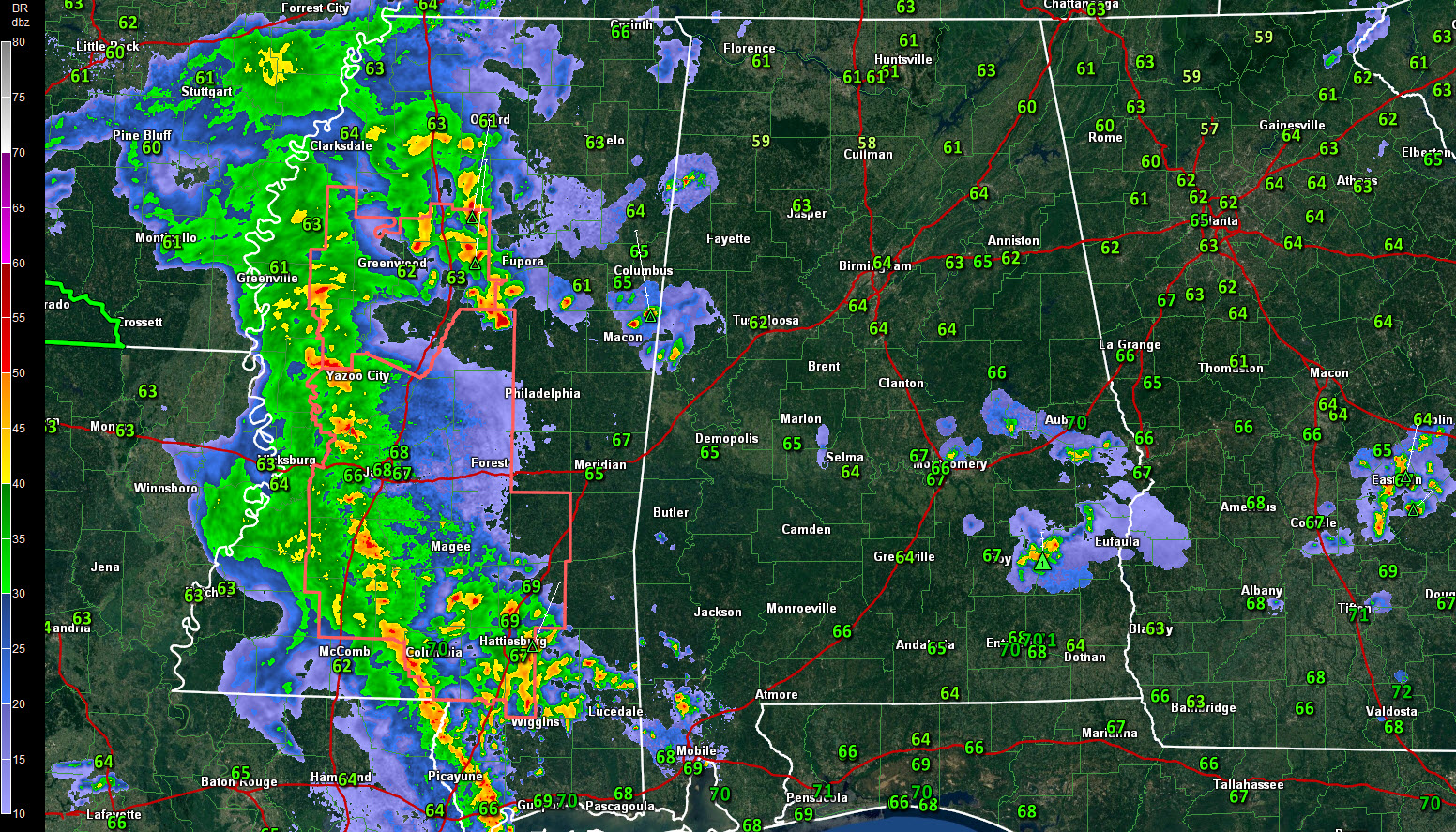
A quick radar check at 9:57 p.m. shows things quieting down across Alabama. The lone exception is storms between Troy and Eufaula. They have gusty winds, heavy rain, lightning and perhaps some small hail.
There is good news in the Weather Department for tonight: the mesoscale convective complex that has been looking so fierce all day across Texas, Louisiana and Mississippi is running out of steam tonight and should not produce any severe weather as it limps into western Alabama later tonight.
The severe thunderstorm watch to the west is starting to be canceled.
The stronger storms will be accompanied by gusty winds, heavy rain, and lightning, but they should not be severe.
Now we are not out of the woods yet for Monday, however.
The dying storms will leave boundaries across our area for daytime heating to work on tomorrow. As instabilities rise, storms will redevelop. An approaching upper level low will lead to favorable upper-level conditions for storms to intensify. Bulk shear will increase as upper-level winds at about 18.000 feet pick up speed. An increasing low-level jet and the presence of a weak surface low nearby will allow increase severe chances. Throw in a little dry air aloft and you have the possibility of damaging winds.
Damaging winds and hail look to be the primary threats. The tornado threat appears to be low.
Category: Alabama's Weather, ALL POSTS
About the Author (Author Profile)
Bill Murray is the President of The Weather Factory. He is the site's official weather historian and a weekend forecaster. He also anchors the site's severe weather coverage. Bill Murray is the proud holder of National Weather Association Digital Seal #0001 @wxhistorianSubscribe
If you enjoyed this article, subscribe to receive more just like it.


