Showers & A Few Claps Of Thunder At Midday, Severe Potential Continues
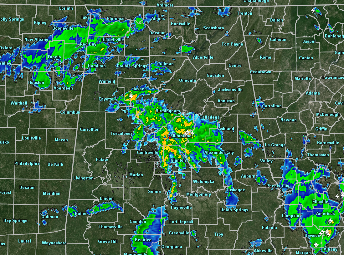
At just before the noon hour, we continue to have scattered showers and a few embedded strokes of lightning across portions of North/Central Alabama. The heaviest activity is located right in the middle of the area just south and east of the Birmingham metropolitan area, especially over Calera, Columbiana, and Alabaster, and along I-65 down to Clanton.
Temperatures are currently in the mid-60s to the lower 70s but it is rather humid out there with dewpoints in the mid to upper 60s and getting very close to 70.
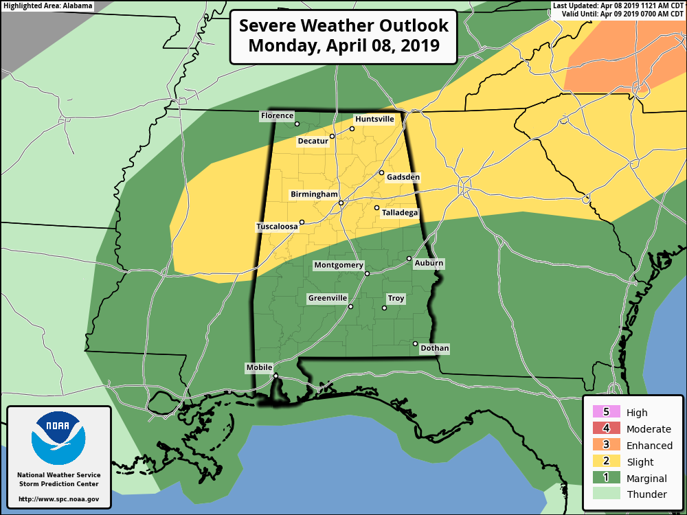
The Slight Risk area has been reduced a little since the last update, but still encompasses much of North/Central Alabama, with the rest of the area in a Marginal Risk.
All modes of severe weather are the threats for today… tornadoes, damaging winds up to and exceeding 60 MPH, and large hail.
The window for stronger to severe storms will be from now until 9:00 pm tonight for the western-third of the area, and from 11:00 am to 7:00 pm for the central and eastern parts.
Things will become more active as we get more into the heating of the day. There will be plenty of instability later this morning and into the afternoon hours. Storms will develop and will be scattered to numerous in nature with the potential for the development of supercells, some of which could rotate and possibly drop a tornado or two.
Afternoon highs will top out in the mid-70s to the lower 80s with skies staying cloudy when it is not raining in your location.
Once the severe threat ends later tonight, we can still expect scattered to numerous showers and a few rumbles of thunder as the low-pressure center finally starts to move into and through the area. Lows will be in the lower 60s.
Today is a day we do not need to let our guard down. Be ready just in case your location goes under a warning. We also need to expect the unexpected as this is the prime of our Spring Severe Weather Season. We’ll keep you posted on the blog throughout the day.
Category: Alabama's Weather, ALL POSTS, Severe Weather
About the Author (Author Profile)
Scott Martin is an operational meteorologist, professional graphic artist, musician, husband, and father. Not only is Scott a member of the National Weather Association, but he is also the Central Alabama Chapter of the NWA president. Scott is also the co-founder of Racecast Weather, which provides forecasts for many racing series across the USA. He also supplies forecasts for the BassMaster Elite Series events including the BassMaster Classic.Subscribe
If you enjoyed this article, subscribe to receive more just like it.


