Severe Weather Threat Continues for Alabama Overnight
The SPC just issued their new Day One for the rest of tonight until 7 a.m.
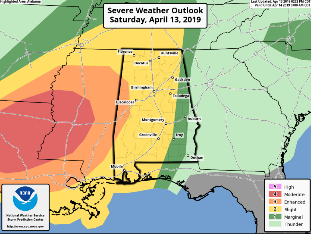
We have been cautioning all day not to worry about whether you are in the yellow or the orange, or the slight or the enhanced, but I think it is interesting to note that the enhanced risk area was pushed a little further into the state.
On the afternoon update, the risk areas looked like this:
The latest update looks like this:
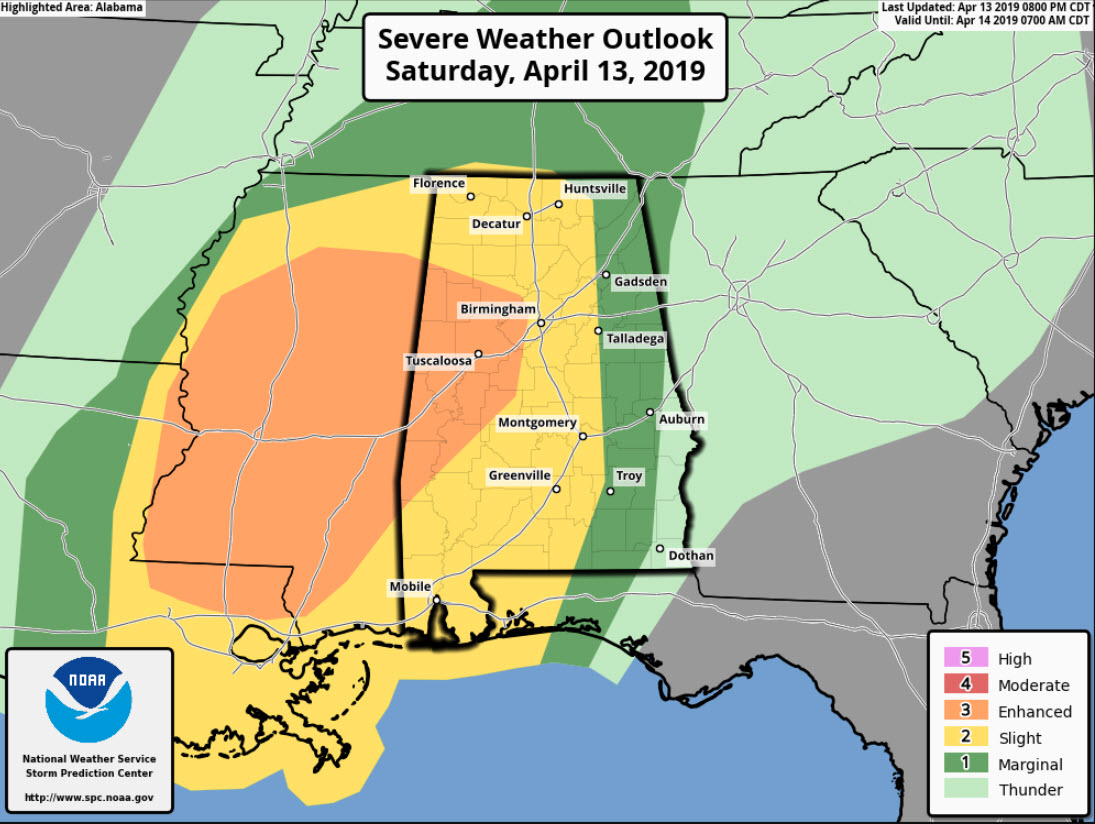
The faster motion of the storms over Mississippi is a large contributor to the eastward extension of the enhanced risk area. The storms will arrive with a little more instability since it is earlier in the evening. But the thing to watch for is the eastward progression of the low-level jet. It is pushing eastward across northern Mississippi and will be over western Alabama by midnight-1 a.m. This screaming ribbon of air will transport warm, moist air northward efficiently, feeding the storms over West Alabama and perhaps overcoming the lessening instability due to cooling. It will also provide even more wind shear.
A tornado watch remains in effect for much of North and Central Alabama until 3 a.m. The watch in Mississippi has been expanded to include more counties in South Central Mississippi.
Flooding has been a problem over Mississippi as well this afternoon and evening. The storms will be utilizing some high precipitable water air as they move into Alabama. The storms will produce around 1 inch of rain overnight on average.
Category: Alabama's Weather, ALL POSTS
About the Author (Author Profile)
Bill Murray is the President of The Weather Factory. He is the site's official weather historian and a weekend forecaster. He also anchors the site's severe weather coverage. Bill Murray is the proud holder of National Weather Association Digital Seal #0001 @wxhistorianSubscribe
If you enjoyed this article, subscribe to receive more just like it.


