A Severe Thunderstorm Warning Remains In Effect Until 3:15 AM CDT For Northern Walker And Eastern Winston Counties

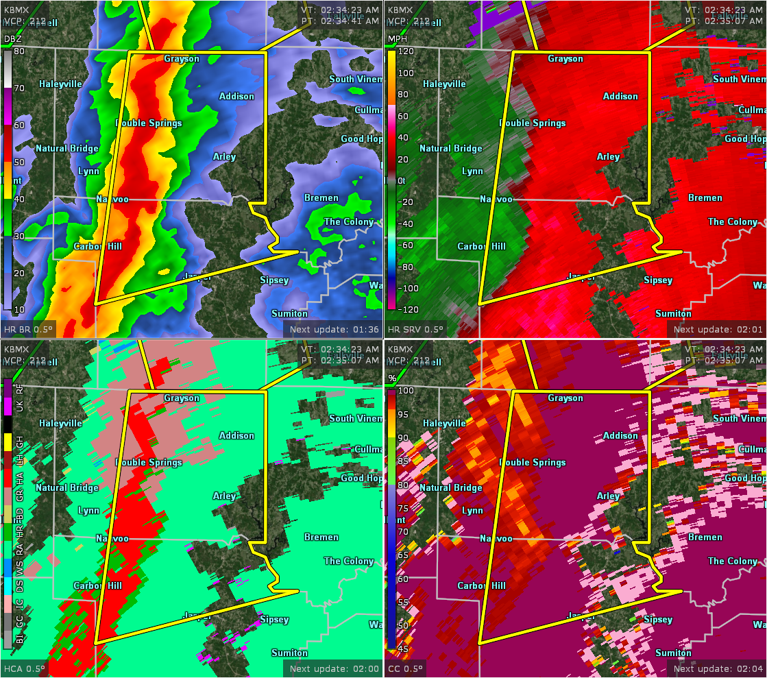
…A SEVERE THUNDERSTORM WARNING REMAINS IN EFFECT UNTIL 315 AM CDT FOR NORTHERN WALKER AND EASTERN WINSTON COUNTIES… At 251 AM CDT, severe thunderstorms were located along a line extending from Brushy Lake to near Falls City to near Jasper, moving northeast at 35 mph.
HAZARD…60 mph wind gusts and penny size hail.
SOURCE…Radar indicated.
IMPACT…Expect damage to roofs, siding, and trees. Locations impacted include… Jasper, Arley, Addison, Curry, Smith Dam, Nesmith, Smith Lake, Brushy Lake, Helicon, Inmanfield, Sardis, Falls City, Moreland, Camp McDowell, Houston, Mill Branch, Maple Branch, Hullett Branch, Little Dismal Creek and Bull Branch.
Severe Thunderstorm Warning Issued For Parts Of Walker And Winston Counties Until 3:15AM
Apr 14th @ 2:34 am

The National Weather Service in Birmingham has issued a
* Severe Thunderstorm Warning for…
Northern Walker County in central Alabama…
Winston County in northwestern Alabama…
* Until 315 AM CDT.
* At 234 AM CDT, severe thunderstorms were located along a line extending from near Brushy Lake to 6 miles west of Jasper, moving northeast at 40 mph.
HAZARD…60 mph wind gusts and penny size hail.
SOURCE…Radar indicated.
IMPACT…Expect damage to roofs, siding, and trees.
* Locations impacted include…
Jasper, Carbon Hill, Arley, Double Springs, Addison, Nauvoo, Curry, Houston Recreational Area, Camp McDowell, Smith Dam, Nesmith, Ashbank, Brushy Lake, Poplar Springs, Falls City, Moreland, Smith
Lake, Helicon, Inmanfield and Sardis.
Category: ALL POSTS
About the Author (Author Profile)
Subscribe
If you enjoyed this article, subscribe to receive more just like it.


