A Severe Thunderstorm Warning Remains In Effect Until 3:00 AM CDT For Western Morgan And Lawrence Counties

…A SEVERE THUNDERSTORM WARNING REMAINS IN EFFECT UNTIL 300 AM CDT FOR WESTERN MORGAN AND LAWRENCE COUNTIES… At 248 AM CDT, severe thunderstorms were located along a line extending from 7 miles northeast of Courtland to near Brushy Lake, moving east at 35 mph.
HAZARD…60 mph wind gusts and quarter size hail.
SOURCE…Radar indicated.
IMPACT…Hail damage to vehicles is expected. Expect wind damage to roofs, siding, and trees. Locations impacted include… Decatur, Moulton, Trinity, Courtland, North Courtland, Hillsboro, Chalybeate Springs, Speake, Caddo and Wren.
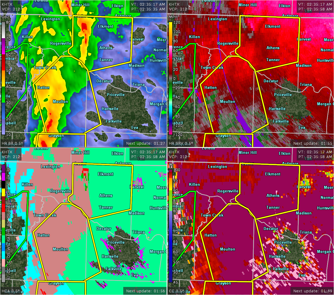
Severe Thunderstorm Warning Issued For Parts Of Lawrence And Morgan Counties Until 3:00AM
Apr 14th @ 2:34 am

The National Weather Service in Huntsville Alabama has issued a
* Severe Thunderstorm Warning for…
Western Morgan County in north central Alabama…
Lawrence County in northwestern Alabama…
* Until 300 AM CDT.
* At 234 AM CDT, severe thunderstorms were located along a line extending from near Town Creek to near Brushy Lake, moving northeast at 50 mph.
HAZARD…60 mph wind gusts and quarter size hail.
SOURCE…Radar indicated.
IMPACT…Hail damage to vehicles is expected. Expect wind damage to roofs, siding, and trees.
* Locations impacted include…
Decatur, Moulton, Trinity, Town Creek, Courtland, North Courtland, Hillsboro, Chalybeate Springs, Speake and Ne Smith.
Category: ALL POSTS
About the Author (Author Profile)
Subscribe
If you enjoyed this article, subscribe to receive more just like it.


