Activity Firing Back Up Before Leaving North/Central Alabama
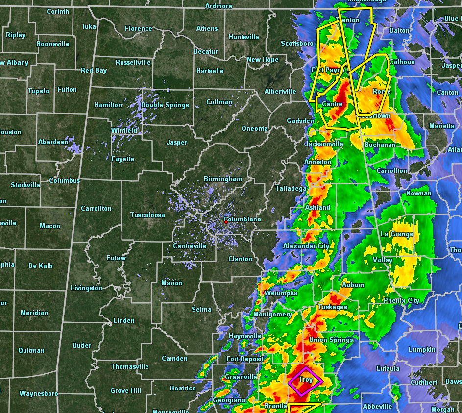
As the back edge of the line of strong to severe storms has now reached locations from Gadsden to Clanton to Prattville, it looked like we were going to finally put the severe weather threat to bed… but we have had new warnings issued within the last 20 minutes.
A confirmed Tornado Warning is in effect for Pike County as a radar confirmed tornado was located over Goshen and was moving to the northeast at 35 MPH. Troy and Banks are the next locations in the path of this tornadic cell. If you are in these locations, seek shelter immediately.
Severe Thunderstorm Warnings are in effect for cells with possible damaging winds over parts of Cherokee, Dekalb, and Jackson counties. These cells were moving to the northeast at 50 MPH and should be moving into Georgia by 7:15 am.
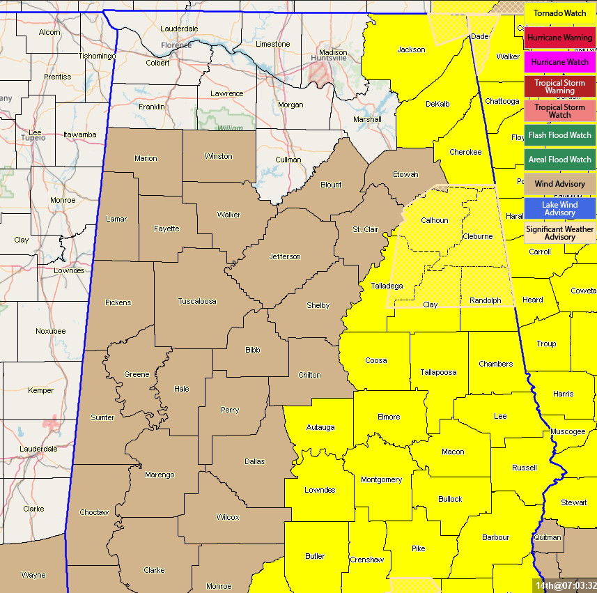
A Tornado Watch continues for Autauga, Barbour, Bullock, Calhoun, Chambers, Cherokee, Clay, Cleburne, Coosa, Dekalb, Elmore, Jackson, Lee, Lowndes, Macon, Montgomery, Pike, Randolph, Russell, Talladega, and Tallapoosa counties until 9:00 am this morning.
Category: Alabama's Weather, ALL POSTS, Severe Weather
About the Author (Author Profile)
Scott Martin is an operational meteorologist, professional graphic artist, musician, husband, and father. Not only is Scott a member of the National Weather Association, but he is also the Central Alabama Chapter of the NWA president. Scott is also the co-founder of Racecast Weather, which provides forecasts for many racing series across the USA. He also supplies forecasts for the BassMaster Elite Series events including the BassMaster Classic.Subscribe
If you enjoyed this article, subscribe to receive more just like it.


