A Late Look At Thursday’s Potential For Severe Storms
We continue to have the potential for strong to severe thunderstorms during the late afternoon through the late night and overnight hours Thursday and into the early morning hours on Friday. A vigorous system will move into Central Alabama during the late afternoon hours that could start as early as 4:00 pm and progress through the area with the threat coming to an end around or before 4:00 am Friday.
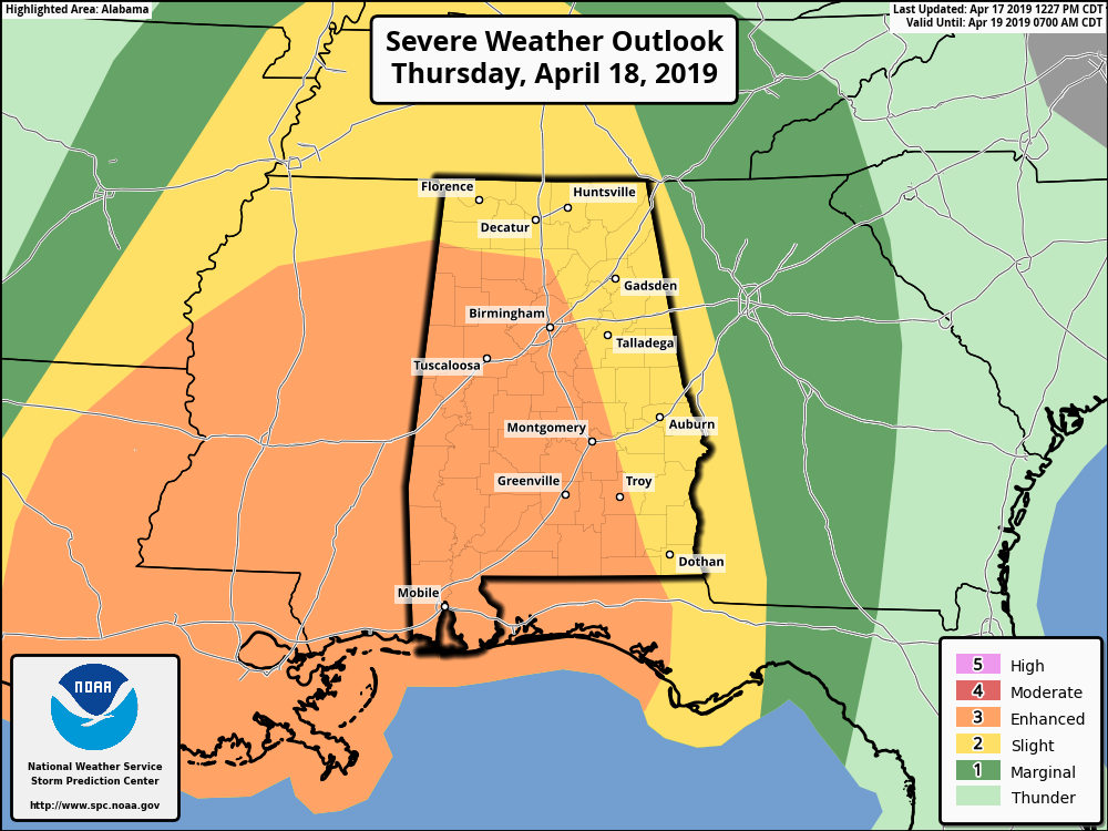
The Storm Prediction Center continues to have the western 2/3rds of Central Alabama in an Enhanced Risk of severe storms (level 3 of 5) while the rest of the area is in a Slight Risk. Tornadoes and damaging winds up to and exceeding 60 MPH will be the main threats, but there is a much smaller threat of hail up to quarter-size across the area.
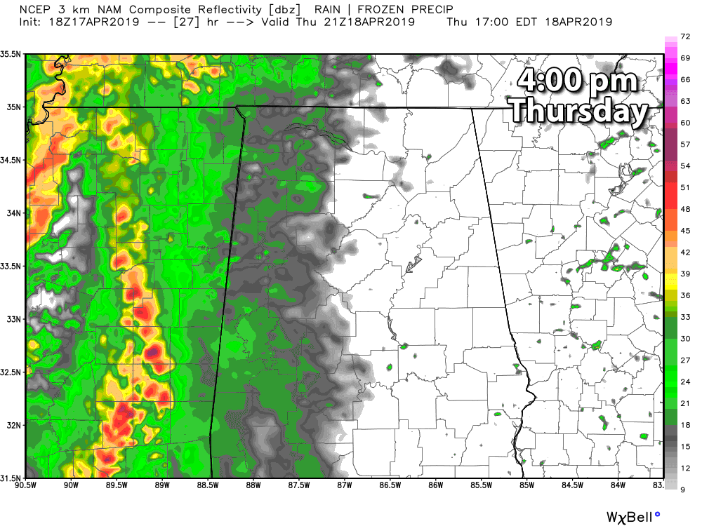
We could have scattered storms move in as early as 4:00 pm in the westernmost locations in Central Alabama, but the main activity will begin to move in within the next hour or so. As they enter the area, the higher potential for tornadoes will be over the southwestern half of the area (south of a line from Hamilton to Calera to Auburn) as there will be more moisture return and where it meets up with higher shear. That doesn’t mean that the threat is only limited to that area, as tornadoes are possible across all of Central Alabama.
By 10:00 pm, the leading storms should be in or just past the Birmingham metropolitan area. By this time, we’ll continue to have the threat of a few tornadoes and damaging winds. By 4:00 am Friday, the main line of storms will be exiting the state and moving into Georgia, and the threat for severe storms will be coming to an end.
We’ll have updates at regular intervals throughout the day on the blog. Once a watch is issued, updates will be more frequent. Whenever a warning is issued for any locations in North/Central Alabama, they will be instantly posted to the blog.
Have your severe weather emergency kits ready to go and your severe weather safety plan talked-over and ready to enact if your location goes under a warning tomorrow evening. Have multiple ways to receive weather warnings: an NOAA WeatherRadio, WEAs activated on your phones, a great weather warning app like MyWarn or the FEMA app, and have the ABC 33/40 app downloaded so you can watch live coverage from your safe place.
Category: Alabama's Weather, ALL POSTS, Severe Weather
About the Author (Author Profile)
Scott Martin is an operational meteorologist, professional graphic artist, musician, husband, and father. Not only is Scott a member of the National Weather Association, but he is also the Central Alabama Chapter of the NWA president. Scott is also the co-founder of Racecast Weather, which provides forecasts for many racing series across the USA. He also supplies forecasts for the BassMaster Elite Series events including the BassMaster Classic.Subscribe
If you enjoyed this article, subscribe to receive more just like it.


