

New Tornado Watch Coming for South Alabama
National Weather Service offices in Birmingham and Mobile are coordinating with the Storm Prediction Center on a new tornado watch that will cover parts of South and South Central Alabama through the overnight hours.
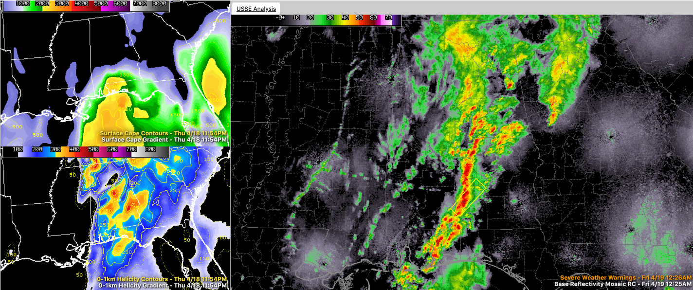
As feared, storms are intensifying tonight from Evergreen to Greenville to Prattville. A severe thunderstorm warning is in effect for parts of Butler, Conecuh, Covington and Crenshaw Counties. Dangerous storms now from Georgiana to just east of Evergreen are moving northeast.
Instability values are increasing, and the presence of a strong low-level jet will contribute to the wind shear factor.
Moderate to heavy rain is falling across parts of central Alabama with some lightning. More moderate rain extends from the Birmingham Metro up to Huntsville. Nothing severe and no more severe weather is expected over the northern half of the area.
Category: Alabama's Weather, ALL POSTS
About the Author (Author Profile)
Bill Murray is the President of The Weather Factory. He is the site's official weather historian and a weekend forecaster. He also anchors the site's severe weather coverage. Bill Murray is the proud holder of National Weather Association Digital Seal #0001 @wxhistorianSubscribe
If you enjoyed this article, subscribe to receive more just like it.


