Quick Check on Our Weather at 7:30 p.m.
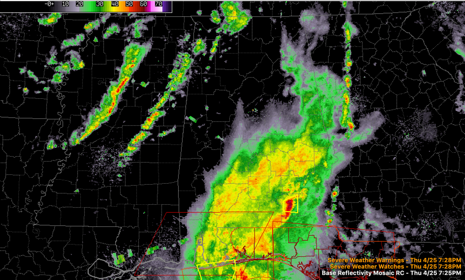
Some showers continue over East Alabama this evening, with a large mass of rain over South Central Alabama, and thunderstorms over the far southern counties.
The tornado watch continues for Baldwin County in Alabama and Escambia, Okaloosa and Santa Rosa counties in Florida. The line of storms that is the threat extends from between Elba and Enterprise in South Alabama to near Fort Walton Beach. A severe thunderstorm warning is in effect for Coffee County in South Alabama.
To the west over Mississippi, a line of showers is approaching the Alabama border. There are no thunderstorms involved in this first line. Back over Central Mississippi, a line of storms has formed ahead of the cold front. These showers and storms will move into West Alabama later this evening and cross the state during the late night hours. Severe weather is not anticipated.
Expect increasing sunshine tomorrow with mild temperatures in the 70s. But a northwest west averaging 10-20 mph may feel a bit chilly at time, with dewpoints lowering into the 40s during the afternoon.
Saturday will be nearly perfect, although the morning will start off mostly in the chilly 40s. Afternoon readings will be in the middle and upper 70s with a good supply of sunshine.
Perfect weather both days for my absolute favorite food festival of the year! See you at the St. Elias Food and Culture Festival this weekend!
Category: Alabama's Weather, ALL POSTS
About the Author (Author Profile)
Bill Murray is the President of The Weather Factory. He is the site's official weather historian and a weekend forecaster. He also anchors the site's severe weather coverage. Bill Murray is the proud holder of National Weather Association Digital Seal #0001 @wxhistorianSubscribe
If you enjoyed this article, subscribe to receive more just like it.


