Alabama Update As We Approach Sunday Brunch Time: Not Too Bad!
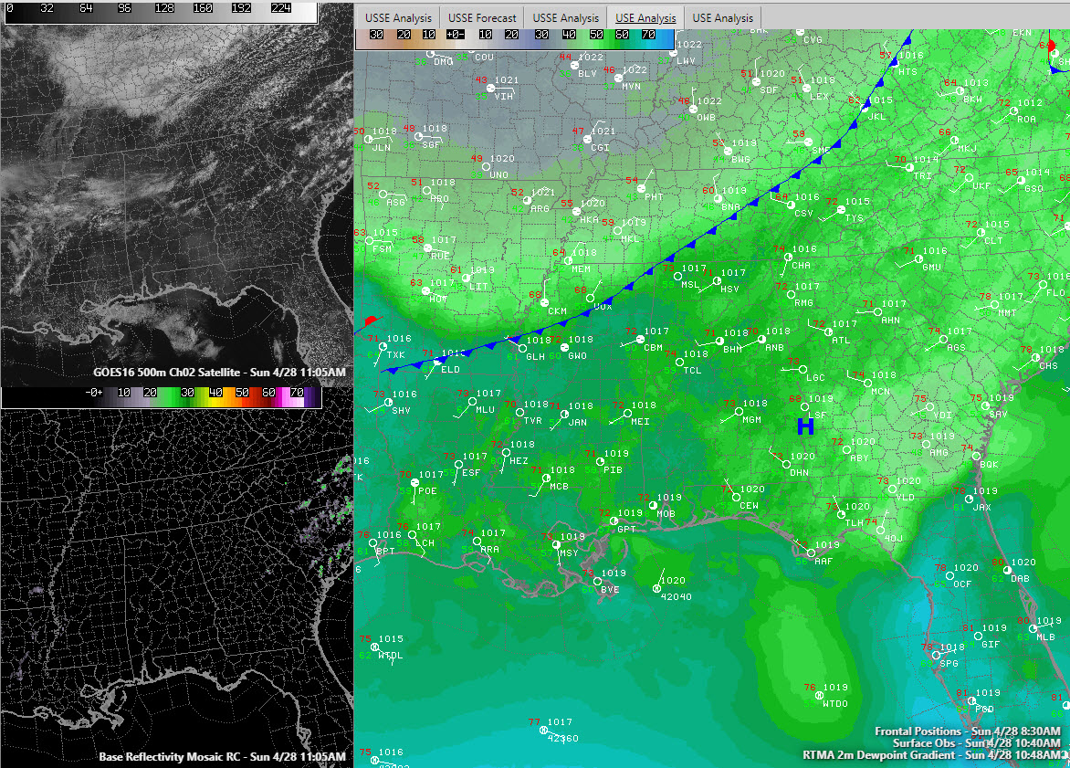
A cold front lies at the door of Northwest Alabama at this hour. It separates dewpoints in the 40s to the north from dewpoints in the 50s to the south.
Temperatures are in the 70s across the area heading for highs in the upper 70s to lower 80s.
The radar is clear.
Visible satellite imagery shows a few clouds across North Central Alabama, but they aren’t enough to block the sun in most spots unless it is briefly.
There just isn’t enough moisture to justify mentioning any showers. Can’t rule out a stray sprinkle somewhere ahead of the front as it comes through, but the chance is small, and it certainly won’t mar the nice day.
High pressure builds in on Monday and we have a nice run of weather til midweek, with the warmest readings we have seen so far this year in most locations. Lows tonight will drop into the upper 50s to near 60F. Highs on Monday, Tuesday, and Wednesday will be in the middle and upper 80s.
Our next rain chances come late Wednesday night into Thursday and continue through Friday. The best chance for Rain will be Friday during the day.
Category: Alabama's Weather, ALL POSTS
About the Author (Author Profile)
Bill Murray is the President of The Weather Factory. He is the site's official weather historian and a weekend forecaster. He also anchors the site's severe weather coverage. Bill Murray is the proud holder of National Weather Association Digital Seal #0001 @wxhistorianSubscribe
If you enjoyed this article, subscribe to receive more just like it.


