Warm Early May Weather Continues
**No afternoon Weather Xtreme video today**
RADAR CHECK: We have a few widely scattered showers and storms on radar this afternoon, mainly over East-Central and South-Central Alabama. Otherwise, the day is warm with a mix of sun and clouds with temperatures in the mid to upper 80s. Dothan reports 90 degrees at 3:00. Scattered showers should end this evening, and the sky will be generally fair overnight.
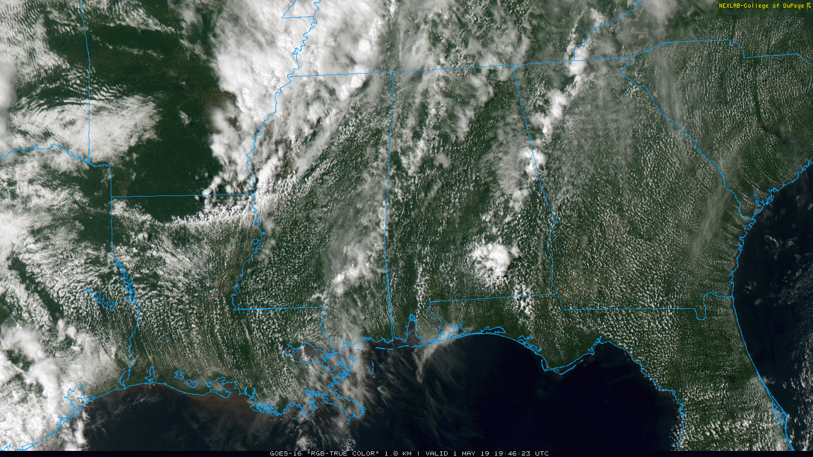
The weather won’t change much tomorrow. Another warm day with a high in the mid 80s. Expect a partly sunny sky, and while few isolated showers could pop up, most communities will remain dry.
FRIDAY AND THE WEEKEND: We will have the chance of scattered showers Friday and Saturday, but understand these won’t be “rainy days”. Showers will be pretty random, and while it certainly could (and probably will) be wet a time or two, a decent part of these two days will be dry. A thunderstorm is possible in spots, but severe storms won’t be an issue in Alabama. The sky will be occasionally cloudy, and highs will be in the mid 80s Friday, and low 80s Saturday.
Sunday should be a warm, dry day for most of the state with only a few widely scattered showers for the southern counties. With a good supply of sunshine, the high Sunday will be in the 81-84 degree range.
NEXT WEEK: The weather will be warm and dry Monday and Tuesday, then we will have the risk of scattered showers or storms on a daily basis Wednesday through Friday. The upper ridge will remain in place, so rain probably won’t be too heavy or widespread, and severe storms are not expected.
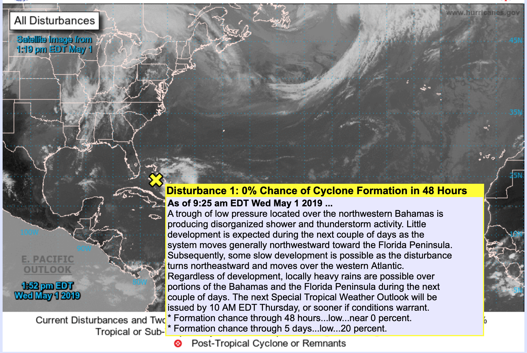
TROPICAL WEATHER: NHC is monitoring a disturbance near the Bahamas… it is moving generally northwestward toward the Florida Peninsula. Some slow development is possible as the disturbance turns northeastward and moves over the western Atlantic. Regardless of development, locally heavy rains are possible over portions of the Bahamas and the Florida Peninsula during the next couple of days. This will NOT impact the Florida Panhandle.
ON THIS DATE IN 1953: A number of tornadoes touched down in Alabama, including an EF-4 in Clay County that was on the ground for 12.1 miles and was 440 yards wide in the Millerville-Lineville area. Seven people died and twelve were injured in this storm. Another EF-4 touched down in Choctaw County… it was on the ground for 10 miles and 200 yards wide, this tornado was responsible for the deaths of two people and injuries to three others in the Riderwood, Lisman, and Yantley communities.
BEACH FORECAST: Click here to see the AlabamaWx Beach Forecast Center page.
WEATHER BRAINS: Don’t forget you can listen to our weekly 90 minute show anytime on your favorite podcast app. This is the show all about weather featuring many familiar voices, including our meteorologists here at ABC 33/40.
CONNECT: You can find me on all of the major social networks…
Facebook
Twitter
Instagram
Pinterest
Snapchat: spannwx
I had a great time today visiting with the students at Berry Elementary in Fayette County, and Montevallo Elementary in Shelby County… be looking for them on the Pepsi KIDCAM today at 5:00 and 6:00 on ABC 33/40 News! The next Weather Xtreme video will be posted here by 7:00 a.m. tomorrow…
Category: Alabama's Weather, ALL POSTS
About the Author (Author Profile)
James Spann is one of the most recognized and trusted television meteorologists in the industry. He holds the AMS CCM designation and television seals from the AMS and NWA. He is a past winner of the Broadcast Meteorologist of the Year from both professional organizations.Subscribe
If you enjoyed this article, subscribe to receive more just like it.


