About To Get Noisy In The Northwestern Parts Of The Area
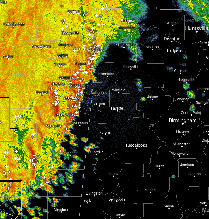
As of 9:15 am, the line of storms is now crossing the state line and moving into the western parts of Lauderdale, Colbert, Franklin, Marion counties, and soon into Lamar County. No severe storms at this point, but there is plenty of cloud-to-ground lightning with this line.
If your location is in the western parts of the counties listed above, move indoors immediately. Lightning can strike a great distance from the parent thunderstorm, even up to 10 miles away and more. If you can hear thunder, you are close enough to be struck by lightning.
Once the front part of the line passes, moderate to heavier rain continues for a while behind it. Several Flash Flood Warnings are in effect for multiple counties in the southern half of Mississippi.
Much of the more active weather is located over the southern parts of Mississippi and eastern Louisiana as there are several Severe Thunderstorm Warnings and couple of Tornado Warnings in effect with the southern portions of this line.
We are only expecting a very Marginal Risk for severe storms today, mainly during the afternoon and evening hours as more storms are expected to develop. We’ll have to watch this line just in case instability values start rising and adding fuel to the line.
We’ll keep you posted.
Category: Alabama's Weather, ALL POSTS, Severe Weather
About the Author (Author Profile)
Scott Martin is an operational meteorologist, professional graphic artist, musician, husband, and father. Not only is Scott a member of the National Weather Association, but he is also the Central Alabama Chapter of the NWA president. Scott is also the co-founder of Racecast Weather, which provides forecasts for many racing series across the USA. He also supplies forecasts for the BassMaster Elite Series events including the BassMaster Classic.Subscribe
If you enjoyed this article, subscribe to receive more just like it.


