Storms Continue To Push East Across Western Parts Of North/Central Alabama

The line of rain and thunderstorms continue to move eastward through the western parts of Central Alabama as of 10:30 am, stretching from Lester (Limestone Co.) to Double Springs (Winston Co.) to Fayette (Fayette Co.) to Memphis (Pickens Co.). No warnings are in effect at this time for any parts of North/Central Alabama, but heavy rainfall and dangerous cloud-to-ground lightning is occurring. If you are directly ahead of this line, go ahead and make it indoors before it arrives, especially if you can already hear thunder.
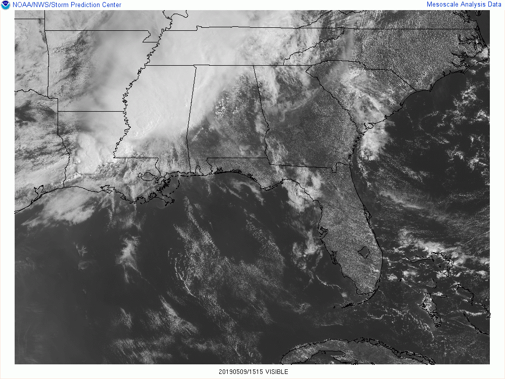
Out ahead of the line of storms, we are seeing a decent amount of sunshine making it to the surface, especially over the eastern and southern parts of the area. Wherever sunshine is appearing, that is allowing the atmosphere to destabilize more quickly as heat levels begin to rise.
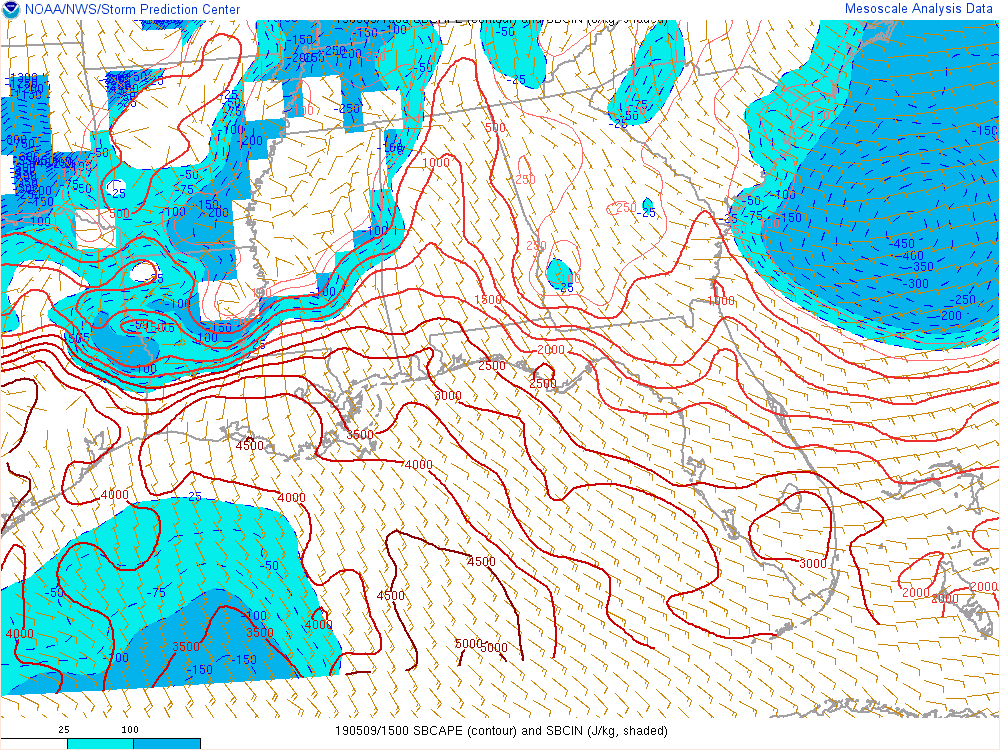
Speaking of instability, CAPE values across North/Central Alabama have increased since the last update and is now in the 500-2000 J/kg range from northeast to southwest. That means that any thunderstorms will have the available energy to continue and may be able to strengthen as the line moves into more unstable air.
We’ll have to start watching for bowing segments in the line of storms that may produce damaging winds up to 60 MPH and possibly more. While the threat level remains at Marginal (level 1 of 5), this instability will only continue to build with the heating of the day. Also with the increasing instability, we’ll have to watch for the increase of dangerous cloud-to-ground lightning.
Category: Alabama's Weather, ALL POSTS, Severe Weather
About the Author (Author Profile)
Scott Martin is an operational meteorologist, professional graphic artist, musician, husband, and father. Not only is Scott a member of the National Weather Association, but he is also the Central Alabama Chapter of the NWA president. Scott is also the co-founder of Racecast Weather, which provides forecasts for many racing series across the USA. He also supplies forecasts for the BassMaster Elite Series events including the BassMaster Classic.Subscribe
If you enjoyed this article, subscribe to receive more just like it.


