Severe Thunderstorm Warning Issued For Parts Of Walker County Until 12:30PM

The National Weather Service in Birmingham has issued a
* Severe Thunderstorm Warning for…
Walker County in central Alabama…
* Until 1230 PM CDT.
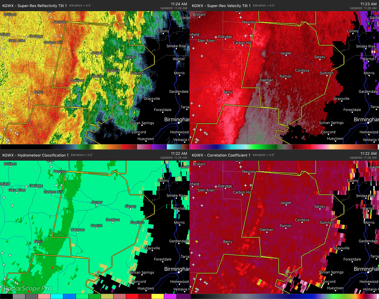
* At 1123 AM CDT, severe thunderstorms were located along a line extending from Camp McDowell to near Boley Springs, moving east at 30 mph.
HAZARD…60 mph wind gusts.
SOURCE…Radar indicated.
IMPACT…Expect damage to roofs, siding, and trees.
* Locations impacted include…
Jasper, Sumiton, Cordova, Dora, Parrish, Oakman, Sipsey, West
Jefferson, Curry, Gorgas Steam Plant, Smith Dam, Gorgas, Rocky
Hollow, Burnwell, Beloit, Quinton, Lynns Park, Smith Lake, Empire and West Corona.
Category: ALL POSTS
About the Author (Author Profile)
Subscribe
If you enjoyed this article, subscribe to receive more just like it.


