SPC Drops Slight Risk, But Marginal Risk Remains Through Tonight
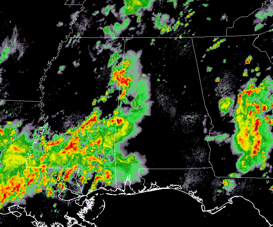
At 3:40 pm, stronger storms have pushed across the state line and are now affecting the western-most counties in Central Alabama. So far, none of these storms are severe, but the one over Lamar County recently had a tornado warning on it back in Mississippi. It is the strongest storm on radar at this point. We can expect a possibility of winds up to 40 MPH and some small hail with these storms unless they can build with the available energy and strengthen.
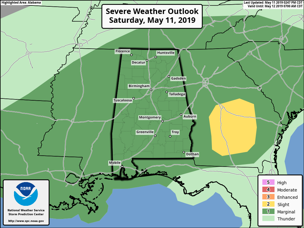
The Storm Prediction Center has removed the Slight Risk from the western parts of the area and leaves a Marginal Risk for severe storms for the rest of the day across all of Alabama. Threats continue to be from damaging winds up to 60 MPH and hail up to quarter-size. While we have weaker low-level shear in place, we have a non-zero tornado threat. As we have already seen in Mississippi, there may be just enough to get a brief tornado warning for a quick spin up, but odds for that is very, very low.
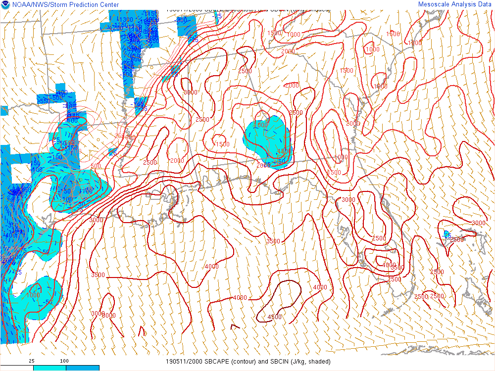
Instability continues to climb higher with the heating of the day, with CAPE values now up in the 1,000-3,000 J/kg range… plenty of juice for these thunderstorms to feed off of. With the lift available from the stalled front in the northwestern parts of the state and dewpoints approaching or just over 70 degrees, these storms will be able to continue to develop and persist for quite a while longer.
Our severe storm threat remains from now until 9:00 pm tonight as instability will rapidly drop after the sun goes down and some radiational cooling takes place. We’ll still have the possibility of showers and storms across the area after 9:00 pm and through the overnight hours, but stronger to severe storms are not expected.
Category: Alabama's Weather, ALL POSTS, Severe Weather
About the Author (Author Profile)
Scott Martin is an operational meteorologist, professional graphic artist, musician, husband, and father. Not only is Scott a member of the National Weather Association, but he is also the Central Alabama Chapter of the NWA president. Scott is also the co-founder of Racecast Weather, which provides forecasts for many racing series across the USA. He also supplies forecasts for the BassMaster Elite Series events including the BassMaster Classic.Subscribe
If you enjoyed this article, subscribe to receive more just like it.


