Very Warm With A Few Clouds At Midday
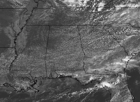
Other than some cumulus clouds dotting the skies across Central Alabama, we are getting a good bit of sunshine as we have crossed over into the midday hour. Temperatures are currently in the 80s across much of the area, but Tuscaloosa and Dannelly Field in Montgomery both have readings at 90 degrees at the moment. Birmingham was at 84 degrees while the cool spot in Central Alabama was Haleyville at 81 degrees.
We’ll continue to have these cumulus clouds throughout the afternoon hours, but they will be on the decrease especially when we start to cool off during the early evening hours. Afternoon highs will be in the upper 80s to the lower 90s across the area. For tonight, skies will mainly be clear with lows in the lower to mid-60s for most, while the urban heat islands may hold on to some heat and only drop into the upper 60s.
We’ll have plenty of sunshine and warm temperatures on Saturday, but at least we will not be putting up with the oppressive heat. Highs will be up in the mid-80s to the lower 90s across Central Alabama. Skies will be clear on Saturday night with lows in the lower to mid-60s.
BEACH FORECAST CENTER
For the Alabama Gulf Coast from today through Thursday, June 6th… There will be plenty of sunshine with the only small rain chance occurring today, then small chances on Wednesday and Thursday. Highs will be in the upper 80s to the lower 90s. Looks like the yellow flags will be flying as the Rip Index will be in the Moderate Risk range. Get the latest weather and rip current forecasts for the beaches from Fort Morgan to Panama City on our Beach Forecast Center page. There, you can select the forecast of the region that you are interested in.
ALREADY OFF TO A HOT START IN 2019! ADVERTISE WITH THE BLOG!
We have enjoyed over 10 MILLION page views on AlabamaWx.com so far in 2019! Don’t miss out! We can customize a creative, flexible and affordable package that will suit your organization’s needs. Contact Bill Murray at (205) 687-0782.
E-FORECAST
Get the Alabama Wx Weather Blog’s Seven-Day Forecast delivered directly to your inbox by email twice daily. It is the most detailed weather forecast available in Central Alabama. Subscribe here… It’s free!
CONNECT WITH THE BLOG ON SOCIAL MEDIA
You can find the AlabamaWx Weather Blog on the major social media networks:
Facebook
Twitter
Instagram
WEATHERBRAINS
Don’t forget you can listen to our weekly 90 minute netcast anytime on the web at WeatherBrains.com or on iTunes, Stitcher, or Spotify. This is the show all about weather featuring many familiar voices, including the meteorologists at ABC 33/40.
ON THIS DAY IN WEATHER HISTORY
1889 – The Johnstown disaster occurred, the worst flood tragedy in U.S. history. Heavy rains collapsed the South Fork Dam sending a thirty-foot wall of water rushing down the already flooded Conemaugh Valley. The wall of water, traveling as fast as twenty-two feet per second, swept away all structures, objects, and people. 2100 persons perished in the flood.
Category: Alabama's Weather, ALL POSTS
About the Author (Author Profile)
Scott Martin is an operational meteorologist, professional graphic artist, musician, husband, and father. Not only is Scott a member of the National Weather Association, but he is also the Central Alabama Chapter of the NWA president. Scott is also the co-founder of Racecast Weather, which provides forecasts for many racing series across the USA. He also supplies forecasts for the BassMaster Elite Series events including the BassMaster Classic.Subscribe
If you enjoyed this article, subscribe to receive more just like it.


