June Starts With Dry Weather
**No afternoon Weather Xtreme video today; I am in Cullman for live weather on ABC 33/40 from Rock The South at 4, 5, and 6:00**
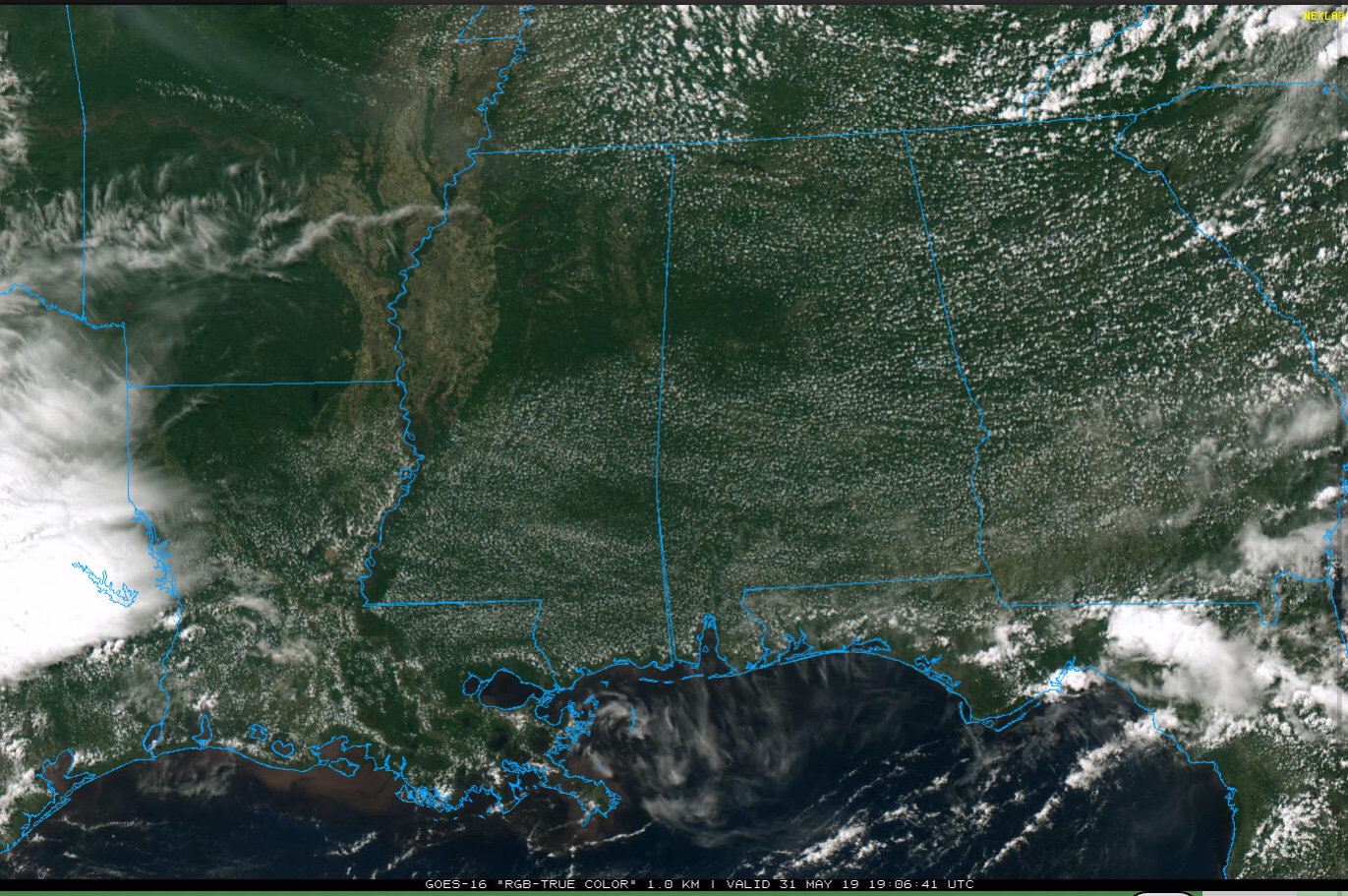
ANOTHER QUIET DAY: We actually had a few showers along the Gulf Coast this morning… even a waterspout or two. But, otherwise, today has been another dry day for most of Alabama. With ample sunshine, temperatures are mostly in the upper 80s at mid-afternoon, although Tuscaloosa has reached the low 90s. The sky will stay mostly fair tonight.
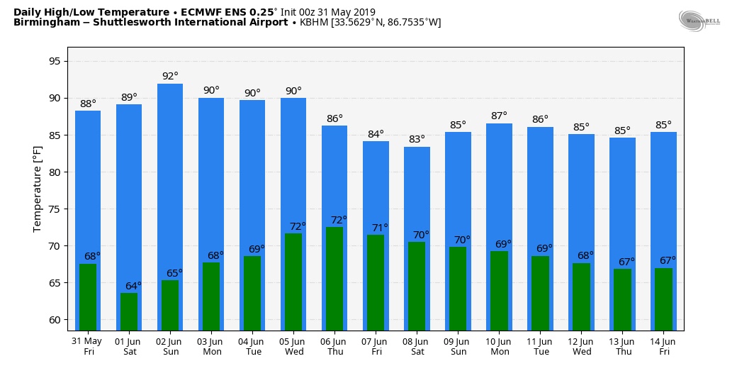
THE ALABAMA WEEKEND: No real change. Tomorrow will be a sunny day, and the sky Sunday will be partly to mostly sunny. We will mention the chance of a few small, very isolated showers or storms over North Alabama Sunday afternoon as a cold front approaches, but most places will stay dry. Highs over the weekend will be in the 87-91 degree range.
NEXT WEEK: Dry weather is the story Monday and Tuesday; lots of sun both days with lower humidity and cooler nights. Some spots could reach the 50s early Tuesday morning over North Alabama. Then, we will phase in a chance of scattered showers and thunderstorms over the latter half of the week as moisture levels rise, and the upper high over the region weakens.
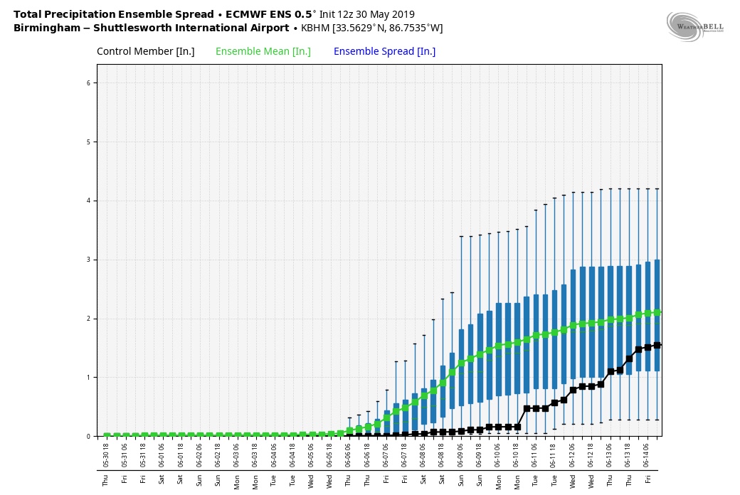
DROUGHT MONITOR: New data released yesterday shows moderate drought conditions creeping into parts of East and Southeast Alabama… other parts of the state are “abnormally dry”. Today is the 15th consecutive day without measurable rain at Birmingham.
The total for the month of May will be 4.35″, and for the year the total so far is 24.19″. The surplus for the year is down to 0.38″.
ON THIS DATE IN 2013: A very large EF3 tornado occurred over rural areas of Central Oklahoma…. the widest tornado in recorded history, it was part of a larger weather system that produced dozens of tornadoes over the preceding days. The tornado initially touched down west-southwest of El Reno, rapidly growing in size and becoming more violent as it tracked through central portions of Canadian County. Remaining over mostly open terrain, the tornado did not impact many structures; however, measurements from mobile weather radars revealed extreme winds up to 301 mph within the vortex; these are the second-highest observed wind speeds on Earth, with only the 1999 Bridge Creek–Moore tornado having recorded slightly higher wind speeds.
The tornado killed four storm chasers, the first known deaths in the history of storm chasing. Although the tornado remained over mostly open terrain, dozens of storm chasers unaware of its immense size and erratic movement were caught off-guard. Near Highway 81, scientist and engineer Tim Samaras, along with his son Paul and research partner Carl Young, died in the tornado. Paul and Young were ejected from their Chevrolet Cobalt by the storm’s sub-vortex, while Tim was still buckled in the passenger’s seat.
Look for my next Weather Xtreme video here by 7:00 a.m. Monday… enjoy the weekend!
Category: ALL POSTS
About the Author (Author Profile)
James Spann is one of the most recognized and trusted television meteorologists in the industry. He holds the AMS CCM designation and television seals from the AMS and NWA. He is a past winner of the Broadcast Meteorologist of the Year from both professional organizations.Subscribe
If you enjoyed this article, subscribe to receive more just like it.


