A Few Isolated Showers Possible Today, Better Rain Chances Returns Late This Week
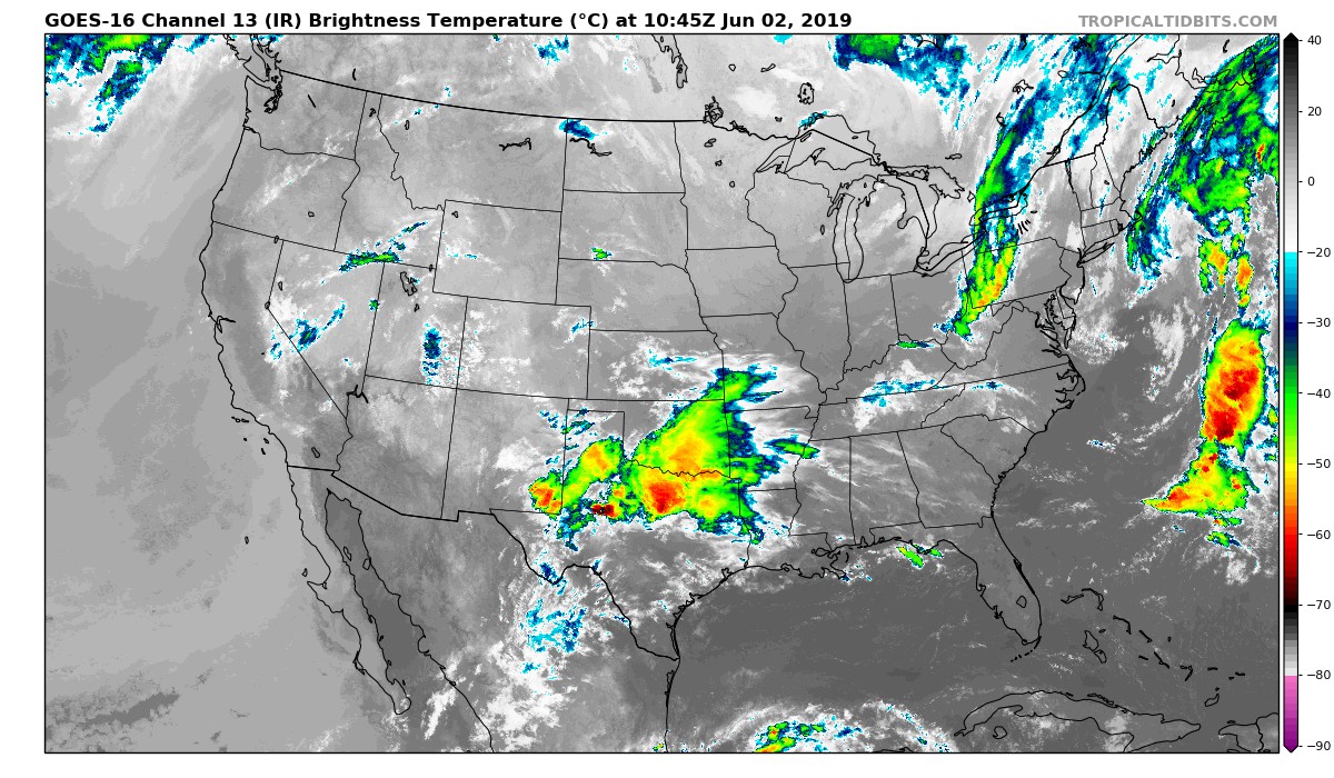
As of 6:00 am this morning, we have a good bit of clear skies across Central Alabama but we do have a few clouds streaming in from the west that may dim the sunrise for some for just a little bit. Temperatures across the area were in the upper 50s to the mid-60s. A few locations were tied at 66 degrees as the warm spot, while we have a few tied at 59 degrees as the cool spot. Birmingham was at 65 degrees.
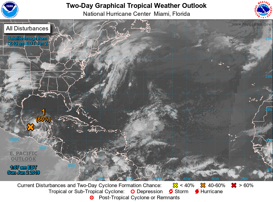
It is only the second day of the 2019 Atlantic Hurricane Season and we already have an area of concern over the southern parts of the Bay of Campeche. Movement will be to the west-northwest and has a 60% chance of becoming a depression before moving inland over Mexico early next week. No threat to the US mainland. The rest of the tropics are quiet at this time.
Now let’s get to the forecast for Central Alabama for today and through the rest of this first week of June.
We are starting off the morning hours with a cold front off to our north that will eventually sweep through Central Alabama later this evening and through the overnight hours. While we have a good bit of dry air in place, there may be just enough for a few isolated showers and thunderstorms over the north and northeastern parts of the area during the afternoon, including the cities of Jasper, Birmingham, Cullman, Gadsden, and Anniston. The chance of any one spot getting rain is roughly around 20%. Locations south and west of those will stay dry with mostly clear skies. Highs will be in the lower to mid-90s across the area. For tonight, we’ll have diminishing rain chances in the northeast during the evening and back to dry conditions with partly cloudy skies throughout the late night and overnight hours. Lows will be in the mid-60s to the lower 70s.
On Monday, the cold front will be down to our south and some of us will be lucky enough to have slightly cooler temperatures, especially over the northern parts of the area. Skies will be mostly sunny with highs reaching the mid-80s to the mid-90s across the area from north to south.
On Tuesday, we’ll have some clouds moving in from the west as a low starts to build over the Colorado/New Mexico border. We’ll stay dry for one more day with mostly clear to partly cloudy skies and highs in the upper 80s to the lower 90s.
We’ll start to get more of a southwesterly flow across the area on Wednesday that will pull more moisture up into the area from the gulf. With the heating of the day, we’ll have a small chance of a few isolated to scattered showers and thunderstorms across the area. Afternoon highs will be in the upper 80s to the lower 90s.
The trough and low-pressure move closer to the area on Thursday and our chances for scattered showers and thunderstorms will increase for the day. We’ll start off with rain chances in the 30%-50% from east to west during the daytime and increasing to 40%-60% by the evening and late night hours. While some sun is possible, I don’t expect we’ll see much of it. Highs will be in the mid-80s to the lower 90s.
Showers and thunderstorms will become likely on Friday as we continue to see the system move slowly to the east. With the rainfall and cloud cover across Central Alabama, highs should stay in the mid to upper 80s.
Showers and thunderstorms continue to look likely throughout next weekend as we continue to stay in an unsettled weather pattern. While a few peeks of sunshine is possible, it will be a gray weekend. Highs will remain in the mid to upper 80s on both days. After that, it looks like we’ll have a chance of rain on each day with our next completely dry day possibly coming on Monday, June 10th.
BEACH FORECAST CENTER
Get the latest weather and rip current forecasts for the beaches from Fort Morgan to Panama City on our Beach Forecast Center page. There, you can select the forecast of the region that you are interested in.
ALREADY OFF TO A HOT START IN 2019! ADVERTISE WITH THE BLOG!
We have enjoyed over 10 MILLION page views on AlabamaWx.com so far in 2019! Don’t miss out! We can customize a creative, flexible and affordable package that will suit your organization’s needs. Contact Bill Murray at (205) 687-0782.
E-FORECAST
Get the Alabama Wx Weather Blog’s Seven-Day Forecast delivered directly to your inbox by email twice daily. It is the most detailed weather forecast available in Central Alabama. Subscribe here… It’s free!
CONNECT WITH THE BLOG ON SOCIAL MEDIA
You can find the AlabamaWx Weather Blog on the major social media networks:
Facebook
Twitter
Instagram
WEATHERBRAINS
Don’t forget you can listen to our weekly 90 minute netcast anytime on the web at WeatherBrains.com or on iTunes, Stitcher, or Spotify. This is the show all about weather featuring many familiar voices, including the meteorologists at ABC 33/40.
Category: Alabama's Weather, ALL POSTS, Weather Xtreme Videos
About the Author (Author Profile)
Scott Martin is an operational meteorologist, professional graphic artist, musician, husband, and father. Not only is Scott a member of the National Weather Association, but he is also the Central Alabama Chapter of the NWA president. Scott is also the co-founder of Racecast Weather, which provides forecasts for many racing series across the USA. He also supplies forecasts for the BassMaster Elite Series events including the BassMaster Classic.Subscribe
If you enjoyed this article, subscribe to receive more just like it.


