Rain Chances Going Up Later This Week
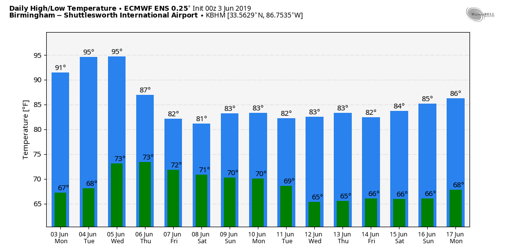
LOWER HUMIDITY: Drier air has entered Alabama this morning, meaning a good supply of sunshine today with lower humidity levels. Tonight will be clear and pleasant; some of the cooler pockets across North Alabama could reach the 50s early tomorrow morning.
Tomorrow will be another dry today; ample sunshine along with a high in the low 90s.
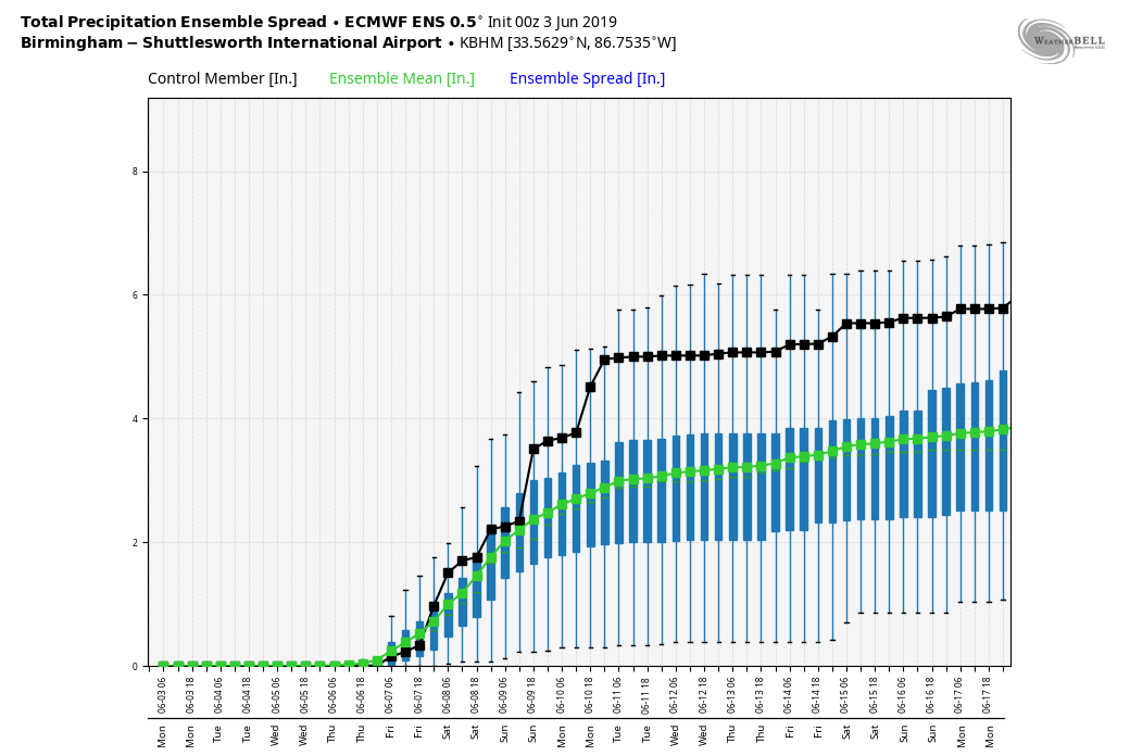
RAIN RETURNS: Moisture levels begin to rise across the state Wednesday, and a few scattered showers and thunderstorms are possible across the northern counties by afternoon. Otherwise, Wednesday will feature a mix of sun and clouds with a high close to 90.
Then, on Thursday and Friday, the sky will be occasionally cloudy with a good chance of showers and thunderstorms both days. Highs drop into the mid to upper 80s. While most of the rain will come during the afternoon and evening hours, we can’t rule out showers late at night or during the morning hours.
THE ALABAMA WEEKEND: The unsettled pattern continues. Tropical moisture will be in place; look for scattered to numerous showers and thunderstorms Saturday and Sunday with only a limited amount of sunshine. Highs remain in the 80s. If you have something planned outdoors, there will be some breaks in the wet weather, but plan on rain (with thunder) from time to time.
NEXT WEEK: For now the weather looks fairly routine for June… partly sunny days with “scattered mostly afternoon and evening showers and thunderstorms” each day. Highs will be generally in the 80s… See the Weather Xtreme video for maps, graphics, and more details.
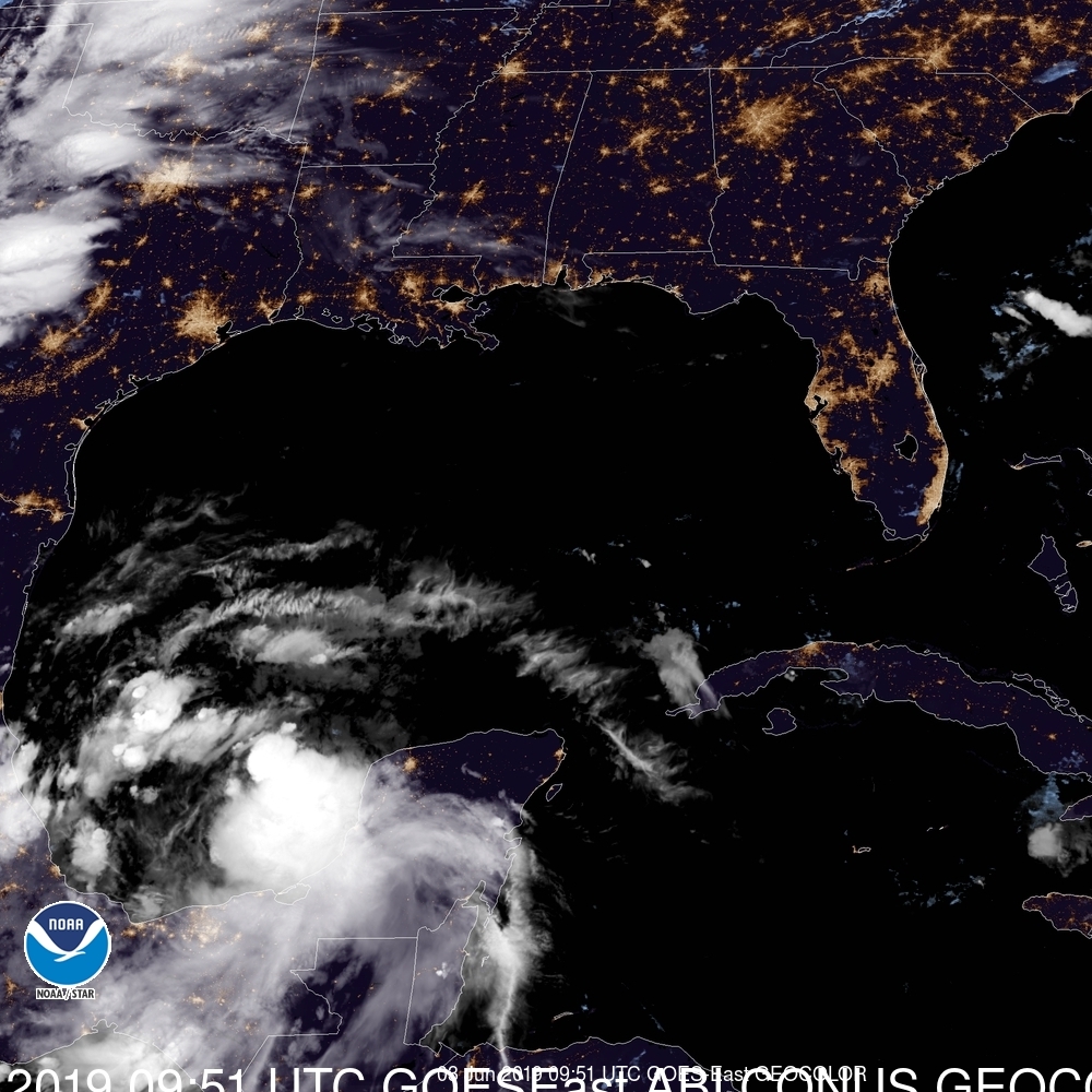
TROPICS: A disturbance in the Bay of Campeche has a 60 percent chance of becoming a tropical depression or tropical storm over the next 48 hours before it moves into Mexico. Some of the moisture from this feature will actually curve up into the southern U.S. later this week, helping to enhance rain coverage. The rest of the Atlantic basin is quiet for now.
RAIN UPDATE: Today will be the 18th consecutive day without rain for Birmingham (although showers did move through areas just east of Birmingham late yesterday and last night). Rain total for the year is 24.19″, and we now have a deficiency of 0.07″.
ON THIS DATE IN 1993: Early morning severe thunderstorms dumped huge hailstones across northern Oklahoma. Hail, up to 6 inches in diameter in Enid, went through roofs of homes, damaged three jets at Vance Air Force Base, and did $500,000 in damage at a car dealership. Winds gusts reached 70 mph at Vance Air Force Base as well. Hail damage to the wheat crop was estimated at 70 million dollars.
BEACH FORECAST: Click here to see the AlabamaWx Beach Forecast Center page.
WEATHER BRAINS: Don’t forget you can listen to our weekly 90 minute show anytime on your favorite podcast app. This is the show all about weather featuring many familiar voices, including our meteorologists here at ABC 33/40.
CONNECT: You can find me on all of the major social networks…
Facebook
Twitter
Instagram
Pinterest
Snapchat: spannwx
This is Lineman Appreciation Day; I will be doing the weather on ABC 33/40 this evening at 4, 5, and 6:00 with some Alabama Power linemen. They do a wonderful job of getting power restored after big weather events… look for the next Weather Xtreme video here by 4:00 this afternoon. Enjoy the day!
Category: Alabama's Weather, ALL POSTS, Weather Xtreme Videos
About the Author (Author Profile)
James Spann is one of the most recognized and trusted television meteorologists in the industry. He holds the AMS CCM designation and television seals from the AMS and NWA. He is a past winner of the Broadcast Meteorologist of the Year from both professional organizations.Subscribe
If you enjoyed this article, subscribe to receive more just like it.


