One More Dry Day, Then Rain Returns
SUNNY, HOT AFTERNOON: For Birmingham, today is the 18th consecutive day without measurable rain (although showers did move through areas just east of Birmingham late yesterday and last night). Rain total for the year is 24.19″, and we now have a deficiency of 0.07″. The sky is mostly sunny, and temperatures are around 90 degrees (we do note Tuscaloosa has soared to 96 degrees). Tonight will be mostly fair and pleasant… some of the colder spots across North Alabama could reach the 50s.
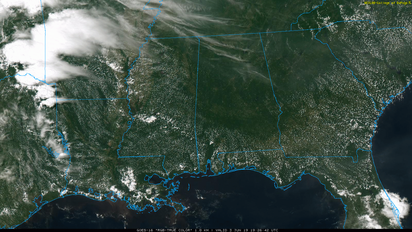
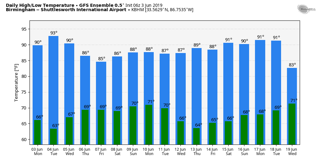
Tomorrow will be another sunny, hot day with a high in the low 90s; mid 90s are possible over West Alabama.
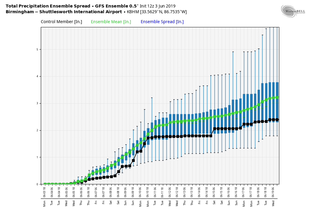
RAIN RETURNS: Moisture levels rise, and we will bring in a chance of showers and thunderstorms on Wednesday, especially during the afternoon and evening hours; the high will be in the 87 to 90 degree range. Then, unsettled weather is the forecast for Thursday and Friday… mostly cloudy both days with a good chance of showers and thunderstorms. While most of the rain will come from 2:00 until 11:00 p.m… we can’t rule out late night or morning showers. Highs will be in the 80s.
THE ALABAMA WEEKEND: The pattern stays wet as tropical moisture feeds into the state; look for generally cloudy conditions Saturday and Sunday with occasional showers and thunderstorms. For those planning outdoor events, there will be some decent breaks in the rain, but plan on wet weather along with potential for lightning at times. We don’t expect any organized severe thunderstorms, and highs will be in the 80s.
NEXT WEEK: We slowly trend drier next week, although we will maintain the risk of at least “scattered, mostly afternoon and evening showers and thunderstorms” on a daily basis. Highs will be in the upper 80s Monday and Tuesday, then creeping back up around 90 for the rest of the week. See the Weather Xtreme video for maps, graphics, and more details.
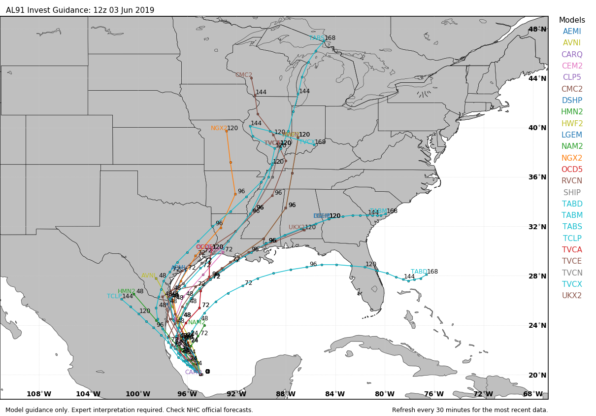
TROPICS: A broad disturbance is over the Bay of Campeche; this still has a 60 percent chance of becoming a tropical depression or storm during the next 48 hours before moving into the coast of Mexico. Moisture from this system will curve up into the southern U.S. late this week, helping to enhance rain chances for Alabama.
ON THIS DATE IN 1993: Early morning severe thunderstorms dumped huge hailstones across northern Oklahoma. Hail, up to 6 inches in diameter in Enid, went through roofs of homes, damaged three jets at Vance Air Force Base, and did $500,000 in damage at a car dealership. Winds gusts reached 70 mph at Vance Air Force Base as well. Hail damage to the wheat crop was estimated at 70 million dollars.
BEACH FORECAST: Click here to see the AlabamaWx Beach Forecast Center page.
WEATHER BRAINS: Don’t forget you can listen to our weekly 90 minute show anytime on your favorite podcast app. This is the show all about weather featuring many familiar voices, including our meteorologists here at ABC 33/40.
CONNECT: You can find me on all of the major social networks…
Facebook
Twitter
Instagram
Pinterest
Snapchat: spannwx
Look for the next Weather Xtreme video here by 7:00 a.m. tomorrow…
Category: Alabama's Weather, ALL POSTS, Weather Xtreme Videos
About the Author (Author Profile)
James Spann is one of the most recognized and trusted television meteorologists in the industry. He holds the AMS CCM designation and television seals from the AMS and NWA. He is a past winner of the Broadcast Meteorologist of the Year from both professional organizations.Subscribe
If you enjoyed this article, subscribe to receive more just like it.


