Wet/Unsettled Weather Through The Weekend
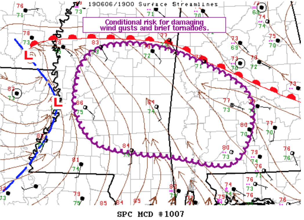
WET PATTERN CONTINUES: Radar shows large areas of rain across Alabama this afternoon… mostly light to moderate rain over the northern half of the state, with heavier storms near the Gulf Coast. A large waterspout was over Mobile Bay around 12:15 this afternoon, but thankfully dissipated before moving into Baldwin County. Periods of rain will continue tonight across the state in the moist, tropical environment. There is a conditional risk of a few strong thunderstorms over West and Southwest Alabama through the evening; a brief tornado can’t be ruled out, but is not especially likely.
Temperatures are only in the 70s this afternoon because of the clouds and rain.
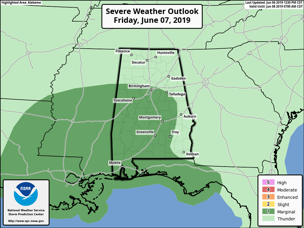
TOMORROW AND THE WEEKEND: Not much change. Tropical air with very high precipitable water values will remain over Alabama, and with an upper trough nearby we expect occasional rain and thunderstorms each day. SPC has much of Central and South Alabama in a “marginal risk” (level 1/5) of severe storms tomorrow; isolated instances of large hail and strong/gusty winds may occur during the afternoon and evening hours.
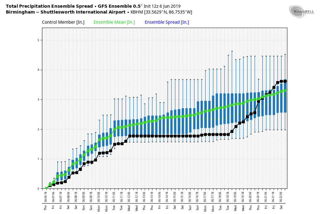
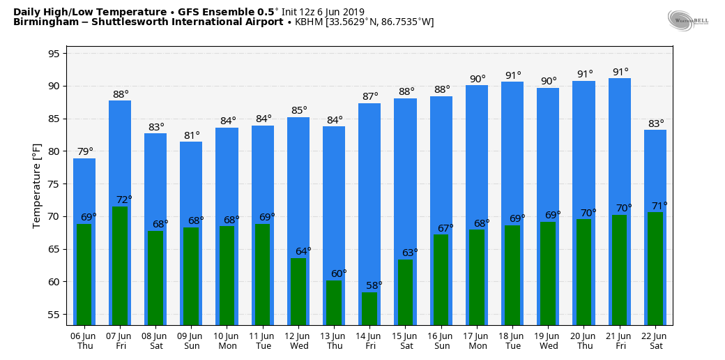
There will be some good breaks in the rain over the weekend, but showers or storms will be possible at any hour. We are not expecting any severe storms Saturday and Sunday, and rain totals by Sunday night will be in the 3-5 inch range for much of the state (five day totals, including the rain from yesterday and today). Highs will be mostly in the 80-85 degree range.
NEXT WEEK: Showers and a few storms remain likely Monday, but drier air begins to enter the state Tuesday, when the best chance of rain will shift to the eastern and southern counties. Then, the rest of the week is looking generally dry with highs in the 80s. See the Weather Xtreme video for maps, graphics, and more details.
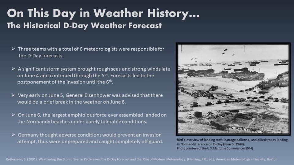
ON THIS DATE IN 1944: A very important forecast led to the largest amphibious invasion in history on the shores of Normandy, France. Without the use of supercomputers, radar, or satellites, six meteorologists predicted a brief break in stormy weather offering optimal invasion conditions on “D Day”.
BEACH FORECAST: Click here to see the AlabamaWx Beach Forecast Center page.
WEATHER BRAINS: Don’t forget you can listen to our weekly 90 minute show anytime on your favorite podcast app. This is the show all about weather featuring many familiar voices, including our meteorologists here at ABC 33/40.
CONNECT: You can find me on all of the major social networks…
Facebook
Twitter
Instagram
Pinterest
Snapchat: spannwx
Look for the next Weather Xtreme video here by 7:00 a.m. tomorrow…
Category: Alabama's Weather, ALL POSTS, Weather Xtreme Videos
About the Author (Author Profile)
James Spann is one of the most recognized and trusted television meteorologists in the industry. He holds the AMS CCM designation and television seals from the AMS and NWA. He is a past winner of the Broadcast Meteorologist of the Year from both professional organizations.Subscribe
If you enjoyed this article, subscribe to receive more just like it.


