

Storms Building Across Alabama
Those popcorn showers continue to burble up over Alabama and some of them are boiling over into storms.
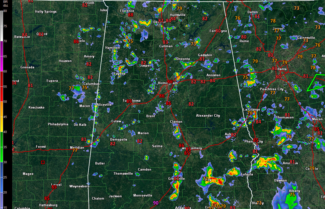
At 3:40 p.m., the strongest storms were over South Alabama, but some were building across Central and North Alabama as well.
The strongest storms were south of Greenville in Butler County, in Coffee County near Enterprise and in Pike County, near and east of Troy. Others were building into Barbour, Bullock, and Macon Counties. An areal flood advisory is in effect for parts of Pike County.
Across Central Alabama, newly formed storms were over eastern Jefferson County extending from Trussville down to Leeds and Moody. Another eas forming west of Ashville in northern St. Clair County. Look for lightning to develop shortly across parts of Marion, Walker, Fayette and western Jefferson Counties as well.
Across North Alabama, strong storms were near Athens in Limestone County and northeast of Moulton in Lawrence County.
If you get near one of these building storms, go inside to take shelter from the lightning. Remember, the first lightning bolt from a new storm doesn’t make thunder until after it has struck. Go inside when you see dark clouds building. Look for brief heavy rain as well.
The activity is pinwheeling in a giant counterclockwise fashion thanks to an upper low that remains over the state.
Category: Alabama's Weather, ALL POSTS
About the Author (Author Profile)
Bill Murray is the President of The Weather Factory. He is the site's official weather historian and a weekend forecaster. He also anchors the site's severe weather coverage. Bill Murray is the proud holder of National Weather Association Digital Seal #0001 @wxhistorianSubscribe
If you enjoyed this article, subscribe to receive more just like it.


