

Showers End This Evening; Mostly Dry Tomorrow
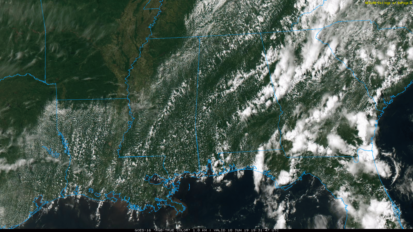
RADAR CHECK: Most of the showers across Alabama are south of I-20; heavier thunderstorms are over parts of East Alabama’s Chambers, Lee, and Macon counties at mid-afternoon. Showers over the northern third of the state are few and far between; and temperatures are mostly in the 80s. Showers and storms will end this evening, and the sky becomes mostly fair late tonight.
REST OF THE WEEK: Drier air flows into the state tomorrow; the day will be mostly sunny with lower humidity levels. Rain chances will be confined the southeast corner of the state around Dothan, and the high will be in the 81-85 degree range for most communities, which is below average for mid June in Alabama. We will bring back a chance of showers and thunderstorms Wednesday afternoon ahead of a cold front; a few strong storms are possible near the Tennessee state line. Then, another surge of dry air will bring very nice weather Thursday and Friday. Ample sunshine both days, lower humidity, cooler nights. Most places across North/Central Alabama will wind up in the 50s early Friday morning… highs will be in the 80s.
THE ALABAMA WEEKEND: A few scattered showers are possible near the Gulf Coast Saturday, otherwise the day should be dry with a good supply of sunshine along with a high in the upper 80s. Then, on Sunday, as moisture levels rise we will mention a chance of scattered showers and thunderstorms statewide with a high in the 80s. Best chance of a shower Sunday will come during the afternoon and evening hours.
NEXT WEEK: For now it looks like fairly routine early summer weather for Alabama; partly sunny days with the daily opportunity of “scattered, mostly afternoon and evening showers and thunderstorms”. Highs will be in the 85-90 degree range… See the Weather Xtreme video for maps, graphics, and more details.
TROPICS: All is quiet across the Atlantic basin and tropical storm formation is not expected this week.
ON THIS DATE IN 2012: South Alabama experienced excessive rain event… some locations received over 1 foot of rain which caused life-threatening flash flooding. Numerous roads, businesses and residences were flooded and some water rescues and evacuations had to be carried out. Three Flash Flood Emergencies were issued due to high water rescues and a private dam failure in southern Mobile County.
BEACH FORECAST: Click here to see the AlabamaWx Beach Forecast Center page.
WEATHER BRAINS: Don’t forget you can listen to our weekly 90 minute show anytime on your favorite podcast app. This is the show all about weather featuring many familiar voices, including our meteorologists here at ABC 33/40.
CONNECT: You can find me on all of the major social networks…
Facebook
Twitter
Instagram
Pinterest
Snapchat: spannwx
Look for the next Weather Xtreme video here by 7:00 a.m. tomorrow…
Category: Alabama's Weather, ALL POSTS, Weather Xtreme Videos
About the Author (Author Profile)
James Spann is one of the most recognized and trusted television meteorologists in the industry. He holds the AMS CCM designation and television seals from the AMS and NWA. He is a past winner of the Broadcast Meteorologist of the Year from both professional organizations.Subscribe
If you enjoyed this article, subscribe to receive more just like it.


