

A Few Storms Left
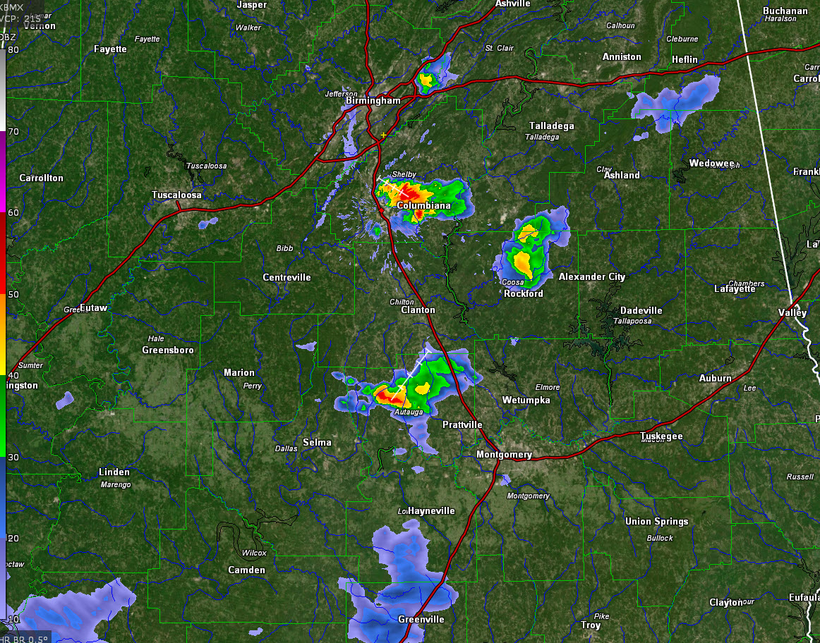
Three clusters of strong storms are ongoing across Central Alabama at this hour, and a new one is forming over areas east of I-459 in eastern Jefferson County.
The first is centered near Columbiana in eastern Shelby County. Tons of lightning in that system. It is back building toward Alabaster.
The second is Coosa County, between Goodwater and Rockford. It is weakening now.
Another is between Billingsley and Prattville. It really a merger of two cells and should begin weakening shortly.
The storm that is developing over eastern Jefferson County is between Leeds and Trussville. It was triggered by a passing outflow boundary from earlier storms over East Alabama.
All of the storms should weaken after sunset.
The HRRR depicts activity firing up late tonight over Northeast Mississippi that clips the Northwest corner of Alabama after midnight. Those storms could be strong, but they will move northeastward into Tennessee. The rest of the night should be quiet.
Category: Alabama's Weather, ALL POSTS
About the Author (Author Profile)
Bill Murray is the President of The Weather Factory. He is the site's official weather historian and a weekend forecaster. He also anchors the site's severe weather coverage. Bill Murray is the proud holder of National Weather Association Digital Seal #0001 @wxhistorianSubscribe
If you enjoyed this article, subscribe to receive more just like it.


