A Brief Late-Morning Update On Today & Thursday’s Severe Storm Potential
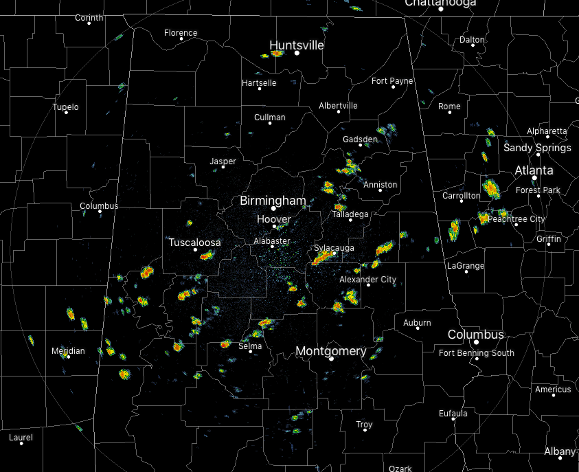
At 11:30 am, we have scattered showers across the central and south-central parts of Central Alabama. The good news is that none of these are displaying any lightning and none are strong at this point. All of these are moving off to the east at around 20-25 MPH.
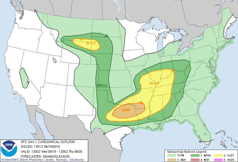
As you can see by the above image, an ugly duckling of severe weather is expected across a good portion of the country throughout the day and into the overnight hours. Severe thunderstorms are most likely across north-central/northeast Texas and the Ark-La-Tex region during the late afternoon and evening. Destructive hail and wind, along with a few tornadoes are possible.
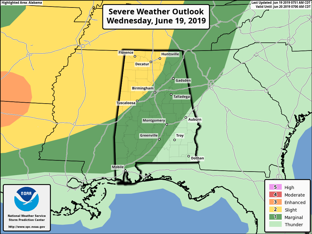
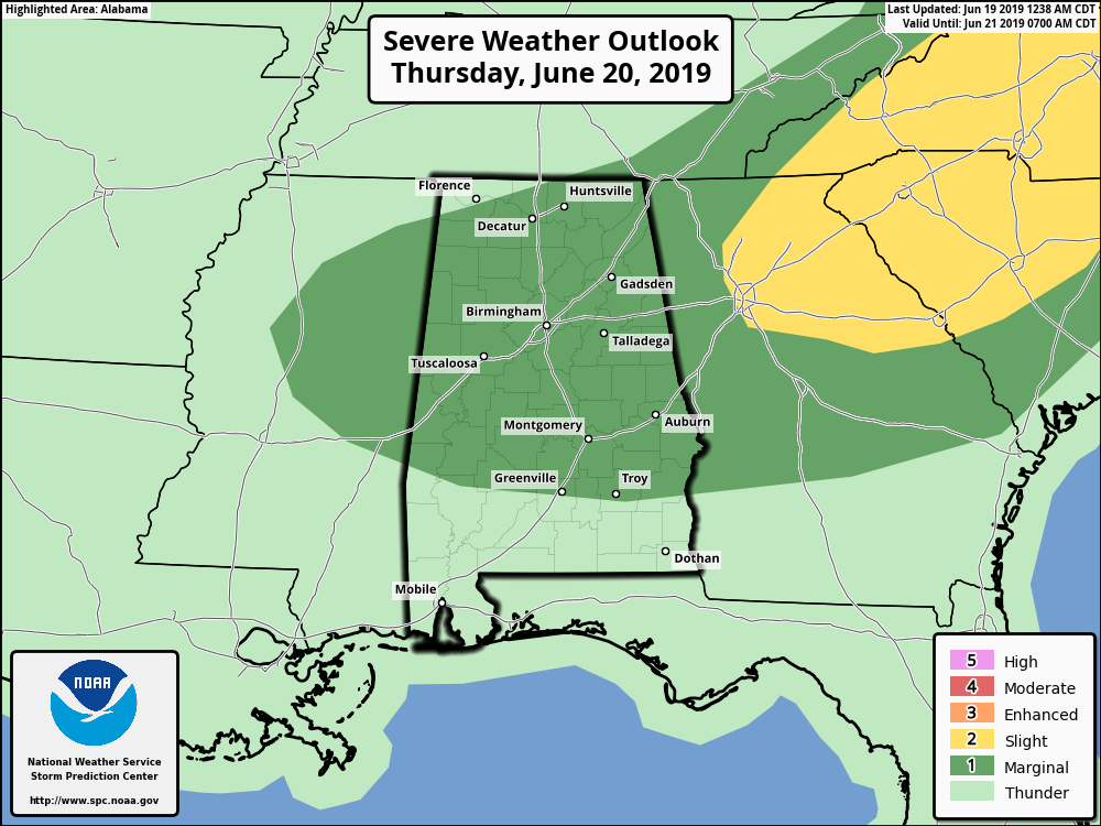
For North and Central Alabama today, the latest update from the Storm Prediction Center shows a Slight Risk for most locations north of the I-59 corridor while most locations along and south of that are under a Marginal Risk for severe storms through 7:00 am Thursday morning.
The first time period for the potential of strong to severe storms will come this afternoon through the early evening hours (roughly 12:00 pm to 7:00 pm) across all of Central Alabama. During this time, NWS Birmingham has a Marginal Risk for severe storms up for the entire area with isolated damaging downburst wind gusts up to 60 MPH and hail up to nickel size in diameter as the main threats. These storms will be scattered in nature but should quickly die off as we lose the daytime heating.
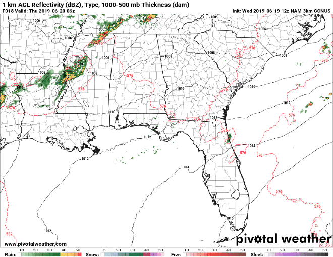
The second time period for the potential of strong to severe storms will come during the overnight hours roughly from 1:00 am to 7:00 am on Thursday morning. An MCS will be moving through Mississippi during the evening and late night hours and will eventually move into the western parts of the area around 1:00 am. This is where the Slight Risk comes into play as bowing line segments will have the potential of damaging thunderstorm wind gusts up to 60 MPH as the main threat, along with a smaller threat of hail. The above animation shows the MCS dissipating somewhat during the overnight hours but I believe it may stay together a little longer than shown due to the wind fields over the area along with instability staying higher. It will be out of the area by 7:00 am.
The third time period for the potential of strong to severe storms will come during the afternoon through the late night hours on Thursday, roughly from 12:00 pm to 11:00 pm. The boundary that will be left over from the MCS will be the catalyst for scattered to numerous convective storms to develop with the main heating of the day. Isolated damaging downburst wind gusts up to 60 MPH and hail up to golf ball size in diameter will be the main threats. There will be a non-zero threat of a brief isolated tornado or two during this stretch as well, but lower level shear will not be all that strong so it will be very difficult for one to spin up.
I’ll continue to keep you updated throughout the day. If any warnings or advisories are issued for North or Central Alabama, they will be automatically posted to the blog. If a watch is issued, NWS Birmingham stated in their briefing earlier this morning that, more than likely, it would be a severe thunderstorm watch. With any of these storms, rain could be heavy at times but should be moving at a fast enough pace that flash flooding issues will be unlikely. There will be plenty of lightning as well, so if you hear thunder, move indoors immediately. If you can hear thunder, you are close enough to the parent thunderstorm that you can be struck by lightning.
I’ll be back in a couple of hours with another update.
Category: Alabama's Weather, ALL POSTS, Severe Weather
About the Author (Author Profile)
Scott Martin is an operational meteorologist, professional graphic artist, musician, husband, and father. Not only is Scott a member of the National Weather Association, but he is also the Central Alabama Chapter of the NWA president. Scott is also the co-founder of Racecast Weather, which provides forecasts for many racing series across the USA. He also supplies forecasts for the BassMaster Elite Series events including the BassMaster Classic.Subscribe
If you enjoyed this article, subscribe to receive more just like it.


