Early Evening Check On The Potential For Severe Weather
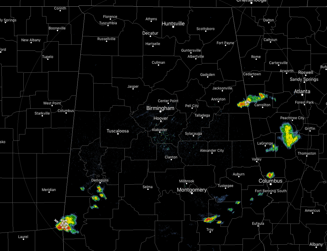
At 5:45 pm, shower and thunderstorm activity have dropped off from the last update a few hours ago. We have a few spotty showers located over parts of Marengo County along with another grouping of isolated showers over the extreme southeastern counties in Central Alabama. We also have a thunderstorm over parts of Cleburne County that will completely in Georgia within the next 30-45 minutes. All of the activity today has stayed below strong limits.
The first window for stronger to severe storms has come to an end since the activity has mainly come to an end. Now we wait until the storms associated with an MCS pushes into the area during the overnight hours.
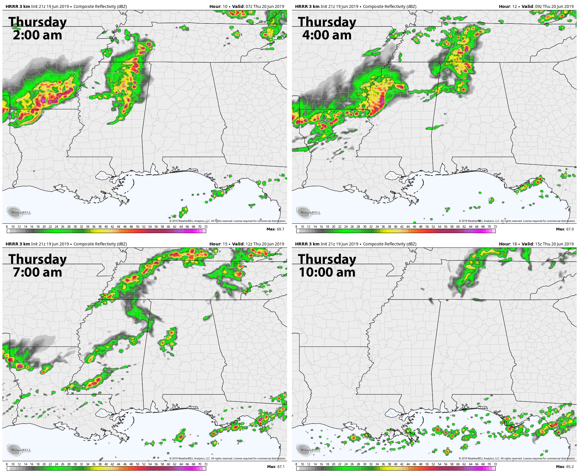
The latest HRRR shows that MCS beginning to move into the western parts of Central Alabama around 2:00 am and moving eastward through the northern parts of the area throughout the predawn hours. By 7:00 am, the MCS has moved out of the area and into eastern Tennessee, but we’ll continue to have showers and thunderstorms possible even though that severe threat will be over.
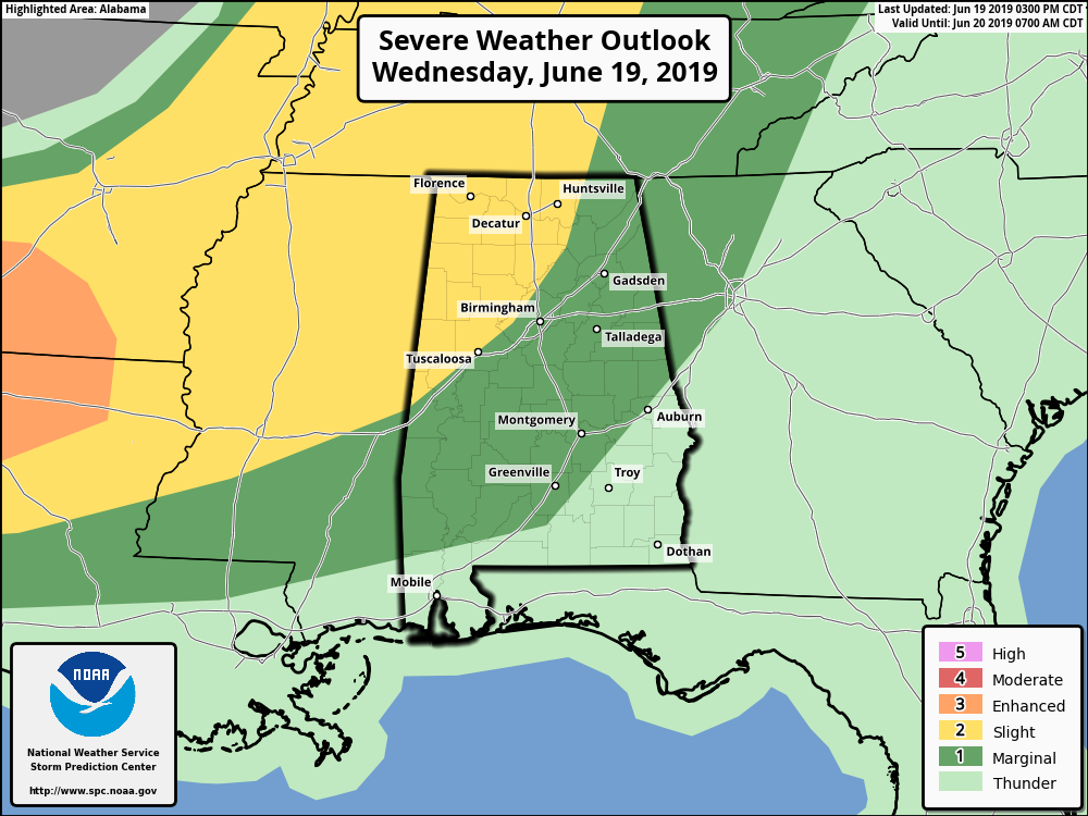
A Slight Risk continues for most locations north of the I-59 corridor through 7:00 am Thursday morning while a Marginal Risk continues for much of the rest of the area south of that to roughly the I-85 corridor. We’ll have the threat of damaging winds up to 60 MPH along with some smaller hail possible. The main windof for this round of potential severe weather will be from 1:00 am to 7:00 am.
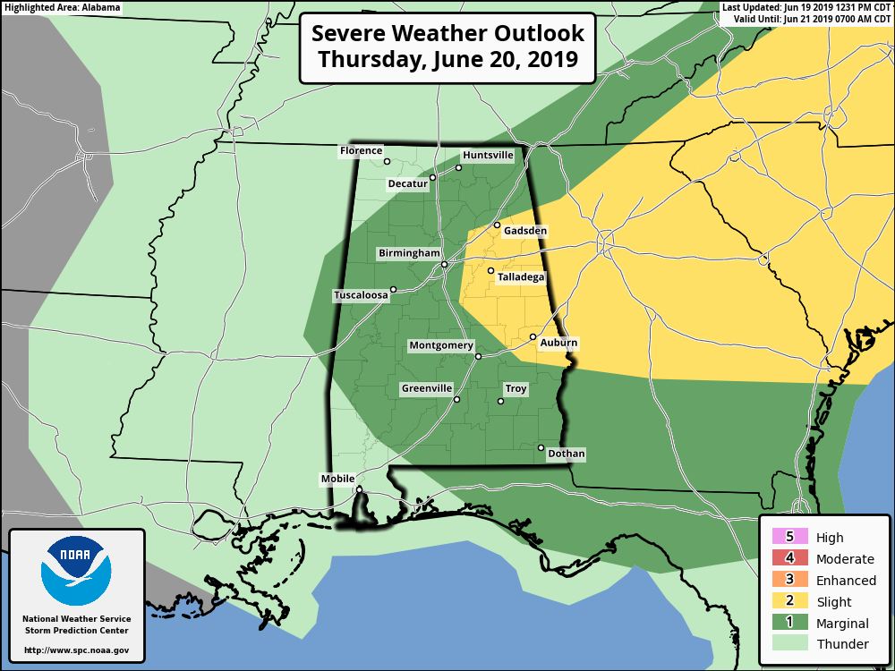
We have a Slight Risk up for the east and southeastern parts of Central Alabama throughout the day on Thursday, while a Marginal Risk is up for nearly all of the rest of the area. Main threat window will be from 12:00 pm to 11:00 pm with damaging downburst winds up to 60 MPH and large hail up to golf ball size possible. There is also a non-zero tornado threat during the same window, but it will be very difficult for one to spin up as low-level shear will be on the weaker side.
The next update will be out around 9:00 pm tonight unless there are drastic changes to the forecast. Please continue to check back often.
Category: Alabama's Weather, ALL POSTS, Severe Weather
About the Author (Author Profile)
Scott Martin is an operational meteorologist, professional graphic artist, musician, husband, and father. Not only is Scott a member of the National Weather Association, but he is also the Central Alabama Chapter of the NWA president. Scott is also the co-founder of Racecast Weather, which provides forecasts for many racing series across the USA. He also supplies forecasts for the BassMaster Elite Series events including the BassMaster Classic.Subscribe
If you enjoyed this article, subscribe to receive more just like it.


