MCS Pushing Across Mississippi River, Roughly 3 Hours From Western Parts Of North/Central Alabama
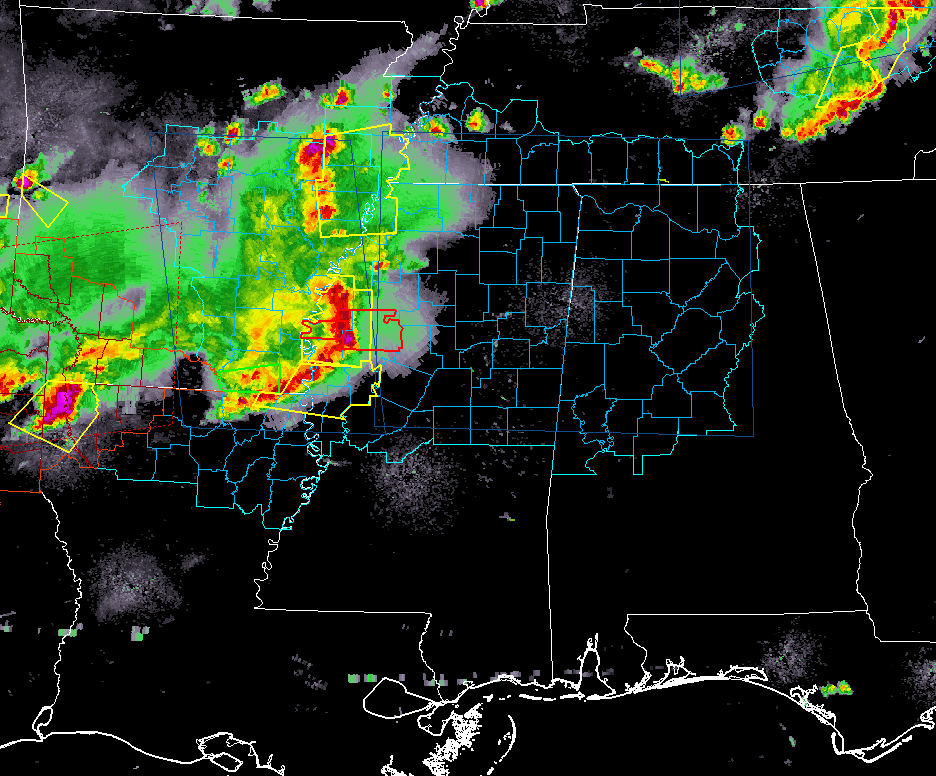
At 10:50 pm, strong to severe thunderstorms associated with an MCS has now pushed across the Mississippi River and is now affecting the western and northwestern parts of Mississippi and back into eastern Arkansas and extreme northern Louisiana.
Several Severe Thunderstorm Warnings and a couple of Tornado Warnings are in effect on the leading edge of the MCS.
The system is moving eastward at around 60 MPH. At its current rate of speed, we will see it enter into the western parts of North/Central Alabama somewhere in the 1:30 am to 2:30 am time frame.
These storms are really packing a punch as power outages in the state of Arkansas are now up to over 105,000.
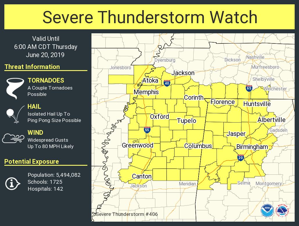
A Severe Thunderstorm Watch is in effect for a good chunk of North/Central Alabama until 6:00 am Thursday morning. Main threats will be from damaging winds up to 60-70 MPH, with a smaller threat of hail and a brief spin-up tornado or two.
Please have a dependable way of receiving warnings during the overnight hours, especially one that will wake you up. Don’t wait to hear a siren… you may never hear it. I’ll be with you throughout the night.
Category: Alabama's Weather, ALL POSTS, Severe Weather
About the Author (Author Profile)
Scott Martin is an operational meteorologist, professional graphic artist, musician, husband, and father. Not only is Scott a member of the National Weather Association, but he is also the Central Alabama Chapter of the NWA president. Scott is also the co-founder of Racecast Weather, which provides forecasts for many racing series across the USA. He also supplies forecasts for the BassMaster Elite Series events including the BassMaster Classic.Subscribe
If you enjoyed this article, subscribe to receive more just like it.


