A Quick Check On Our Weather Situation At Midday
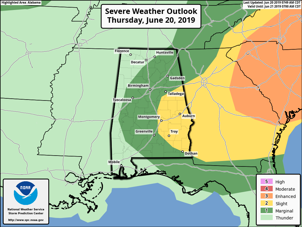
Nearly all of Central Alabama remains in a Marginal Risk for severe storms throughout the remainder of today with the exception of the extreme western locations. A Slight Risk is up for a good portion of the east and southeastern parts of the area.
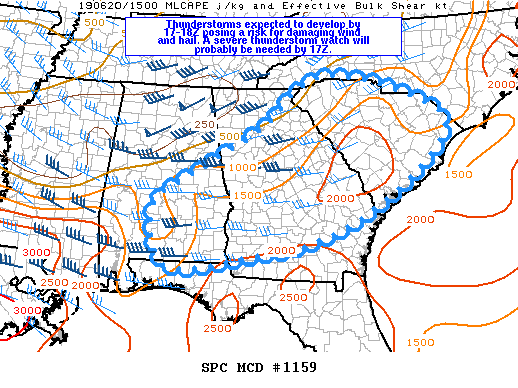
Thunderstorms are expected to develop by 12:00 pm to 1:00 pm over a large part of the Southeast U.S. and increase in coverage and intensity during the afternoon, posing a risk for damaging wind and hail. A weather watch will probably be needed for a portion of this region by 12:00 pm.
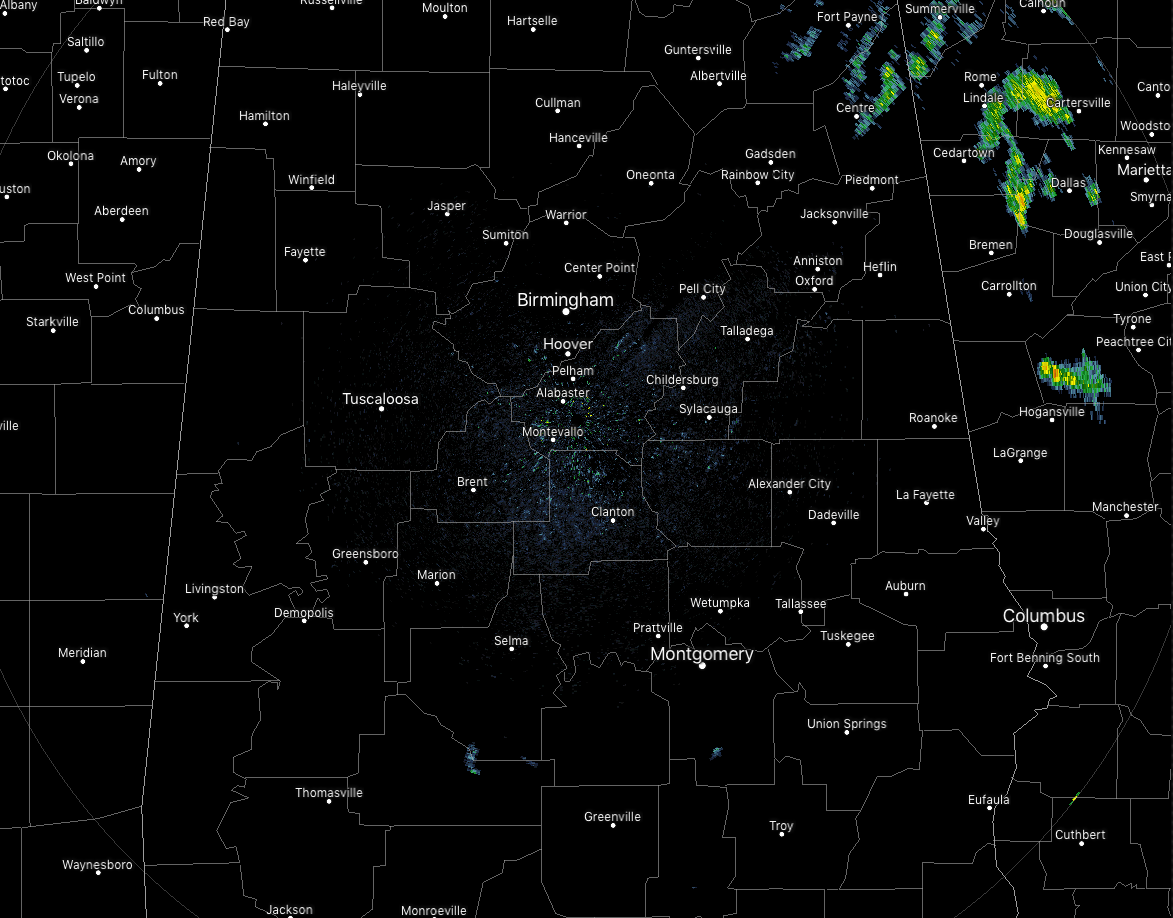
Radar at 11:11 am is quiet for the most part with only a few spotty showers up over the northern parts of Cherokee County. It won’t stay that way for long as we are already seeing instability values ranging from 500-2500 J/kg from north to south across the area. Bulk shear is currently in the 35-40 knot range.
So the ingredients are in place, we’ll just have to wait and see when and where convection will start firing up. Most likely it will be south of the I-20 corridor over the southern half of the area. The environment is conducive for both multicell and supercell formation. The main threats will be from damaging downburst winds of up to 60 MPH and large hail up to quarter size. There is a non-zero tornado threat for today as there will be enough shear to possibly get an isolated tornado or two. The main window for stronger to severe storms will be from 1:00 pm to 10:00 pm.
So the forecast for today… skies will be mostly sunny across Central Alabama but scattered showers and thunderstorms will begin to develop during the early afternoon through the late evening hours. Some of the storms have the potential to become strong to severe, with damaging winds and quarter size hail possible. Afternoon highs will be in the mid-80s to the lower 90s. For tonight, storms will continue through at least 10:00 pm before starting to wane in coverage. Higher chances through the nighttime hours will be in the south and southeastern parts of the area. Lows will be in the upper 60s to the mid-70s.
Category: Alabama's Weather, ALL POSTS, Severe Weather
About the Author (Author Profile)
Scott Martin is an operational meteorologist, professional graphic artist, musician, husband, and father. Not only is Scott a member of the National Weather Association, but he is also the Central Alabama Chapter of the NWA president. Scott is also the co-founder of Racecast Weather, which provides forecasts for many racing series across the USA. He also supplies forecasts for the BassMaster Elite Series events including the BassMaster Classic.Subscribe
If you enjoyed this article, subscribe to receive more just like it.


