

First Day Of Summer Brings A Possibility Of Strong Storms Later In The Day
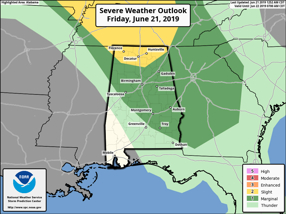
TODAY: Skies will be mostly clear throughout the day today as ridging starts to set up over the southeast. That will pump more warm and humid air up into the area. We will have a small chance of a few isolated to scattered afternoon showers and thunderstorms across the area. Then, late in the afternoon through the evening hours, we’ll be watching to our northwest to see if we’ll have an MCS moving in this direction. The latest NAM is showing one moving into North Alabama by 3:00 pm and into the northern parts of Central Alabama about an hour or so later. It is modeled to progress nearly due southward through Central Alabama throughout the evening and late night hours before dying out over the extreme southern parts of the area right at or just after midnight. SPC has a Marginal Risk up for much of Central Alabama with the exception of the southwestern parts of the area, while a Slight Risk is up for much of North Alabama. Damaging winds up to 60 MPH will be the main concern with this MCS. Today’s highs will be in the lower to mid-90s across the area, and with the humidity levels, heat index values will be around 5 to 7 degrees warmer than the actual temperature.
SATURDAY: With ridging in place, it will force most of the afternoon shower and thunderstorm development to the eastern half of the area on Saturday. Skies will be partly cloudy with a small chance of isolated to scattered afternoon and early evening showers and thunderstorms. Highs will be in the lower to mid-90s with heat index values reaching 95-103 degrees.
SUNDAY: Much of the same story on Sunday… We’ll have mostly clear to partly cloudy skies from west to east across the area throughout the day with a small chance of isolated to scattered afternoon showers and thunderstorms with the higher chances on the eastern side of the area. Highs will be in the lower to mid-90s with some locations possibly hitting the upper 90s.
MONDAY: On Monday, shower and thunderstorm chances increase as we’ll have a shortwave that will move into the area. Skies will start off mostly clear but clouds will be on the increase throughout the day. Those rain chances will increase during the morning hours and the higher chances will be along and north of the I-20 corridor. Highs will be in the upper 80s to the mid-90s across the area.
TUESDAY: On Tuesday, the shortwave will be exiting the area, but we’ll continue to have slightly higher chances of showers and thunderstorms during the daytime hours. We should start to see those dissipate by the evening and be dry during the late night and overnight hours. Highs will be in the mid-80s to the lower 90s.
WEDNESDAY THROUGH FRIDAY: We’ll be back to a more seasonal pattern to end out the work week as we’ll have mostly clear to partly cloudy skies on all three days with only a very small risk of a few isolated afternoon showers and thunderstorms. Highs on each day will be in the upper 80s to the lower 90s across the area.
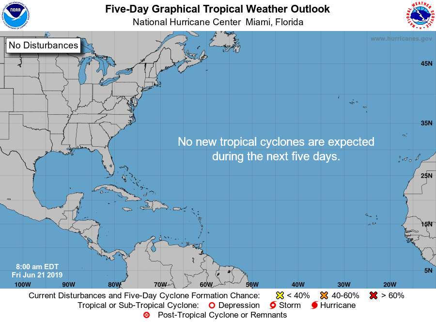
TROPICS: All is quiet across the Atlantic Basin and no tropical cyclones are expected to form over the next five days.
BEACH FORECAST CENTER: Get the latest weather and rip current forecasts for the beaches from Fort Morgan to Panama City on our Beach Forecast Center page. There, you can select the forecast of the region that you are interested in.
ALREADY OFF TO A HOT START IN 2019! ADVERTISE WITH THE BLOG!: We have enjoyed over 10 MILLION page views on AlabamaWx.com so far in 2019! Don’t miss out! We can customize a creative, flexible and affordable package that will suit your organization’s needs. Contact Bill Murray at (205) 687-0782.
E-FORECAST: Get the Alabama Wx Weather Blog’s Seven-Day Forecast delivered directly to your inbox by email twice daily. It is the most detailed weather forecast available in Central Alabama. Subscribe here… It’s free!
CONNECT WITH THE BLOG ON SOCIAL MEDIA: You can find the AlabamaWx Weather Blog on the major social media networks:
Facebook
Twitter
Instagram
WEATHERBRAINS: Don’t forget you can listen to our weekly 90 minute netcast anytime on the web at WeatherBrains.com or on iTunes, Stitcher, or Spotify. This is the show all about weather featuring many familiar voices, including the meteorologists at ABC 33/40.
Category: Alabama's Weather, ALL POSTS, Severe Weather, Weather Xtreme Videos
About the Author (Author Profile)
Scott Martin is an operational meteorologist, professional graphic artist, musician, husband, and father. Not only is Scott a member of the National Weather Association, but he is also the Central Alabama Chapter of the NWA president. Scott is also the co-founder of Racecast Weather, which provides forecasts for many racing series across the USA. He also supplies forecasts for the BassMaster Elite Series events including the BassMaster Classic.Subscribe
If you enjoyed this article, subscribe to receive more just like it.


