

More Strong To Severe Storms Possible Today While The Heat Continues
SATURDAY: Today will be another day that features hot and humid conditions across Central Alabama with the potential for more scattered showers and thunderstorms to develop during the heating of the day. With the environment in place, a few storms that develop could become strong to severe. Highs will top out in the lower to mid-90s across the area with heat index values in the 100-105 degree range.
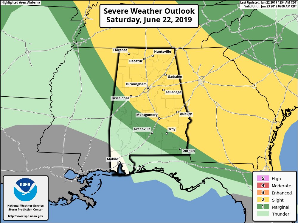
There is a Slight Risk for severe thunderstorms capable of producing quarter size hail and damaging winds through this evening, generally along and north of a line from Reform to Autaugaville to Blue Springs. Additional strong to severe thunderstorms south of this line cannot be ruled out.
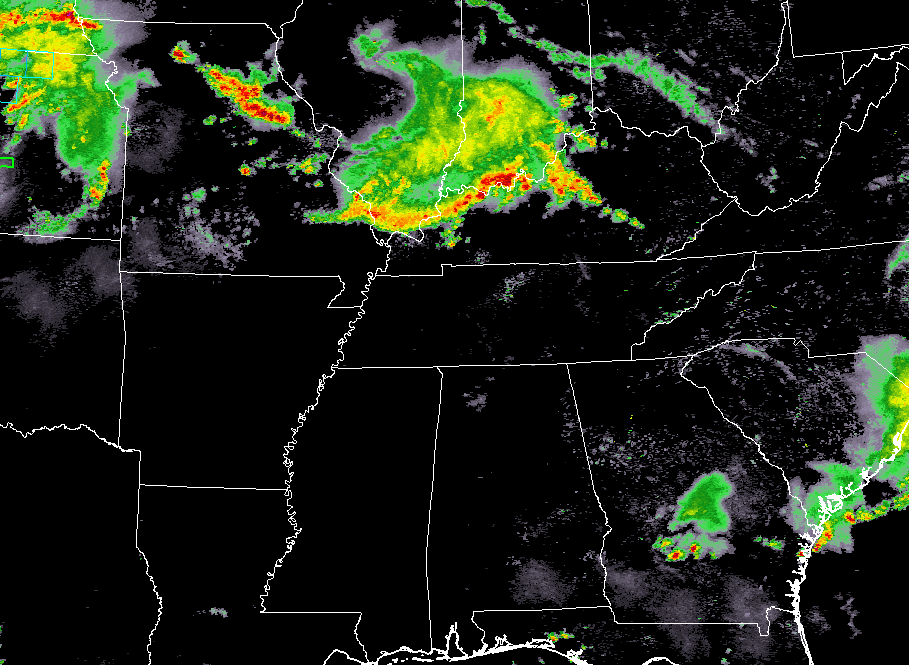
We’ll also have to watch for another MCS that is currently headed southward through southern Illinois, southern Indiana, and northern Kentucky. If it can stay together through the morning hours and makes it to Central Alabama, we’ll have to watch for damaging winds in excess of 60 MPH as it moves through. Latest guidance from the high-resolution NAM has it arriving in the northern parts of the area by 2:00 pm, then reaching the east-central locations by 5:00 pm. Then we may have another MCS move into the area from the north around 7:00 pm and weaken until it diminishes by midnight.
We’ll keep you posted throughout the day.
SUNDAY: Ridging in place over the southeast will continue to pump more warm and humid air up into Central Alabama on Sunday, but our rain chances will be less than what we’ll see for today. Skies will be mostly clear to partly cloudy and we’ll have a slight chance of a few isolated showers and thunderstorms mainly over the eastern half of the area. Highs will be in the lower to mid-90s across much of the area with heat index values in the 100-105 degree range.
MONDAY: The ridge moves eastward which will allow a more southerly flow across Central Alabama on Monday. This will increase rain chances across the area, especially for the northern parts of the area as a front will try to work in. Skies will be partly to mostly cloudy with scattered showers and thunderstorms possible south of the I-59 corridor and likely north of that. Highs will be in the mid-80s to the mid-90s across the area from northwest to southeast.
TUESDAY & WEDNESDAY: The ridge will build back into Central Alabama on Tuesday, but we’ll keep a good bit of moisture in place. That moisture will stick around on Wednesday as well, as well have a chance of scattered afternoon showers and thunderstorms on both days. Highs on both days will be in the upper 80s to the lower 90s across the area.
THURSDAY & FRIDAY: The ridge looks to break down to end the work week, allowing for more gulf moisture to move into Central Alabama. We’ll have a chance of scattered showers and thunderstorms on Thursday with highs in the lower to mid-90s. Those scattered shower and thunderstorm chances increase for Friday and would even see a strong storm or two. Friday’s highs will be in the upper 80s to the lower 90s.
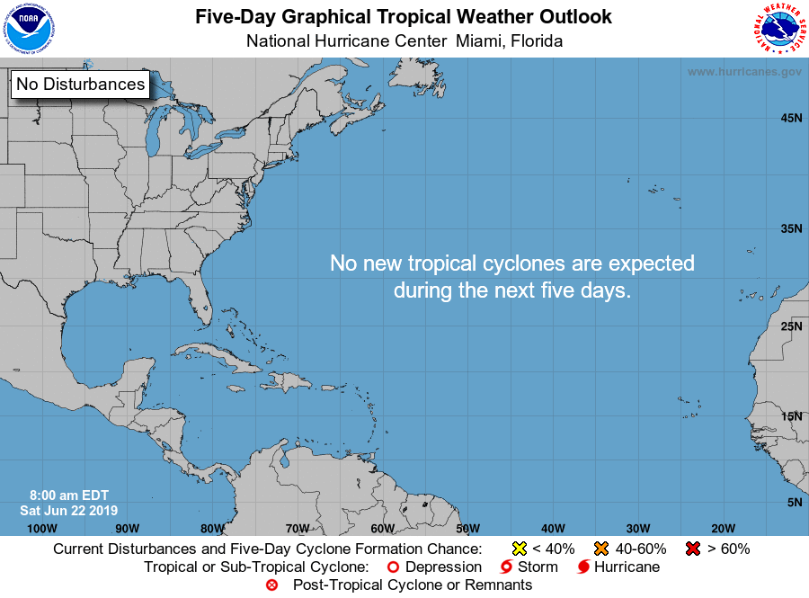
TROPICS: All is quiet across the Atlantic Basin and no tropical cyclones are expected to form over the next five days.
Category: Alabama's Weather, ALL POSTS, Severe Weather, Weather Xtreme Videos
About the Author (Author Profile)
Scott Martin is an operational meteorologist, professional graphic artist, musician, husband, and father. Not only is Scott a member of the National Weather Association, but he is also the Central Alabama Chapter of the NWA president. Scott is also the co-founder of Racecast Weather, which provides forecasts for many racing series across the USA. He also supplies forecasts for the BassMaster Elite Series events including the BassMaster Classic.Subscribe
If you enjoyed this article, subscribe to receive more just like it.


