Showers and Storms Dropping Southeast Into Central Alabama
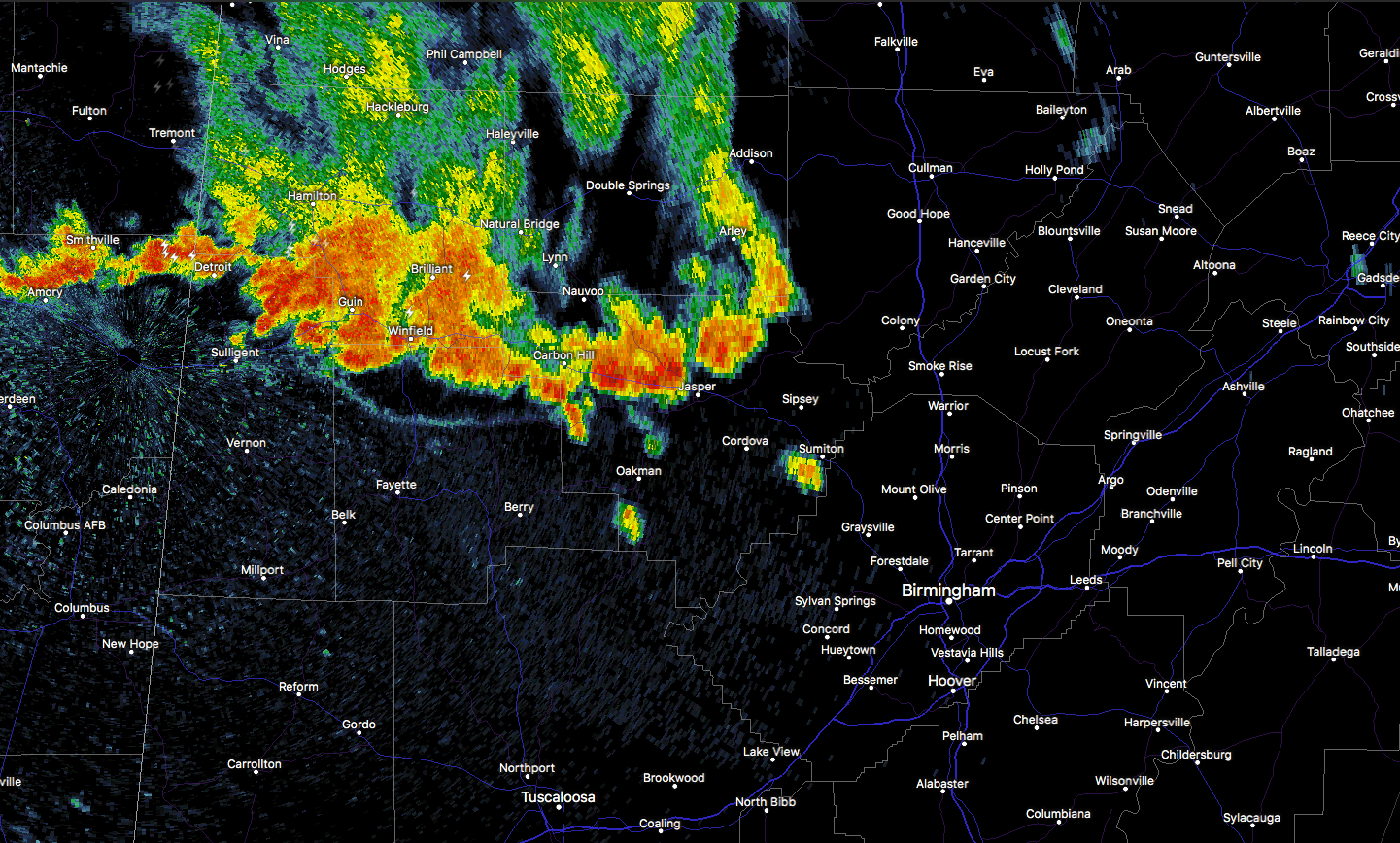
A large grouping of showers and thunderstorms has been dropping southeastward all morning through North and northwestern Alabama. The leading edge of the storms at 10:45 a.m. is pushing into much of Walker, Fayette, and Lamar Counties. The strongest storms were moving into Lamar and Fayette Counties from Marion County, where there is a good bit of lightning.
Moving southeast at 15 mph, the storms should reach western Jefferson County before 11:30, although some advance showers may arrive before then. They will also sink into northern Tuscaloosa and Pickens Counties between 11:30 and 12.
The airmass ahead of the storms is fairly uncontaminated by clouds, and temperatures are heating through the middle 80s. Instability values are moderate and increasing, running 2,000-2,750 joules of CAPE, so the storms should intensify. Downdraft CAPE values will increase the further south of Birmingham that the complex goes, leading to a better chance of stronger wind gusts. That will be the main threat, along with lightning and heavy rain. There could be some small hail with any stronger storms.
The storms will bring beneficial rain and will cool things off a bit, which is good news.
Category: Alabama's Weather, ALL POSTS
About the Author (Author Profile)
Bill Murray is the President of The Weather Factory. He is the site's official weather historian and a weekend forecaster. He also anchors the site's severe weather coverage. Bill Murray is the proud holder of National Weather Association Digital Seal #0001 @wxhistorianSubscribe
If you enjoyed this article, subscribe to receive more just like it.


