Weather Xtreme Video: Alabama Continues on the Outer Fringes of Barry Today
Hurricane Barry became the first Atlantic Hurricane of 2019 and the first named storm to affect Louisiana and the United States this year. Flooding has fierce over some of the lower Parishes of southern Louisiana with trees and power lines down, structures damaged and roads inundated. It will take days to clean things up in the affected areas. In Alabama, the western end of Dauphin Island will require that lots of sand be cleared from roads on the western end of the island, but the state appears to have escaped relatively unscathed. Parts of the state will deal with the outer rain bands of Barry again today and tomorrow, along with the threat of heavy rain and isolated tornadoes, especially tomorrow. But the threat is low. Let’s dig into the details.
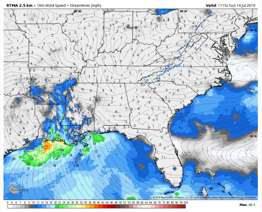
Surface Winds This Morning
TROPICAL STORM BARRY: Barry is hanging in there like a rusty fishhook over western Louisiana some 80 miles south of Shreveport. Top winds are still 45 mph. The storm is expected to weaken to depression status by early afternoon and it tracks northward into Arkansas.
FOR ALABAMA TODAY: Some of that heavy rain and thunderstorms now over Mississippi will try to edge over into western Alabama today. Wind shear values will be generally low enough to rule out any tornadic development, but the SPC does have the western 1/3 of the state in a marginal risk for today and tonight. Highs will range from the lower and middle 80s west of I-65 to upper 80s to lower 90s east of the interstate. It will be breezy at times over western and northwestern Alabama, with occasional gusts in the 20-25 mph range.
TONIGHT: Can’t rule out showers continuing through the overnight hours, with a small severe weather threat even after midnight over extreme western Alabama around Pickens and Sumter Counties if wind shear ramps up a bit. Lows will be in the muggy 70s.
MONDAY MONDAY: The weakening surface low will be near Little Rock. We start out the day cloudy but see some breaks in the clouds during the late morning and early afternoon over eastern sections. Another rain band from Barry will venture into the state from the west during the day. We will be monitoring shear levels in case an isolated tornado threat materializes. Highs will again be in the 80s west to upper 80s to lower 90s east. It will be breezy at times over the western and northwestern parts of the state.
TUESDAY/WEDNESDAY: The surface low will be moving slowly eastward through the Ohio Valley by then. Tuesday and Wednesday both will still be breezy as surface high pressure begins to build over Alabama and Georgia, setting up a nice pressure gradient between the high and the remnants of Barry. It will be drier with only a few showers over the Tennessee Valley. Temperatures will heat up into the lower 90s again in all but northwestern sections.
THURSDAY AND ON INTO THE WEEKEND: The departing Barry will send us a parting gift on Thursday in the form of a trailing cold front. That may trigger a few showers and storms before it settles into South Alabama and washes out. Highs will start to warm up into the lower and middle 90s. Lows will be in the muggy middle 70s.
GULF COAST WEATHER: Unsettled conditions through Monday along the beautiful beaches of Alabama and Northwest Florida with a good chance of rain and storms. Things will begin to return to normal by Tuesday with the standard fare of 8-10 hours of sunshine each day, scattered storms developing during the afternoon, and highs around 90f and lows in the upper 70s. Water temperatures are running around 84F. The rip current risk remains high through Monday night. Click here to see the Beach Forecast Center page.
SHOCKING STORY: The staff at the National Weather Service in Huntsville was stymied on Saturday as their radar at Hytop went into generator mode for no apparent reason, burning unnecessary fuel. A technician was dispatched and found the culprit. A very dead, electrocuted and fried raccoon that had unfortunately gotten into the equipment and thrown the radar into generator mode. Sounds like the new baseball team in Huntsville, the Trash Pandas, will need to seize on this news for a shocking promotion this upcoming season.
WEATHERBRAINS: This week, the panel will entertain a meteorologist from the Mississippi Gulf Coast who will be talking about the big algal bloom that has been plaguing their section of the coast. Check out the show at www.WeatherBrains.com. You can also subscribe on iTunes. You can watch the show live at live.bigbrainsmedia.com You will be able to see the show on the James Spann 24×7 weather channel on cable or directly over the air on the dot 2 feed.
ON THIS DATE IN 1980: Heatwave deaths were soaring nationally and in Alabama as a powerful heatwave held much of the country in its grips. Birmingham’s Mayor Richard Arrington called for emergency relief. The mayor declared a state of emergency in Birmingham. Volunteer organizations called for people to donate electric fans. Emergency shelters were opened. Fifteen fatalities had been discovered in Birmingham, and it was suspected that heat had played a role in another twenty-seven. Across Alabama, officially 21 heat-related deaths had been reported. The apartments of the Central City housing project were like ovens. The national death toll stood at 495. It was 103F at the Birmingham Airport on Monday, July 14th and the forecast called for 105F on Tuesday. Forecasters warned that no relief was in sight. The 103F on the 14th marked the fifth consecutive day that Birmingham had seen temperatures of 100F or higher. Eventually, the mercury would soar to 100F or higher on eight straight days, a record that would stand until 2007. Follow my weather history tweets on Twitter. I am @wxhistorian at Twitter.com.
Category: Alabama's Weather, ALL POSTS, Tropical, Weather Xtreme Videos
About the Author (Author Profile)
Bill Murray is the President of The Weather Factory. He is the site's official weather historian and a weekend forecaster. He also anchors the site's severe weather coverage. Bill Murray is the proud holder of National Weather Association Digital Seal #0001 @wxhistorianSubscribe
If you enjoyed this article, subscribe to receive more just like it.


