Tropical Showers Again Today
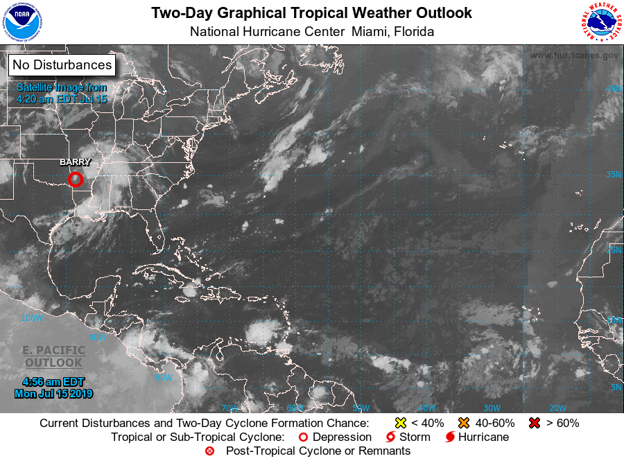
ON THE MAPS: The remnant circulation of former Tropical Storm Barry is over Arkansas, and Alabama remains on the wet, east side of the system. Deep moisture remains in place, and we expect a number of tropical showers today.
Rain is falling early this morning over the northwest counties of the state, and showers and storms will increase during the afternoon and evening hours when the air is most unstable. The highest coverage of rain will be over the western half of the state, but some places in East Alabama will see a good downpour this afternoon. We note SPC has a “marginal risk” defined today for the northwest corner of the state due to the potential of a brief, isolated spin-up tornado, but the better chance of that will be west of our state.
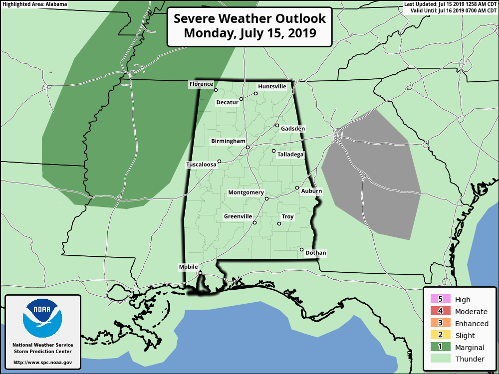
The high today will be in the mid 80s over West Alabama, and close to 90 for the eastern side of the state.
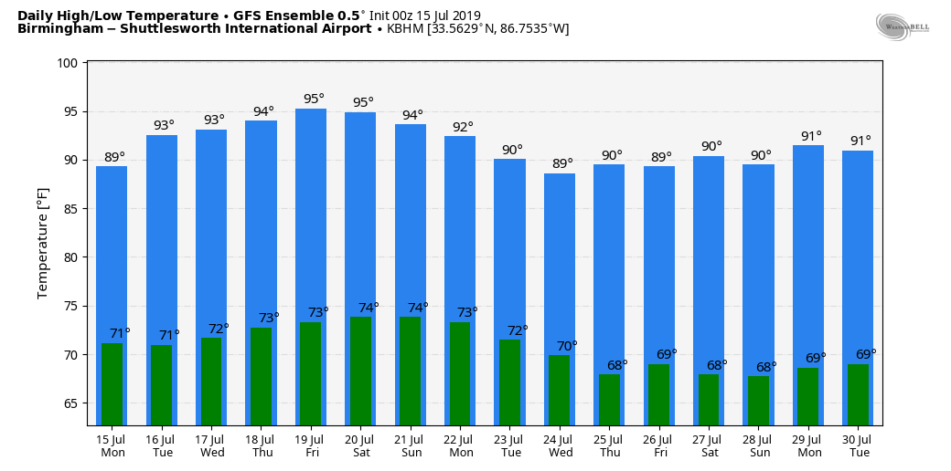
REST OF THE WEEK: Showers and storms should be fewer in number for most of the state tomorrow; the highest coverage will be over Northwest Alabama and the Tennessee Valley. Heat levels will creep back up with highs in the low 90s for most communities. Then, for the rest of the week, we will mention “scattered, mostly afternoon and evening showers and thunderstorms” each day with a partly sunny sky along with highs in the low 90s. Showers will be harder to find over the southern half of the state, where mid 90s are possible.
THE ALABAMA WEEKEND: More routine summer weather for the state. Partly sunny, hot, humid days with random, scattered showers and storms, mostly between 1:00 and 9:00 p.m. No way of knowing in advance exactly when and where they form. Highs will be at or just over 90 degrees… right at seasonal averages.
Showers and storms could be a little more numerous early next week as a surface front approaches, but fronts, as we all know, rarely push through our state in late July. See the Weather Xtreme video for maps, graphics, and more details.
TROPICS: The remnant circulation of Barry is over Arkansas this morning; out in the Atlantic the weather is very quiet, and tropical storm formation is not expected this week.
HEAT BREAK: Temperatures have failed to reach 90 degrees in Birmingham for two consecutive days. Prior to this past weekend, the high was 90 or higher for 13 consecutive days.
ON THIS DATE IN 1901: The city of Marquette, Michigan set their all-time record high temperature with 108-degree reading.
BEACH FORECAST: Click here to see the AlabamaWx Beach Forecast Center page.
WEATHER BRAINS: Don’t forget you can listen to our weekly 90 minute show anytime on your favorite podcast app. This is the show all about weather featuring many familiar voices, including our meteorologists here at ABC 33/40.
CONNECT: You can find me on all of the major social networks…
Facebook
Twitter
Instagram
Pinterest
Snapchat: spannwx
Look for the next Weather Xtreme video here by 4:00 this afternoon… enjoy the day!
Category: Alabama's Weather, ALL POSTS, Weather Xtreme Videos
About the Author (Author Profile)
James Spann is one of the most recognized and trusted television meteorologists in the industry. He holds the AMS CCM designation and television seals from the AMS and NWA. He is a past winner of the Broadcast Meteorologist of the Year from both professional organizations.Subscribe
If you enjoyed this article, subscribe to receive more just like it.


