

Tropical Showers & Storms Affecting Western Parts Of The Area At Midday
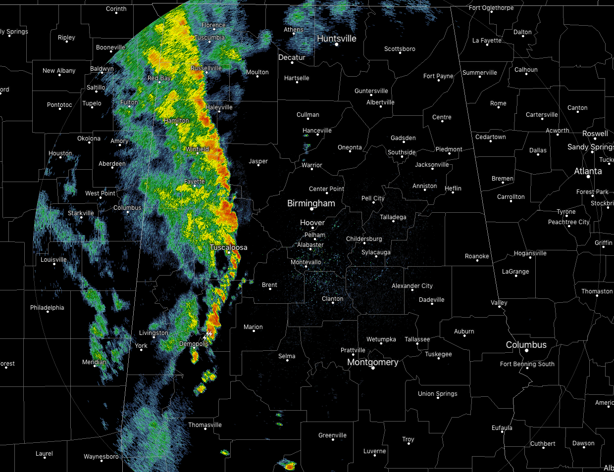
At 11:10 am, an outer band from the remnants of Barry is working its way through the extreme western parts of North/Central Alabama, while pretty much the rest of the area is rain free with partly cloudy to mostly clear skies. The heaviest band of rain and storms stretches from Russellville to Carbon Hill to Tuscaloosa to Greensboro. There is very little lightning occurring with this band, but we could see some brief gusty winds and some training of the cells along the band.
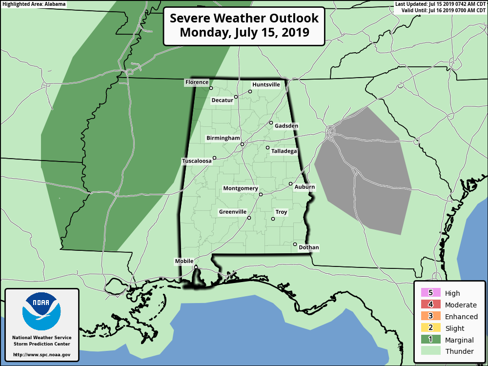
At this point, the SPC only has the extreme northwestern parts of the area in a Marginal Risk of severe storms with the threat being the potential of a brief spin-up tornado or two. The higher tornado risks will be west of the state.
So for today, rain activity will range from a very small risk of a few isolated to scattered showers in the east to numerous showers and storms in the west. There will be more clouds than sun for most with afternoon highs ranging in the lower 80s to the mid-90s across the area from northwest to southeast. Once we lose the heating of the day, rain activity across the state will diminish with only a very slight risk of a stray shower or two east of I-65 while there is a chance of showers and storms in the west continuing from Barry’s remnants. Lows will be in the lower to mid-70s.

Much of the area will be much drier as rain chances will be limited to the northern parts of the area north of the I-59 corridor. There is a Marginal Risk of severe storms with the threat being the potential of a brief spin-up tornado or two in the northwestern corner of the state. Where there is no rain, temperatures will get very hot. Highs will reach the upper 80s to the upper 90s across the area from northwest to southeast. While it will remain rather humid, dewpoints will be lower in the southeastern parts of the area which will keep heat indices out of advisory range.
BEACH FORECAST CENTER: Get the latest weather and rip current forecasts for the beaches from Fort Morgan to Panama City on our Beach Forecast Center page. There, you can select the forecast of the region that you are interested in.
ALREADY OFF TO A HOT START IN 2019! ADVERTISE WITH THE BLOG!: We have enjoyed over 11 MILLION page views on AlabamaWx.com so far in 2019! Don’t miss out! We can customize a creative, flexible and affordable package that will suit your organization’s needs. Contact Bill Murray at (205) 687-0782.
E-FORECAST: Get the Alabama Wx Weather Blog’s Seven-Day Forecast delivered directly to your inbox by email twice daily. It is the most detailed weather forecast available in Central Alabama. Subscribe here… It’s free!
CONNECT WITH THE BLOG ON SOCIAL MEDIA: You can find the AlabamaWx Weather Blog on the major social media networks:
Facebook
Twitter
Instagram
WEATHERBRAINS: Don’t forget you can listen to our weekly 90 minute netcast anytime on the web at WeatherBrains.com or on iTunes, Stitcher, or Spotify. This is the show all about weather featuring many familiar voices, including the meteorologists at ABC 33/40.
Category: Alabama's Weather, ALL POSTS, Severe Weather, Tropical
About the Author (Author Profile)
Scott Martin is an operational meteorologist, professional graphic artist, musician, husband, and father. Not only is Scott a member of the National Weather Association, but he is also the Central Alabama Chapter of the NWA president. Scott is also the co-founder of Racecast Weather, which provides forecasts for many racing series across the USA. He also supplies forecasts for the BassMaster Elite Series events including the BassMaster Classic.Subscribe
If you enjoyed this article, subscribe to receive more just like it.


