

Afternoon Showers/Storms Moving East
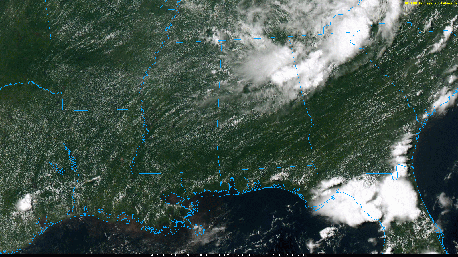
RADAR CHECK: Showers and a few heavy thunderstorms are over East Alabama; at mid-afternoon some of the heaviest rain was falling in a band from Lincoln to Anniston to Heflin. And, new showers are developing over West Alabama in the very moist air over Alabama. Showers and storms remain possible through the evening hours; they fade later tonight once the sun sets. Away from the rain, temperatures are near 90, but many places are in the 70s and 80s due to clouds and showers. Some flash flooding issues developed this morning over Northwest Alabama.
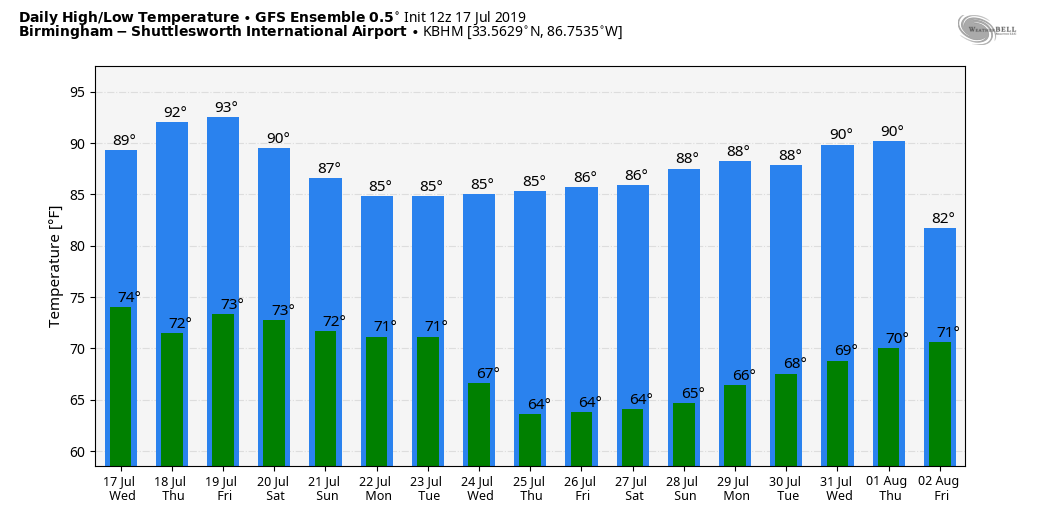
TOMORROW: For now tomorrow looks like a fairly routine summer day. Partly sunny, hot and humid with random, scattered, mostly afternoon and evening showers and thunderstorms. Chance of any one spot getting wet about one in four, and the high will be in the low 90s in most places.
FRIDAY AND THE WEEKEND: An upper trough will bring an increase in the number of showers and thunderstorms on these three days. The sun will be out at times, and the rain will still be scattered and rather random, but most communities will see a good chance of one or two downpours. Most of the showers and thunderstorms will come from 1:00 until 9:00 p.m., but a late night night or morning shower can’t be ruled out. Highs will be in the 86-92 degree range.
NEXT WEEK: Global models continue to show a surface front approaching Alabama from the north, which will keep the weather unsettled Monday and Tuesday with a chance of showers and storms both days. The GFS model hints some drier air will enter North Alabama Wednesday, but we will believe that when we see it. Fronts rarely push deep into Alabama in mid to late July. See the Weather Xtreme video for maps, graphics, and more details.
TROPICS: The Atlantic basin is very quiet, and tropical storm formation is not expected through the weekend.
ON THIS DATE IN 1987: Slow moving thunderstorms caused flooding on the Guadalupe River in Texas resulting in tragic loss of life. A bus and van leaving a youth summer camp stalled near the rapidly rising river, just west of the town of Comfort, or about 50 mile northwest of San Antonio. The powerful surge of water swept away 43 persons, mostly teenagers. Ten drowned in the floodwaters. Most of the others were rescued from treetops by helicopter.
BEACH FORECAST: Click here to see the AlabamaWx Beach Forecast Center page.
WEATHER BRAINS: Don’t forget you can listen to our weekly 90 minute show anytime on your favorite podcast app. This is the show all about weather featuring many familiar voices, including our meteorologists here at ABC 33/40.
CONNECT: You can find me on all of the major social networks…
Facebook
Twitter
Instagram
Pinterest
Snapchat: spannwx
Look for the next Weather Xtreme video here by 7:00 a.m. tomorrow…
Category: Alabama's Weather, ALL POSTS, Weather Xtreme Videos
About the Author (Author Profile)
James Spann is one of the most recognized and trusted television meteorologists in the industry. He holds the AMS CCM designation and television seals from the AMS and NWA. He is a past winner of the Broadcast Meteorologist of the Year from both professional organizations.Subscribe
If you enjoyed this article, subscribe to receive more just like it.


