More Storms Today, Cold Front Invades To Start The Workweek
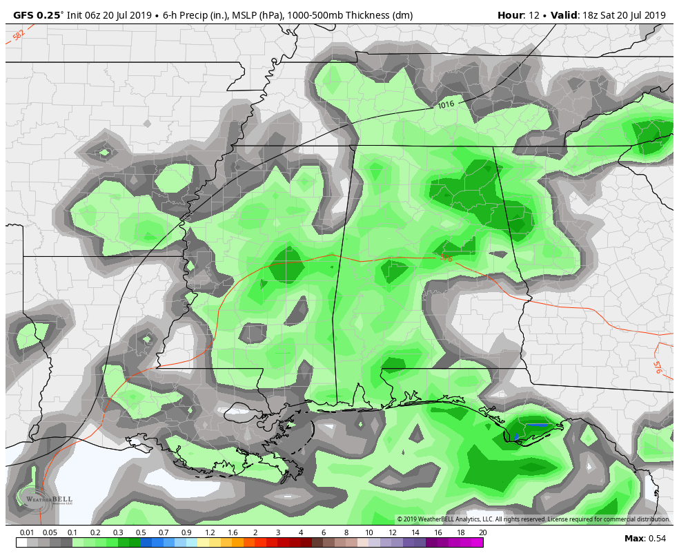
06Z GFS valid today at 1:00 pm.
SATURDAY
We already have a good supply of Gulf moisture in place across Central Alabama, and with the formation of an upper low along the northwestern Florida Panhandle that will slowly shift westward, it will be another day with scattered to numerous showers and thunderstorms across the area. Cells will barely move today as the steering currents will be moving ever so slowly, so we could have the potential of some localized flash flooding issues in urban and other poor drainage areas. Some of these storms could also be strong with gusty winds, and we may even see a severe thunderstorm warning or two, but organized severe weather is not expected. Highs will top out in the mid-80s to the lower 90s across the area. Look for the highest amount of activity between 10:00 am to 6:00 pm, with activity diminishing rather quickly as we lose daylight, but a few lingering showers and storms may hang on for a few hours longer.
SUNDAY
The low along the coast will continue to slowly move west, and with ridging to our east, we’ll have less coverage in afternoon storms. We’ll continue to have a chance of isolated to scattered mainly afternoon showers and thunderstorms with higher chances (up to 50%) coming north and west of the I-59 corridor. Afternoon highs will be in the mid-80s to the lower 90s across the area from northwest to southeast. Once again, a few storms may be strong with gusty winds, but no organized severe weather is expected.
MONDAY
We’ll continue to have a chance of scattered showers and storms mainly during the afternoon hours, but a rare summertime cold front will move into the area late in the evening. This will bring more showers and thunderstorms during the late evening through the late night and overnight hours. Highs will be in the mid-80s to the lower 90s.
TUESDAY
The cold front will continue to work slowly to the southeast through the southern half of Central Alabama. While a few scattered showers and thunderstorms are possible north and west of the I-59 corridor early, much of the activity will be confined along and ahead of the front south and east of I-59. The front will be pushing out of the area during the evening hours and rainfall will come to an end behind the front. Highs will be in the lower 80s to near 90 degrees across the area, with lows dipping down into the lower 60s to right at 70 degrees.
WEDNESDAY
The front actually will stall out just to the south of the area over South Alabama, which will keep the chance of a few isolated to scattered showers and storms in the forecast for locations south of the I-85 corridor. For the rest of the area, we should see a good bit of sunshine with a few clouds. Afternoon highs will be in the mid to upper 80s across the area.
THURSDAY
The front remains stationary to the south of the area which will continue the risk of a few isolated to scattered showers and thunderstorms for the southeastern locations of Central Alabama, while the rest of the area should stay dry. Highs will be in the mid to upper 80s.
FRIDAY
A moist southerly flow will get reestablished over Central Alabama which will bring back a chance of isolated to scattered mainly afternoon showers and thunderstorms to much of Central Alabama while many locations north of the I-59 corridor staying dry. Highs will be in the upper 80s to right at 90 degrees across the area.
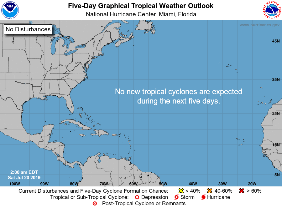
THE TROPICS
All remains quiet across the Atlantic Ocean, the Caribbean Sea, and the Gulf of Mexico, and no new tropical cyclones are expected to develop within the next five days.
Category: Alabama's Weather, ALL POSTS, Weather Xtreme Videos
About the Author (Author Profile)
Scott Martin is an operational meteorologist, professional graphic artist, musician, husband, and father. Not only is Scott a member of the National Weather Association, but he is also the Central Alabama Chapter of the NWA president. Scott is also the co-founder of Racecast Weather, which provides forecasts for many racing series across the USA. He also supplies forecasts for the BassMaster Elite Series events including the BassMaster Classic.Subscribe
If you enjoyed this article, subscribe to receive more just like it.


