Mainly Dry Today, Rain Chances Increase Through Midweek
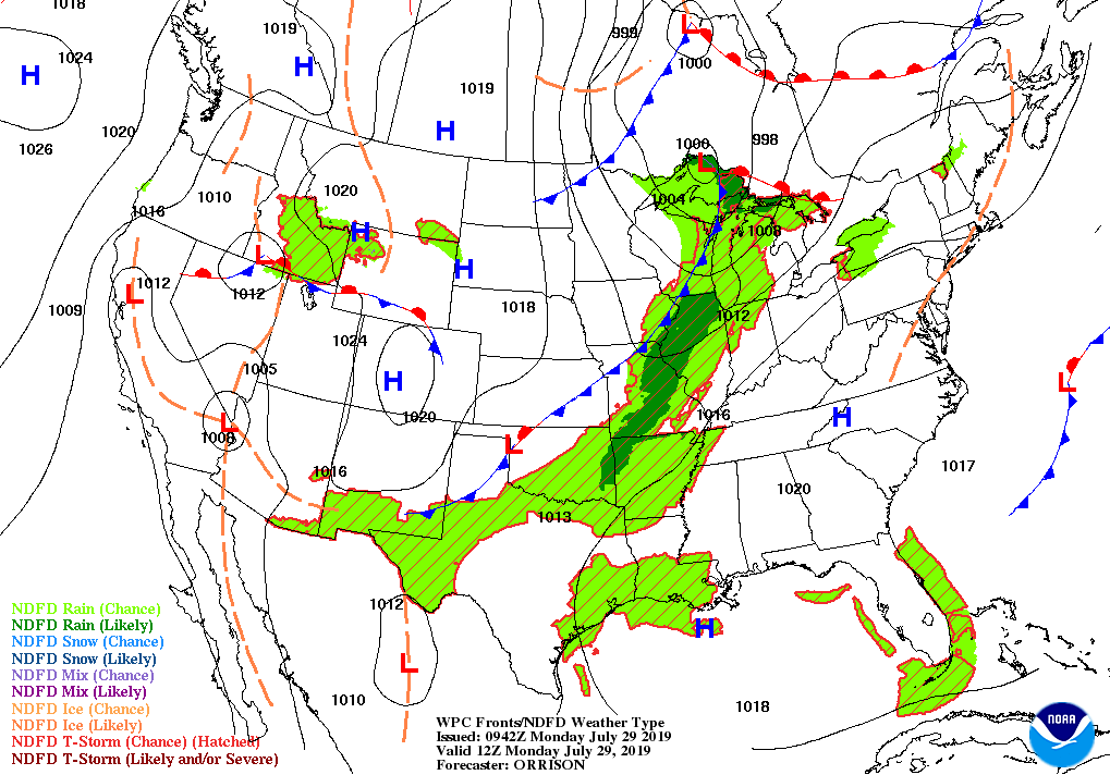
The ridge that has kept most of us dry through the past several days will begin to be forced eastward off of the east coast as a trough will begin to work toward Central Alabama today. We’ll have a good bit of sunshine to start with clouds building with the heating of the day. We can’t rule out a few isolated afternoon showers and thunderstorms mainly over the northeastern parts of the area, but nearly all of Central Alabama will stay dry through sunset. Afternoon highs will be in the lower to mid-90s. Any of the afternoon rain activity should quickly dissipate before it gets dark, then the trough begins to work into the northwestern parts of the area increasing rain chances for the northwestern corner of the area, especially after midnight. Lows will be in the upper 60s to the lower 70s.
The trough arrives on Tuesday and will be attempting to pull a cold front into the area, but it will wash out and stop north of the state. We’ll have an increased risk of scattered showers and thunderstorms north of the I-59 corridor while the standard summertime risk of isolated to scattered afternoon showers and storms will be in place south of I-59. Highs will be in the upper 80s to the mid-90s.
The trough works in a little deeper into the area on Wednesday, pushing the higher rain chances farther southeastward across Central Alabama. Much of the area will see an increased chance of scattered showers and thunderstorms, especially north of the I-85 corridor. Afternoon highs will be in the upper 80s to the mid-90s.
We return to a more classic summertime pattern on Thursday across Central Alabama as we’ll be hot and humid with the standard risk of scattered mainly afternoon showers and thunderstorms. Highs will be in the upper 80s to the mid-90s.
Much of the same story on Friday with coverage of the scattered afternoon showers and thunderstorms being a little higher over the southeastern parts of the area. Highs will top out in the upper 80s to the lower 90s.
Not much change in the weather pattern to start off the weekend. We’ll continue to be hot and humid on Saturday with the standard risk of scattered mainly afternoon showers and thunderstorms. Highs will be in the upper 80s to the lower 90s.
And we’ll do it all over again on Sunday… hot and humid with the standard risk of scattered mainly afternoon showers and thunderstorms. Highs top out in the upper 80s to the lower 90s across the area.
THE TROPICS
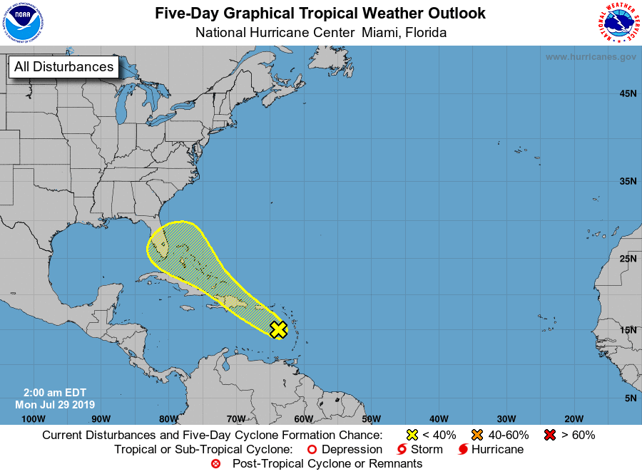
A tropical wave over the eastern Caribbean Sea has been given the name of Invest 95L and will be moving to the west-northwest to northwest over the next few days. While conditions are not favorable for development over the next five days, Invest 95L will be moving into a little better environment near the Straits of Florida or the Bahamas at the end of the week. We’ll be keeping our eyes on this as it will be heading toward the southeastern US coastline. It is too early to be specific on what this disturbance will do once it approaches the US mainland.
ON THIS DAY IN WEATHER HISTORY
1981 – Fifty cattle, each weighing 800 pounds, were killed by lightning near Vance, AL. The lightning struck a tree and then spread along the ground killing the cattle.
BEACH FORECAST CENTER
Get the latest weather and rip current forecasts for the beaches from Fort Morgan to Panama City on our Beach Forecast Center page. There, you can select the forecast of the region that you are interested in.
ALREADY OFF TO A HOT START IN 2019! ADVERTISE WITH THE BLOG!
After a record-setting 2018 with over 19.7 million page views, AlabamaWx.com is already well on its way to setting another record as we’re nearing 12 million page views so far in 2019! Don’t miss out! We can customize a creative, flexible and affordable package that will suit your organization’s needs. Contact Bill Murray at (205) 687-0782.
E-FORECAST
Get the Alabama Wx Weather Blog’s Seven-Day Forecast delivered directly to your inbox by email twice daily. It is the most detailed weather forecast available in Central Alabama. Subscribe here… It’s free!
CONNECT WITH THE BLOG ON SOCIAL MEDIA
You can find the AlabamaWx Weather Blog on the major social media networks:
Facebook
Twitter
Instagram
WEATHERBRAINS
Don’t forget you can listen to our weekly 90 minute netcast anytime on the web at WeatherBrains.com or on iTunes, Stitcher, or Spotify. This is the show all about weather featuring many familiar voices, including the meteorologists at ABC 33/40.
Category: Alabama's Weather, ALL POSTS, Weather Xtreme Videos
About the Author (Author Profile)
Scott Martin is an operational meteorologist, professional graphic artist, musician, husband, and father. Not only is Scott a member of the National Weather Association, but he is also the Central Alabama Chapter of the NWA president. Scott is also the co-founder of Racecast Weather, which provides forecasts for many racing series across the USA. He also supplies forecasts for the BassMaster Elite Series events including the BassMaster Classic.Subscribe
If you enjoyed this article, subscribe to receive more just like it.


