

Scattered Showers & Storms Possible Each Day For The Next Seven Days
SLIGHTLY INCREASED RAIN CHANCES HANG AROUND FOR TODAY
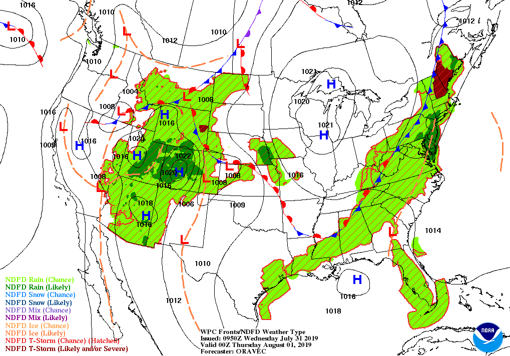
The cold front will make it into Central Alabama and will stall out near the I-59/20 corridor. Along and ahead of the front is where we could see the highest rain chances for today. We’ll have a chance of isolated to scattered showers and thunderstorms across the area mainly during the afternoon and evening hours, but I can’t rule out a few forming before the end of the morning. Afternoon highs will be in the upper 80s to the mid-90s. Rain chances will range from 20% to 50% during the day.
CLASSIC SUMMERTIME PATTERN RETURNS TO END OUT THE WORK WEEK
We get back into a hot and humid weather pattern across Central Alabama with the standard risk of a few isolated afternoon showers and thunderstorms on Thursday and Friday. While clouds will build during the main heating of the day and convective showers form, the mornings will start with mainly clear skies. Highs on each day will be in the upper 80s to the lower 90s. Rain chances will be around 20%-50% for the most part on both days.
THE CENTRAL ALABAMA WEEKEND
Not much change at this point for Saturday and Sunday as we’ll continue with the standard summertime forecast… Hot and humid with a risk of a few isolated to scattered mainly afternoon showers and storms on each day. Mornings will start with a good bit of sunshine with clouds building during the main heating of the day. Highs will be in the upper 80s to the lower 90s. Rain chances will be around 30%-40% on both days.
THE BEGINNING OF THE WORK WEEK
It’s the “wash and repeat” forecast to start next week as we’ll continue with hot and humid conditions along with a risk of a few isolated to scattered mainly afternoon showers and storms on Monday and Tuesday. Mornings will start with a good bit of sunshine with clouds building during the main heating of the day. Highs will be in the upper 80s to the lower 90s. Rain chances will be a little higher on Monday, in the 30%-50% range, but drops back to 20%-30% for Tuesday.
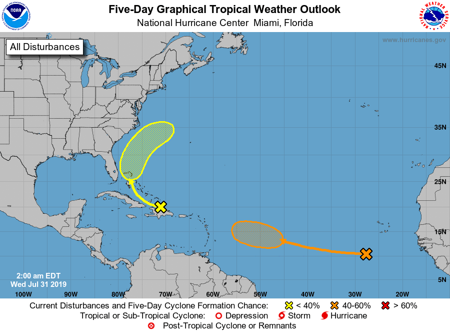
INVEST 95L OVER THE CARIBBEAN
A disorganized tropical wave continues to bring showers and thunderstorms to the Virgin Islands, Puerto Rico, and Hispanola. It will begin to curve to the northwest at 10 MPH and head toward the eastern coast of Florida and the Bahamas over the next few days. Some development could occur once it reaches there, but the NHC is only going with a 10% chance of it developing into a depression within the next five days.
EYES ON THE TROPICAL WAVE OVER THE EASTERN ATLANTIC AS WELL
A little higher risk of development for the wave that is currently moving westward around 15 MPH across the eastern Atlantic Ocean. Conditions are not favorable at this point, but it will move into better conditions by the end of the week and weekend where we could see a depression form well east of the Lesser Antilles. At this point, NHC is giving it a 40% chance of developing into a depression within the next 5 days.
ON THIS DAY IN WEATHER HISTORY
1976 – A stationary thunderstorm produced more than ten inches of rain which funneled into the narrow Thompson River Canyon of northeastern Colorado. A wall of water six to eight feet high wreaked a twenty-five-mile path of destruction from Estes Park to Loveland killing 156 persons. The flash flood caught campers and caused extensive structural and highway damage. Ten miles of U.S. Highway 34 were destroyed as the river was twenty feet higher than normal at times.
1987 – The deadliest tornado in 75 years struck Edmonton, Alberta, killing 26 persons and injuring 200 others. The twister caused more than 75 million dollars damage along its nineteen-mile path, leaving 400 families homeless. At the Evergreen Mobile Home Park, up to 200 of the 720 homes were flattened by the tornado.
BEACH FORECAST CENTER
Get the latest weather and rip current forecasts for the beaches from Fort Morgan to Panama City on our Beach Forecast Center page. There, you can select the forecast of the region that you are interested in.
ALREADY OFF TO A HOT START IN 2019! ADVERTISE WITH THE BLOG!
After a record-setting 2018 with over 19.7 million page views, AlabamaWx.com is already well on its way to setting another record as we’re nearing 12 million page views so far in 2019! Don’t miss out! We can customize a creative, flexible and affordable package that will suit your organization’s needs. Contact Bill Murray at (205) 687-0782.
E-FORECAST
Get the Alabama Wx Weather Blog’s Seven-Day Forecast delivered directly to your inbox by email twice daily. It is the most detailed weather forecast available in Central Alabama. Subscribe here… It’s free!
CONNECT WITH THE BLOG ON SOCIAL MEDIA
You can find the AlabamaWx Weather Blog on the major social media networks:
Facebook
Twitter
Instagram
WEATHERBRAINS
Don’t forget you can listen to our weekly 90 minute netcast anytime on the web at WeatherBrains.com or on iTunes, Stitcher, or Spotify. This is the show all about weather featuring many familiar voices, including the meteorologists at ABC 33/40.
Category: Alabama's Weather, ALL POSTS, Weather Xtreme Videos
About the Author (Author Profile)
Scott Martin is an operational meteorologist, professional graphic artist, musician, husband, and father. Not only is Scott a member of the National Weather Association, but he is also the Central Alabama Chapter of the NWA president. Scott is also the co-founder of Racecast Weather, which provides forecasts for many racing series across the USA. He also supplies forecasts for the BassMaster Elite Series events including the BassMaster Classic.Subscribe
If you enjoyed this article, subscribe to receive more just like it.


