Hot, Humid,A Few Storms
AUGUST IN ALABAMA: It is that time of the year when we can promise just about every day the weather will be hot and humid with a few scattered storms around. The hardest part is always defining when and where thunderstorms will develop.
A mass of storms moved into Alabama late last night, riding down a northwest flow aloft in place across the region. Most of these storms have dissipated as I write this, although a few new ones are creeping into the northwest corner of the state at daybreak.
The overnight storms are responsible for a few small scale boundaries across the state which should serve as the focus for new scattered storms this afternoon and early tonight. Most places won’t see rain, but where those thunderstorms do form, they could pack a punch. SPC has introduced a “marginal risk” for roughly the northern half of Alabama…
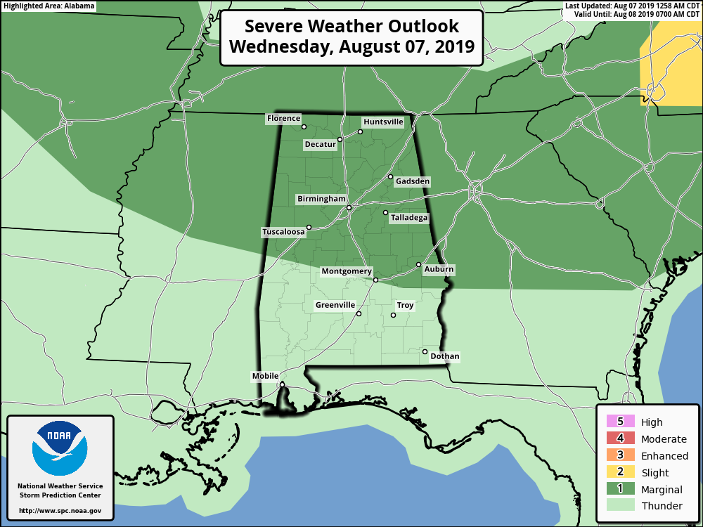
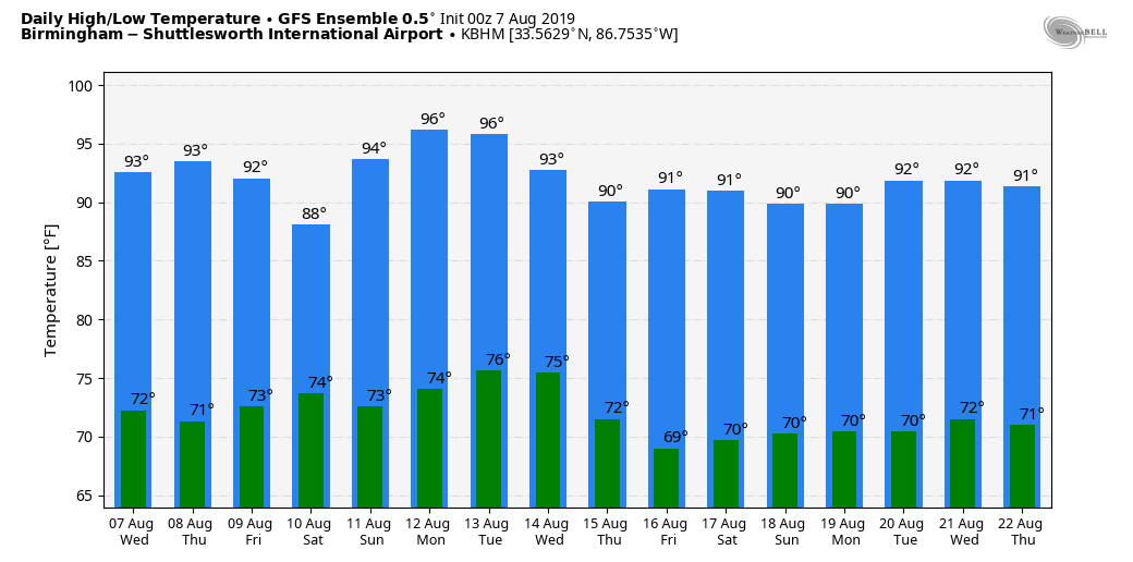
The main threat will come from wet microbursts… small areas of strong straight line winds. Of course, all storms feature lots of cloud to ground lightning. Best chance of storms will come from roughly 12:00 noon until 10:00 p.m. Away the storms, the sky will be partly sunny today with a high between 91 and 96 degrees.
TOMORROW THROUGH THE WEEKEND: Hot, humid summer weather continues. Highs will be mostly in the low 90s, maybe mid 90s in spots. The risk of random, scattered, mostly afternoon and evening showers and thunderstorms will remain in the forecast… odds of any one place seeing rain are around 25 percent tomorrow, and 40 percent Friday through the weekend. No way of knowing in advance exactly when and where the storms will form; you just have to watch radar trends if you have something planned outdoors.
NEXT WEEK: Not much change. An upper ridge will try and nose in here from the west, pushing highs up into the mid 90s early in the week, but some spots will see a cooling afternoon thunderstorm. Bottom line is that standard August weather conditions will continue. See the Weather Xtreme video for maps, graphics, and more details.
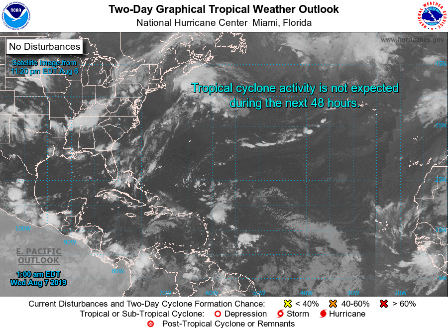
TROPICS: The Atlantic basin remains remarkably quiet for August, and tropical storm formation is not expected through the weekend.
ON THIS DATE IN 1980: Hurricane Allen bottomed out at 899 millibars (26.55 inches of mercury) while moving through the Yucatan Channel in the southeastern part of the Gulf of Mexico. Allen was the second lowest pressure ever recorded in the Western Hemisphere up to that time. Allen’s winds at the time were sustained at 190 mph. Shortly before landfall the next day, a dry air mass in the western Gulf of Mexico caused the storm to weaken substantially. Allen made landfall north of Brownsville, Texas as a Category 3 storm with maximum sustained winds of 115 mph.
BEACH FORECAST: Click here to see the AlabamaWx Beach Forecast Center page.
WEATHER BRAINS: Don’t forget you can listen to our weekly 90 minute show anytime on your favorite podcast app. This is the show all about weather featuring many familiar voices, including our meteorologists here at ABC 33/40.
CONNECT: You can find me on all of the major social networks…
Facebook
Twitter
Instagram
Pinterest
Snapchat: spannwx
I have a weather program this morning at Children’s of Alabama… look for the next Weather Xtreme video here by 4:00 this afternoon. Enjoy the day!
Category: Alabama's Weather, ALL POSTS, Weather Xtreme Videos
About the Author (Author Profile)
James Spann is one of the most recognized and trusted television meteorologists in the industry. He holds the AMS CCM designation and television seals from the AMS and NWA. He is a past winner of the Broadcast Meteorologist of the Year from both professional organizations.Subscribe
If you enjoyed this article, subscribe to receive more just like it.


