Wet At Times Through Early Next Week
UNSETTLED PATTERN SETS UP: With an increasingly moist and unstable airmass, we are expecting rather unsettled weather across Alabama today, over the weekend, and into early next week. This will give much of the state a chance of receiving beneficial rain over the next five days.
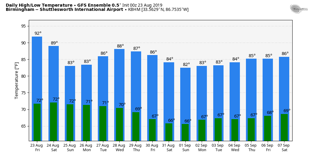
TODAY: The radar is quiet this morning, but numerous showers and thunderstorms should form across the state this afternoon and tonight. Odds of any one spot getting wet are 50-60 percent, and the high will be between 87 and 90 degrees for most locations.
HIGH SCHOOL FOOTBALL: I would suggest taking the rain gear tonight, but it won’t rain at every stadium. Showers are likely during the first half of the games, and a few lightning delays are very possible. Temperatures will be in the low to mid 80s at kickoff.
THE ALABAMA WEEKEND: The sky will be mostly cloudy tomorrow and Sunday with occasional showers and thunderstorms likely. While most of the rain will come from 12:00 noon to 12:00 midnight; we can’t rule out a few late night or morning showers. Afternoon highs will be generally in the mid 80s due to only a very limited amount of sun.
NEXT WEEK: Not much change Monday and Tuesday; we will forecast a good chance of showers and thunderstorms both days with highs in the 80s. Then, the weather trends drier Wednesday through Friday over the northern half of the state as an upper trough sets up over the eastern third of the nation, and drier air filters into the state. See the Weather Xtreme video for maps, graphics, and more details.
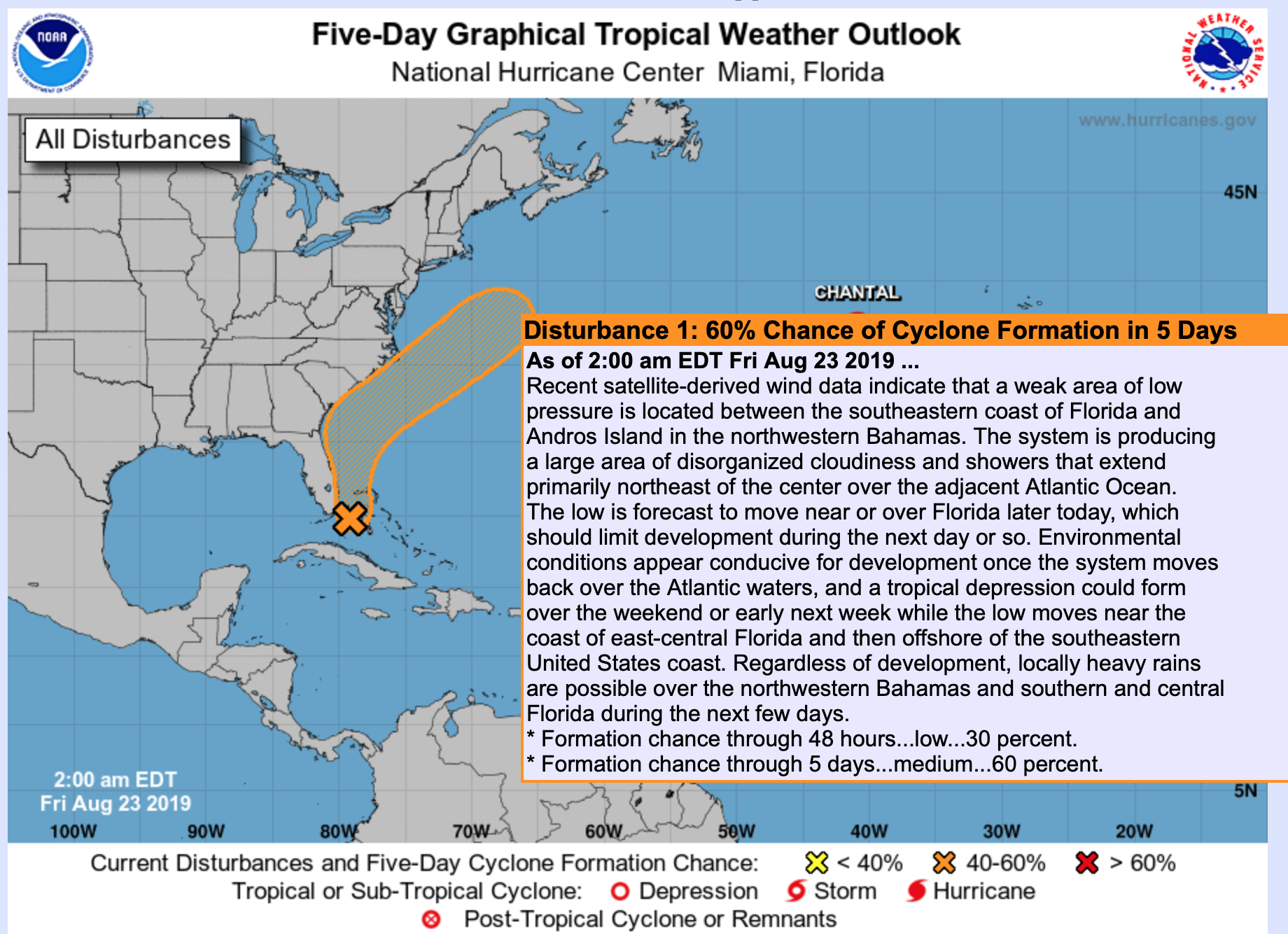
TROPICS: Tropical Depression Chantal, in the North Atlantic far from land, is expected to dissipate by tonight. A tropical wave near the southern tip of Florida now has a 60 percent chance of becoming a tropical depression or storm in coming days… it is expected to move northeast, just off the southeast coast of the U.S. The Gulf of Mexico is quiet for now.
ON THIS DATE IN 1992: While South Florida residents were preparing for Hurricane Andrew, folks in western Montana were dealing with early season snowfall. Some snowfall amounts include 8.3” in Great Falls, 6.2” in Helena, and 5.1” in Cut Bank. This snowfall is the first significant snowfall on record in western Montana in August.
ON THIS DATE IN 2005: Hurricane Katrina formed from Tropical Depression Twelve over the southeastern Bahamas. Katrina would become the costliest ($81.2 billion) and one of the most deadly hurricanes (1,836 lives) in U.S. history.
BEACH FORECAST: Click here to see the AlabamaWx Beach Forecast Center page.
WEATHER BRAINS: Don’t forget you can listen to our weekly 90 minute show anytime on your favorite podcast app. This is the show all about weather featuring many familiar voices, including our meteorologists here at ABC 33/40.
CONNECT: You can find me on all of the major social networks…
Facebook
Twitter
Instagram
Pinterest
Snapchat: spannwx
Look for the next Weather Xtreme video here by 4:00 this afternoon… enjoy the day!
Category: Alabama's Weather, ALL POSTS, Weather Xtreme Videos
About the Author (Author Profile)
James Spann is one of the most recognized and trusted television meteorologists in the industry. He holds the AMS CCM designation and television seals from the AMS and NWA. He is a past winner of the Broadcast Meteorologist of the Year from both professional organizations.Subscribe
If you enjoyed this article, subscribe to receive more just like it.


