Erin Moving North-Northwestward As A Tropical Depression
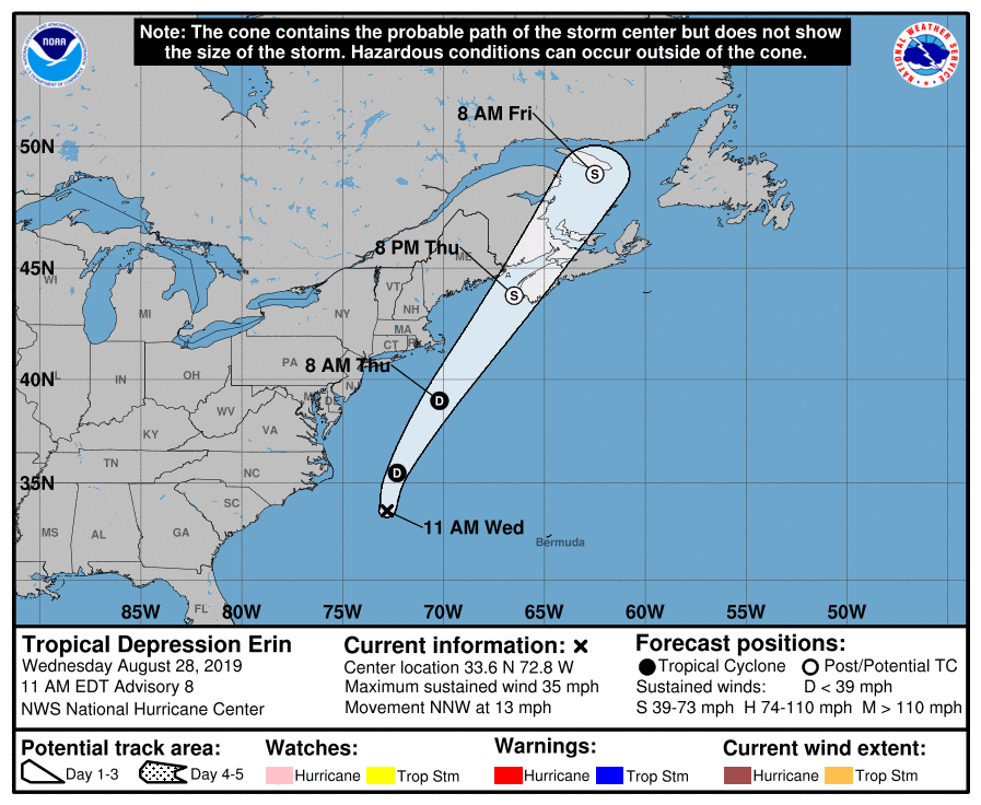
At 1100 AM EDT (1500 UTC), the center of Tropical Depression Erin was located near latitude 33.6 North, longitude 72.8 West (190 southeast of Cape Hatteras, North Carolina). The depression is moving toward the north-northwest near 13 mph (20 km/h). The cyclone is expected to turn northward later today and then north-northeastward early Thursday morning with an increase in forward speed.
Maximum sustained winds are near 35 mph (55 km/h) with higher gusts. Little change in strength is forecast through tonight. The system could strengthen as an extratropical low on Thursday.
The estimated minimum central pressure is 1006 MB (29.71 inches).
Erin has become less organized this morning with the center exposed and becoming more removed from the remaining deep convection. Satellite intensity estimates have decreased and a blend of these support an initial wind speed of 30 kt. The northwesterly shear that has been affecting Erin is forecast to decrease somewhat later today and tonight, but given the current structure of the system, little overall change in intensity is anticipated during that time. If convection does not re-develop closer to the center later today, Erin could become post-tropical. An alternate scenario is for the circulation to become elongated and lose definition as a mid-latitude trough approaches from the west. The global models suggest that the trough is likely to help Erin or its remnants deepen somewhat as an extratropical low on Thursday. The NHC intensity forecast follows suit and shows little change in strength today, then indicates that Erin or its remnants will become an extratropical gale by 36 hours.
Erin is now moving north-northwestward at 11 kt. The dynamical model guidance is in good agreement on Erin turning northward and then northeastward by Thursday ahead of the aforementioned mid-latitude trough. Erin or its remnants are forecast to accelerate and reach Nova Scotia in about 36 hours. The guidance envelope has shifted slightly westward, and the updated official forecast has been adjusted accordingly.
About the Author (Author Profile)
Scott Martin is an operational meteorologist, professional graphic artist, musician, husband, and father. Not only is Scott a member of the National Weather Association, but he is also the Central Alabama Chapter of the NWA president. Scott is also the co-founder of Racecast Weather, which provides forecasts for many racing series across the USA. He also supplies forecasts for the BassMaster Elite Series events including the BassMaster Classic.Subscribe
If you enjoyed this article, subscribe to receive more just like it.


