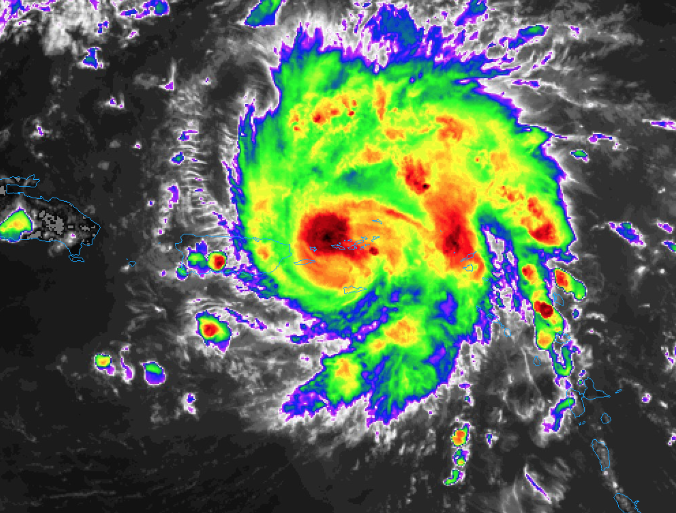
Early Afternoon Look at Dorian
Dorian is now a hurricane with sustained winds of 75 mph. NHC is forecasting major hurricane status over the Labor Day weekend as it approaches the East Coast of Florida.
Important points…
*All indications are that by this Labor Day weekend, a powerful hurricane will be near the Florida or southeastern coast of the United States. The risk of dangerous storm surge and hurricane-force winds is increasing in the central and northwestern Bahamas and along the Florida east coast, although it is too soon to determine where these hazards will occur. Residents in these areas should ensure that they have their hurricane plan in place and not focus on the exact forecast track of Dorian’s center.
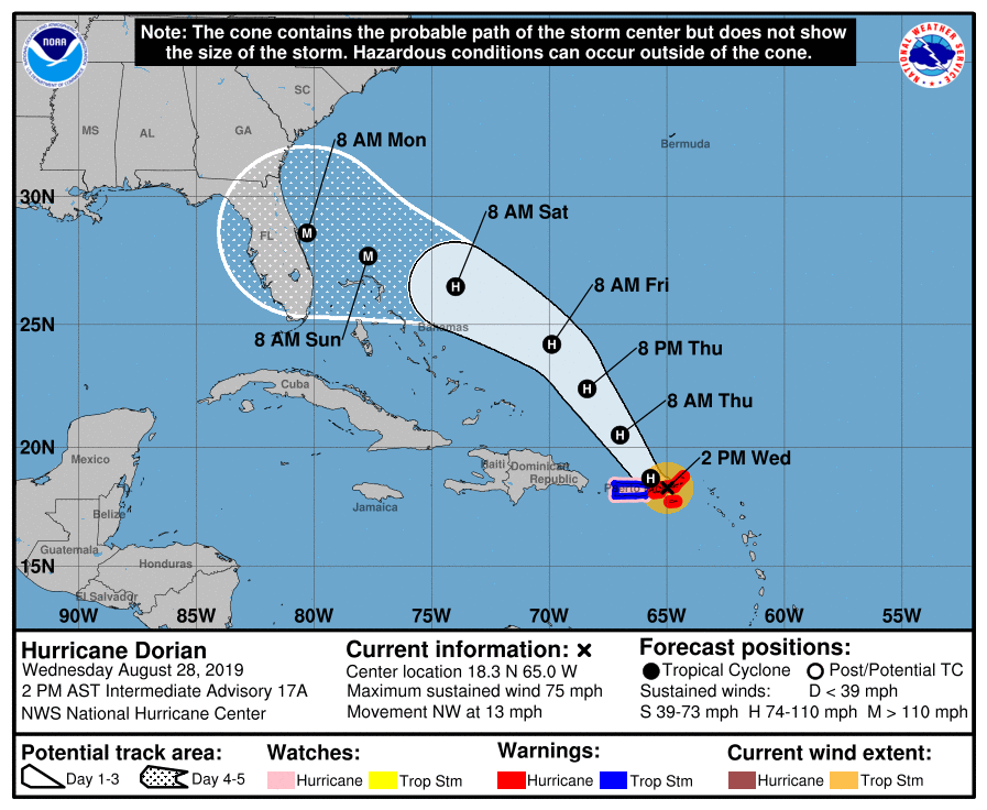
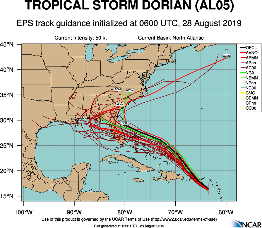
*New model runs (12Z) show a stronger upper high to the north of Dorian, meaning the westward motion could continue into early next week before the re-curve into the mid-latitude westerlies happens. Meaning, the Gulf Coast is not off the hook yet.
*If you are planning a trip to Disney World over the Labor Day weekend, weather continues will deteriorate in Orlando Sunday night and Monday with increasing rain and high winds. The weather Saturday and most of the day Sunday should be fairly routine with the usual risk of scattered storms along with a decent amount of sun.
*We do not expect any direct impact from Dorian along the Gulf Coast over the Labor Day weekend (Saturday through Monday)… including places like Gulf Shores, Destin, and Panama City Beach.
*IF there is an impact on the Central Gulf Coast, it will be toward the middle of next week. And, the same for inland parts of Alabama.
*Do not focus on the exact forecast track, as the average 5-day track error is around 200 miles. The forecast can, and will change.
Category: Tropical
About the Author (Author Profile)
James Spann is one of the most recognized and trusted television meteorologists in the industry. He holds the AMS CCM designation and television seals from the AMS and NWA. He is a past winner of the Broadcast Meteorologist of the Year from both professional organizations.Subscribe
If you enjoyed this article, subscribe to receive more just like it.


